MyTopo
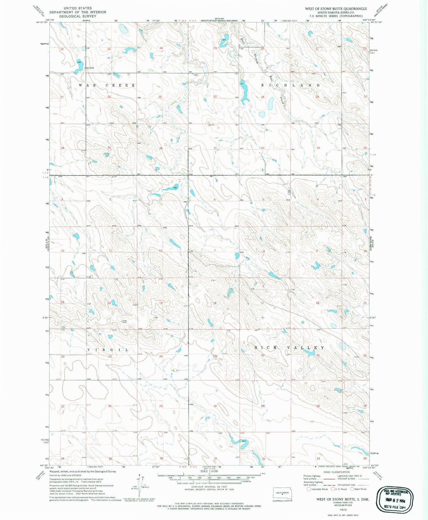
Classic USGS West of Stony Butte South Dakota 7.5'x7.5' Topo Map
Couldn't load pickup availability
Historical USGS topographic quad map of West of Stony Butte in the state of South Dakota. Map scale may vary for some years, but is generally around 1:24,000. Print size is approximately 24" x 27"
This quadrangle is in the following counties: Jones.
The map contains contour lines, roads, rivers, towns, and lakes. Printed on high-quality waterproof paper with UV fade-resistant inks, and shipped rolled.
Contains the following named places: Booth Number 1 Dam, Engen Dam, Engen Reservoir, Kennedy Number 1 Dam, Kennedy Number One Reservoir, Leir, Sheriff Dam, Sheriff Number 1 Dam, Sheriff Reservoir, Stockton Number 1 Dam, Township of Rich Valley, Township of Richland, Township of War Creek, Unorganized Territory of Rich Valley