MyTopo
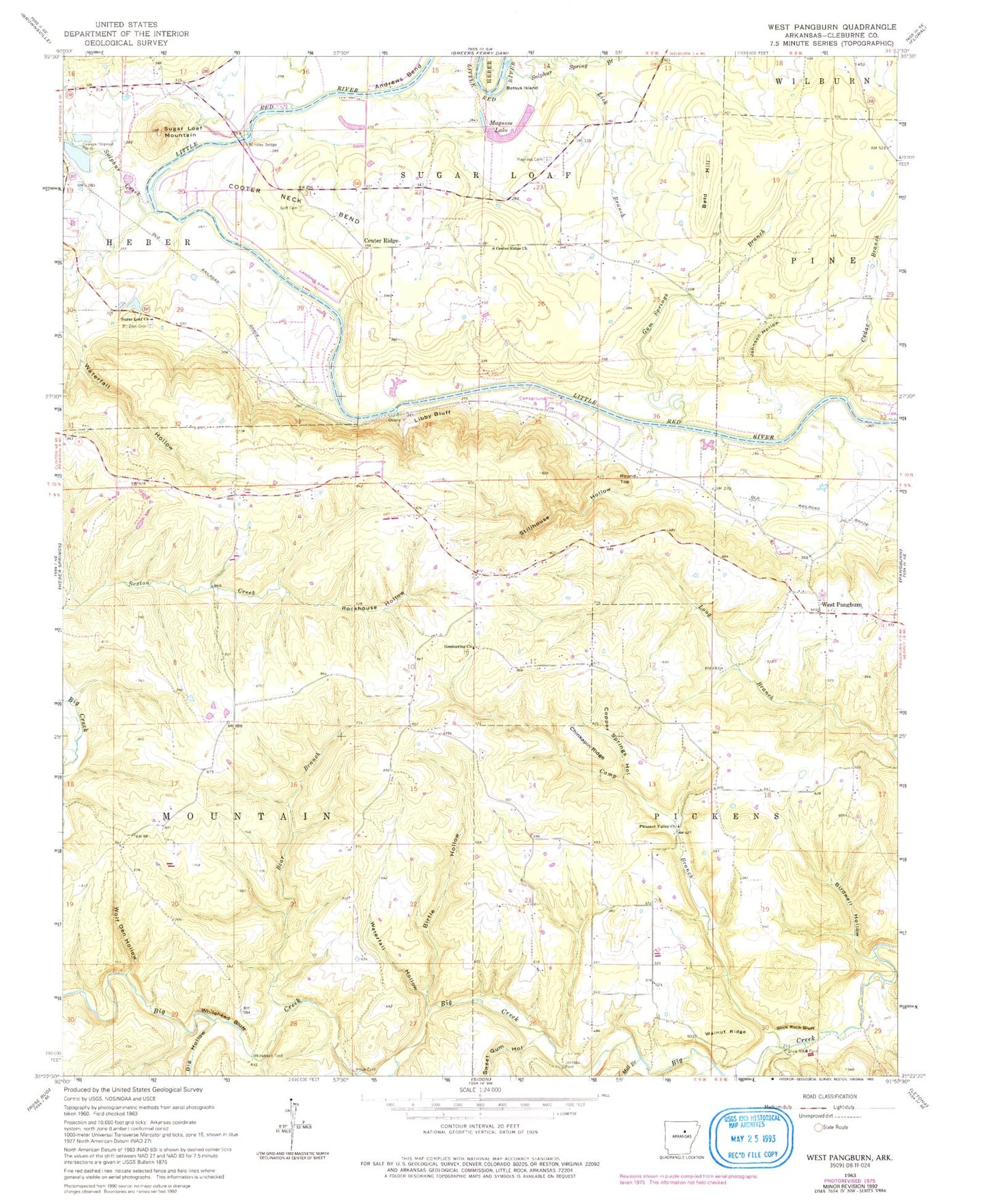
Classic USGS West Pangburn Arkansas 7.5'x7.5' Topo Map
Couldn't load pickup availability
Historical USGS topographic quad map of West Pangburn in the state of Arkansas. Typical map scale is 1:24,000, but may vary for certain years, if available. Print size: 24" x 27"
This quadrangle is in the following counties: Cleburne.
The map contains contour lines, roads, rivers, towns, and lakes. Printed on high-quality waterproof paper with UV fade-resistant inks, and shipped rolled.
Contains the following named places: Andrews Bend, Bear Branch, Betsys Island, Big Hollow, Birdwell Hollow, Birtle Hollow, Camp Branch, Cedar Branch, Center Ridge, Chaney Branch, Chinkapin Ridge, Cooter Neck Bend, Copper Springs Hollow, Golf Cemetery, Gum Springs Branch, Johnson Hollow, Libby Bluff, Lick Branch, Magness Cemetery, Mill Branch, Mount Zion Cemetery, Philips Mill Branch, Rockhouse Hollow, Slick Rock Bluff, Stillhouse Hollow, Sugar Loaf Church, Sugar Loaf Mountain, Sulphur Creek, Sulphur Spring Branch, Sweet Gum Hollow, Walnut Ridge, Waterfall Hollow, Waterfall Hollow, West Pangburn, Whitehead Bluff, Whitehead Hollow, Wolf Den Hollow, Bald Hill, Jackson Ford, Price Ford, Round Top, Slick Rock Ford, Whitehead Ford, Township of Mountain, Township of Pickens, Township of Sugar Loaf, Center Ridge School (historical), Helms Ford, Libby Quarry, Lobo Landing, Snell, Snell School (historical), Turneys Ferry (historical), West Pangburn Union Church, Libby (historical), Center Ridge Baptist Church, Good Springs Baptist Church, Magness Lake, Pleasant Valley Missionary Baptist Church, Winkley Bridge, Sherlock Lake Dam, Sherlock Lake, Grisso Lake Dam, Grisso Lake, River Acres Airport, KWCK-FM (Searcy), Pine Snag Volunteer Fire Department Main Station, Pine Snag Volunteer Fire Department Station 2, Pine Snag Volunteer Fire Department Station 3


