MyTopo
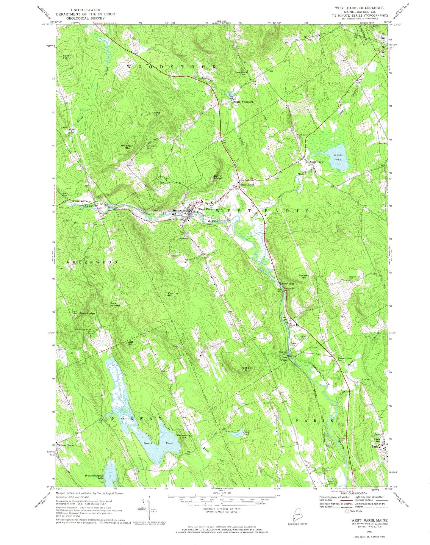
Classic USGS West Paris Maine 7.5'x7.5' Topo Map
Couldn't load pickup availability
Historical USGS topographic quad map of West Paris in the state of Maine. Map scale may vary for some years, but is generally around 1:24,000. Print size is approximately 24" x 27"
This quadrangle is in the following counties: Oxford.
The map contains contour lines, roads, rivers, towns, and lakes. Printed on high-quality waterproof paper with UV fade-resistant inks, and shipped rolled.
Contains the following named places: Agnes Gray Elementary School, Andrews Brook, Andrews Cemetery, Bacon Paine Cemetery, Berry Ledge, Bisco Falls, Bog Brook, Chase Cemetery, Cobble Hill, Cole Brook, Courthouse Square, Curtis Hill, Curtis Hill Cemetery, Eastman Hill, Finnish Cemetery, Forestdale School, Fuller Hill, Hamlin Memorial Library, Hedgehog Hill, Kosekela - Durham Cemetery, Legion Memorial School, Little Androscoggin River Reservoir, Mission Congregational Church, Moody Brook, Moose Pond, Moose Pond Brook, Nobles Corner, North Paris, North Paris Cemetery, North Paris Federated Church, North Pond, North Pond Dam, Oxford County Jail, Paine Pond, Paris, Paris Hill Bible Church, Pleasant Valley Cemetery, Porter Neighborhood Cemetery, Richardson Hollow Cemetery, Rock Dundee, Shaw Ledge, Snow Falls, Snow Falls Gorge, South Woodstock, South Woodstock Cemetery, Stearns Hill, Stearns Hill Cemetery, Town of West Paris, Trap Corner, Tri Town Ambulance and Emergency Rescue Services, Twitchell Brook, Wayside Cemetery, West Paris, West Paris Baptist Church, West Paris Dam, West Paris Fire Department, West Paris Post Office, West Paris Public Library, Whitfield Cemetery, Whitman Mountain, Witt Hill, Woodstock Seventh Day Church, ZIP Code: 04289