MyTopo
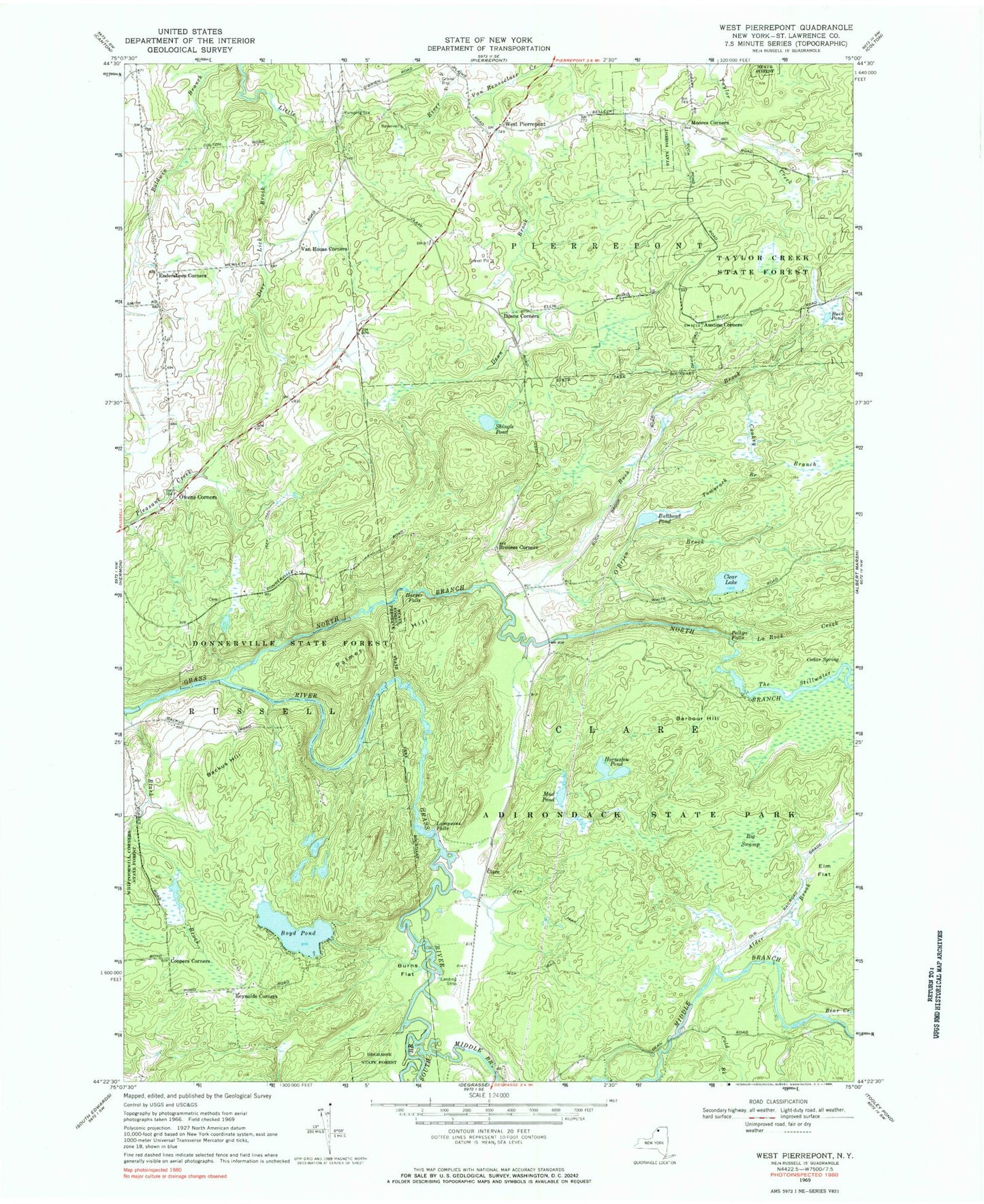
Classic USGS West Pierrepont New York 7.5'x7.5' Topo Map
Couldn't load pickup availability
Historical USGS topographic quad map of West Pierrepont in the state of New York. Typical map scale is 1:24,000, but may vary for certain years, if available. Print size: 24" x 27"
This quadrangle is in the following counties: St. Lawrence.
The map contains contour lines, roads, rivers, towns, and lakes. Printed on high-quality waterproof paper with UV fade-resistant inks, and shipped rolled.
Contains the following named places: Alder Brook, Austins Corners, Backus Hill, Barbour Hill, Bear Creek, Big Swamp, Black Brook, Boyd Pond, Brouses Corners, Buck Brook, Buck Pond, Bullhead Pond, Burns Flat, Cedar Spring, Clare, Clear Lake, Cold Brook, Conkey Branch, Coopers Corners, Dean Brook, Deans Corners, Deer Lick Brook, Donnerville State Forest, Elm Flat, Endersbees Corners, Horseshoe Pond, La Rock Creek, Middle Branch Grass River, Moores Corners, Mud Pond, North Branch Grass River, O'Brien Brook, Owens Corners, Palmer Hill, Reynolds Corners, Shingle Pond, South Branch Grass River, Tamarack Branch, The Stillwater, Van House Corners, Van Rensselaer Creek, Harper Falls, Lampsons Falls, Pelkys Falls, Taylor Creek State Forest, West Pierrepont, Saint Lawrence County, Moores Airport