MyTopo
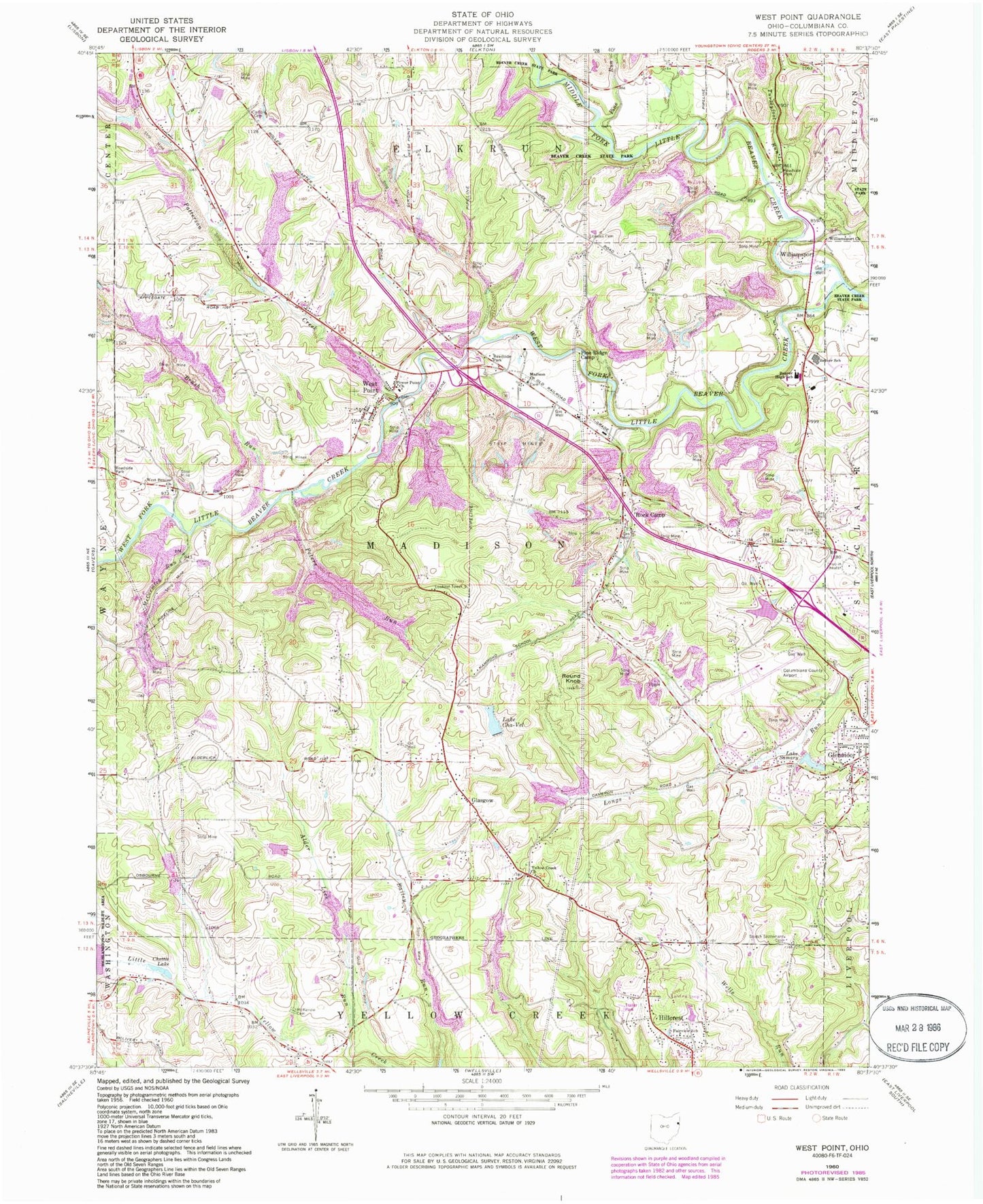
Classic USGS West Point Ohio 7.5'x7.5' Topo Map
Couldn't load pickup availability
Historical USGS topographic quad map of West Point in the state of Ohio. Typical map scale is 1:24,000, but may vary for certain years, if available. Print size: 24" x 27"
This quadrangle is in the following counties: Columbiana.
The map contains contour lines, roads, rivers, towns, and lakes. Printed on high-quality waterproof paper with UV fade-resistant inks, and shipped rolled.
Contains the following named places: Alder Lick Run, Beaver Creek State Forest, Beaver High School, Carlisle Cemetery, Chettle Lake, Fairview School, Lowries Cemetery, McCormick Run, McKenzie Cemetery, Middle Fork Little Beaver Creek, Peters Run, Pine Ridge Camp, Pine Run, Power Point Church, Round Knob, Scotch Settlement Cemetery, Township Line Cemetery, West Beaver United Presbyterian Church, West Fork Little Beaver Creek, Williamsport Church, Hillcrest, Rock Camp, West Point Elementary School, West Point, Williamsport, Campus, Glasgow, Brush Run, Patterson Creek, Turkeyfoot Run, Madison Presbyterian Church, Middle Beaver (historical), Yellow Creek Church, Lake Cha-Vel Dam, Lake Cha-Vel, Lake Samary Dam, Lake Samary, Bibbees Little Rock Lake Dam, Bibbees Little Rock Lake, Highlandtown Lake Dam, Bogart Pond Dam, Bogart Pond, Beaver Middle School, Columbiana County Airport, Johnston Airport (historical), Township of Madison, Twin Oaks Trailer Park, Madison Cemetery, West Beaver Cemetery, Pine Ridge Trail, Rock Camp Post Office (historical), Westpoint Post Office (historical), Glasgow Post Office (historical), Campus Post Office (historical), West Point Post Office, Sunrise Mobile Home Park, Glenmoor Trailer Park, Kam Trailer Park, West Point Volunteer Fire Department, Smith Valley Dairy Farms, Yellow Creek Presbyterian Church Cemetery