MyTopo
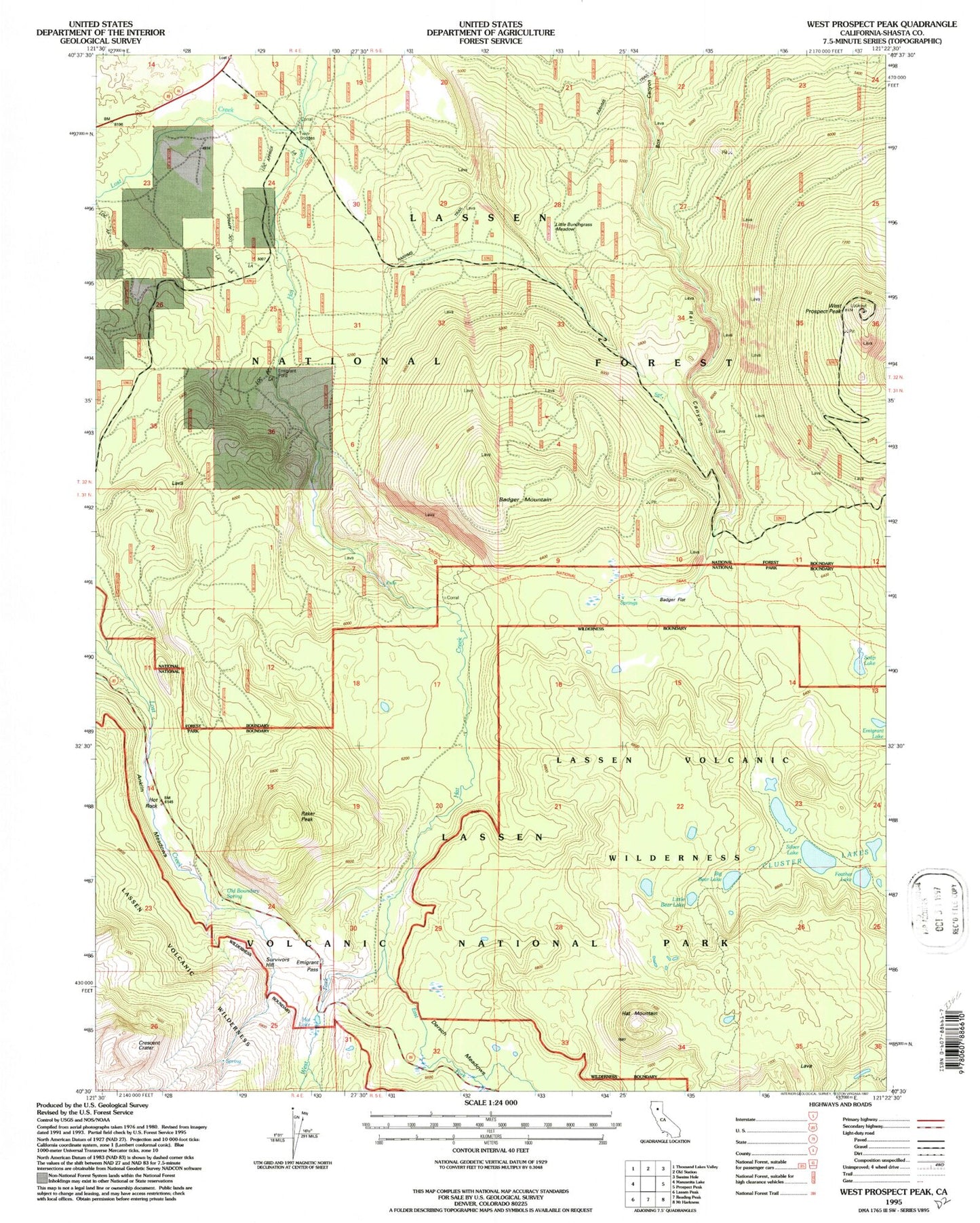
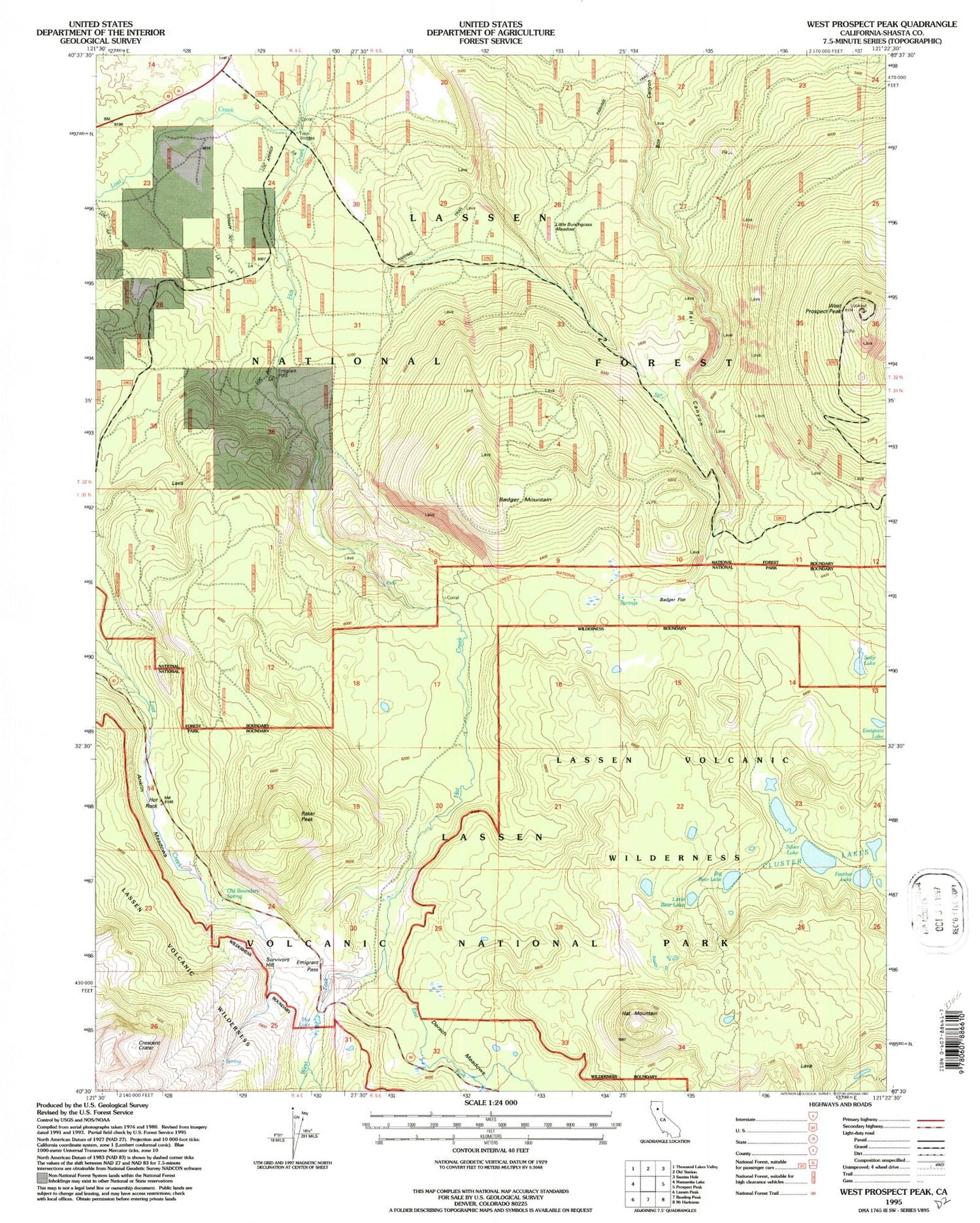
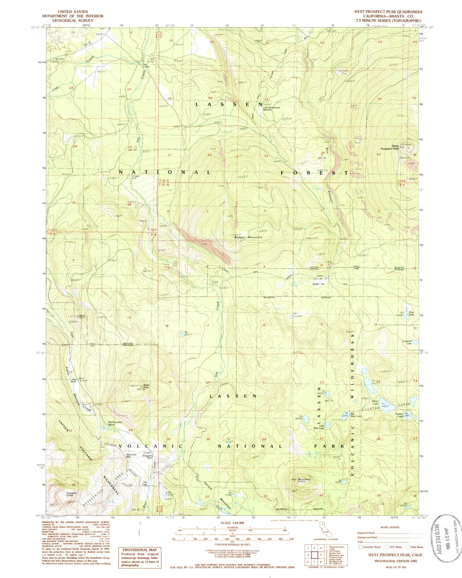
Classic USGS West Prospect Peak California 7.5'x7.5' Topo Map
Couldn't load pickup availability
Historical USGS topographic quad map of West Prospect Peak in the state of California. Typical map scale is 1:24,000, but may vary for certain years, if available. Print size: 24" x 27"
This quadrangle is in the following counties: Shasta.
The map contains contour lines, roads, rivers, towns, and lakes. Printed on high-quality waterproof paper with UV fade-resistant inks, and shipped rolled.
Contains the following named places: Badger Flat, Emigrant Ford Campground, Emigrant Lake, Emigrant Pass, Feather Lake, Hat Lake, Hat Mountain, Hot Rock, Little Bunch Grass Meadow, Old Boundary Spring, Emigrant Trail, Twin Bridges Campground, West Prospect Peak, Rail Canyon, Dersch Meadows, East Fork Hat Creek, Silver Lake, Soap Lake, Anklin Meadows, Badger Mountain, Big Bear Lake, Cluster Lakes, Crescent Crater, Little Bear Lake, Lost Creek, Raker Peak, West Fork Hat Creek, Box Canyon, Survivors Hill, Twin Bridges