MyTopo
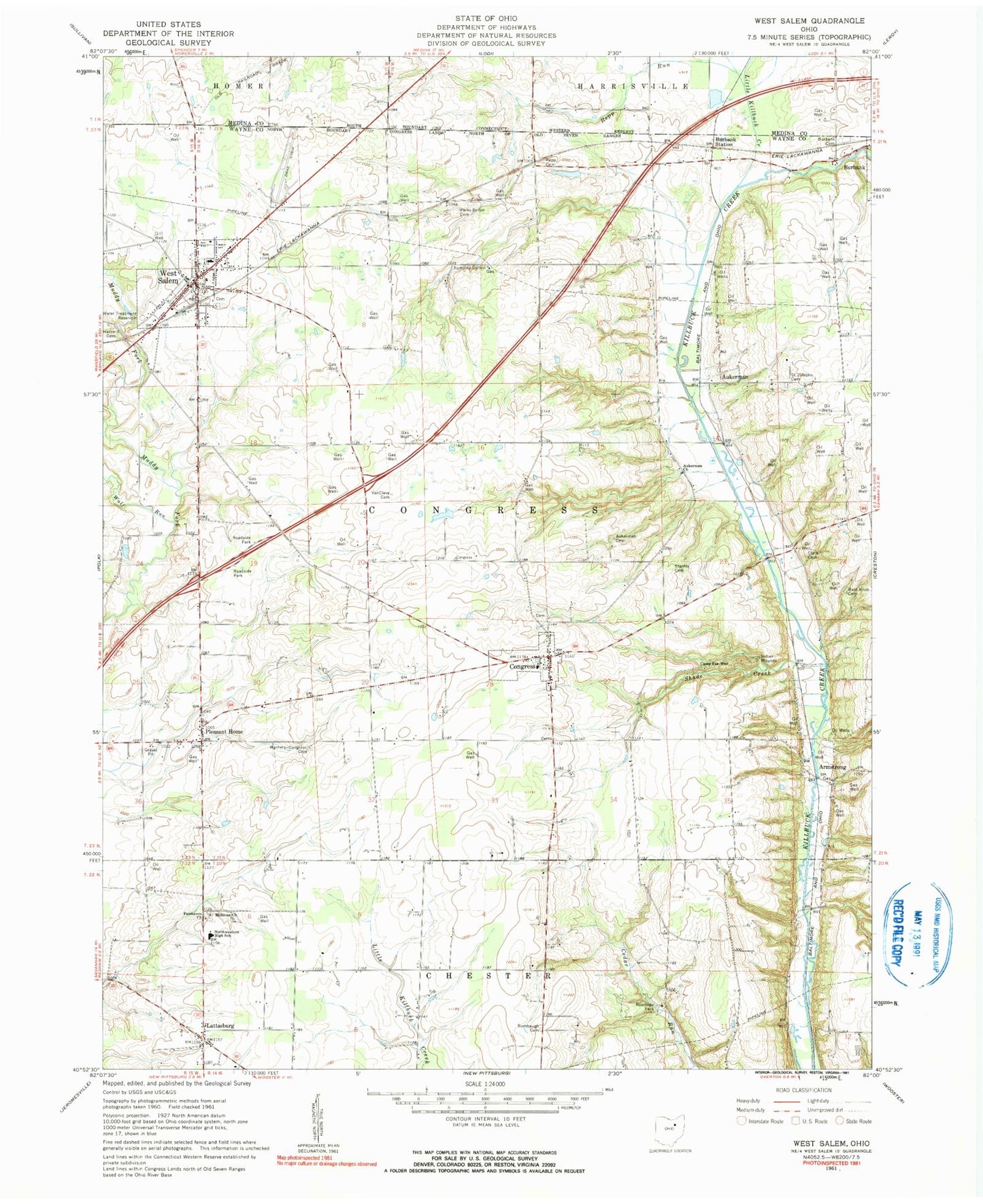
Classic USGS West Salem Ohio 7.5'x7.5' Topo Map
Couldn't load pickup availability
Historical USGS topographic quad map of West Salem in the state of Ohio. Typical map scale is 1:24,000, but may vary for certain years, if available. Print size: 24" x 27"
This quadrangle is in the following counties: Medina, Wayne.
The map contains contour lines, roads, rivers, towns, and lakes. Printed on high-quality waterproof paper with UV fade-resistant inks, and shipped rolled.
Contains the following named places: Aukerman Cemetery, Aukerman Church, Bald Knob Cemetery, Burbank Cemetery, Camp Pee Wee, Fairhaven Church, Hazzard Cemetery, Mohican Church of the Brethren, Repp Run, Rumbaugh Cemetery, Saint Josephs Cemetery, Shade Creek, Stanley Cemetery, Warners - Congress Cemetery, West Salem, Clark Cemetery, Congress Elementary School, West Salem Elementary School, Burbank Station, Congress, Pleasant Home, Armstrong, Aukerman, Lattasburg, Little Killbuck Creek, Wolf Run, School Number 16 (historical), West Salem Mills (historical), Boreman Lake Dam, Boreman Lake, Mowrer Lake, Pleasant Home Gliding Club Gliderport, Van Cleve Cemetery, Township of Congress, Congress Cemetery, Fairhaven Cemetery, Mohican Cemetery, Old Dutch Reformed Cemetery, Repp Cemetery, West Salem Cemetery, Yocum Cemetery, Congress Community Church, Village of Congress, Village of West Salem, Morlock Farms, Town and Country Fire District, Lea Crest Estates Mobile Home Park, Heritage Poultry Farm, Milelong Farm, Badger Farms, Tegtmeier Farm, Foltz Farms, Haley Farms, Lin - Dar Farms, Macdonald Farm, Miley Holsteins Farms, Peacock Farms, Shade Creek Farms, Twin Parks Farm, Wellert Farm, Tri County Animal Clinic, West Salem Village Police Department, West Salem Post Office