MyTopo
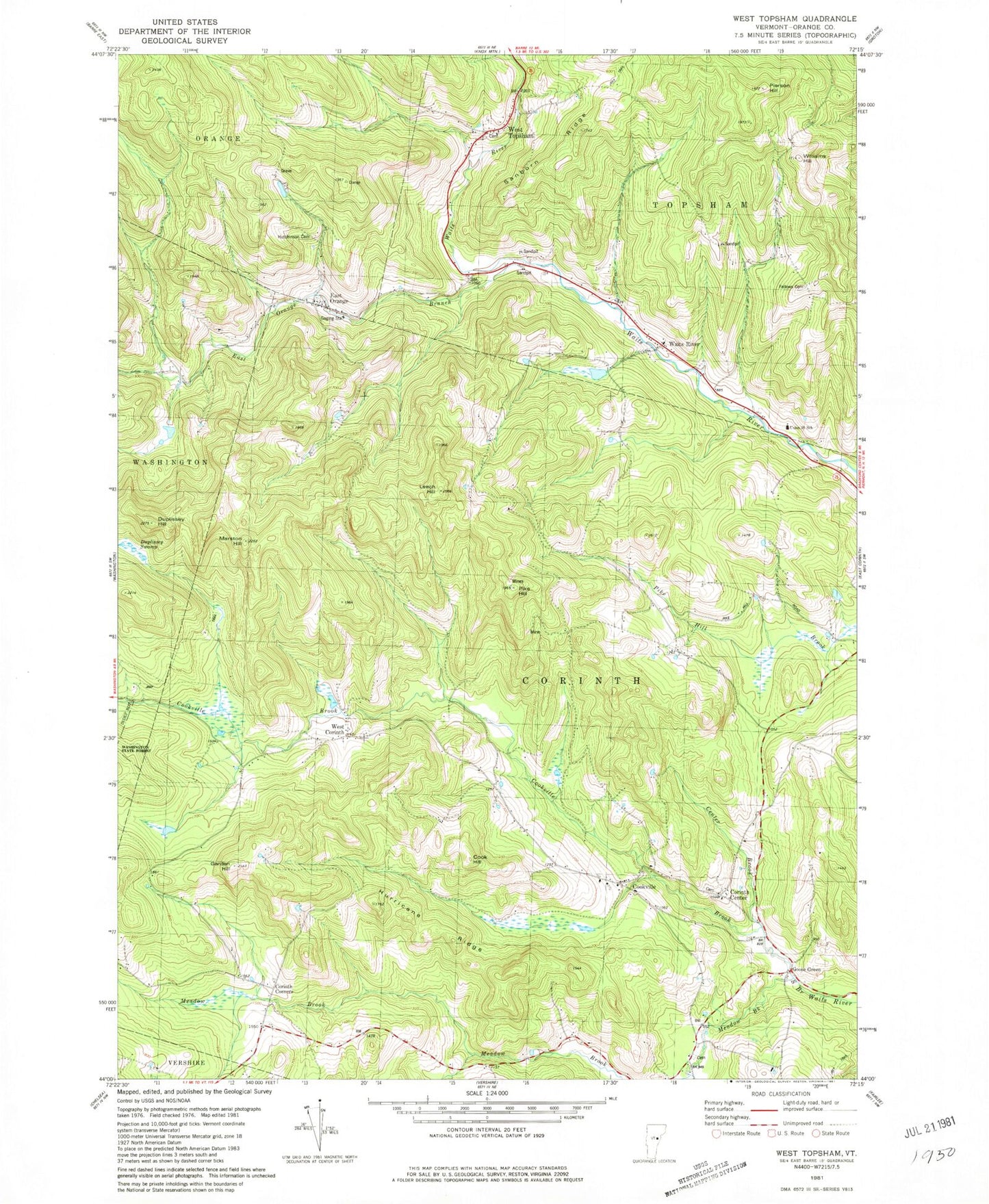
Classic USGS West Topsham Vermont 7.5'x7.5' Topo Map
Couldn't load pickup availability
Historical USGS topographic quad map of West Topsham in the state of Vermont. Typical map scale is 1:24,000, but may vary for certain years, if available. Print size: 24" x 27"
This quadrangle is in the following counties: Orange.
The map contains contour lines, roads, rivers, towns, and lakes. Printed on high-quality waterproof paper with UV fade-resistant inks, and shipped rolled.
Contains the following named places: Center Brook, Cook Hill, Cookville, Cookville Brook, Corinth Corner, Corinth Corners, Duplissey Hill, Duplissey Swamp, East Orange, East Orange Branch, Fellows Cemetery, Garden Hill, Goose Green, Hurricane Ridge, Hutchinson Cemetery, Leech Hill, Mayston Hill, Meadow Brook, Pierson Hill, Pike Hill, Sanborn Ridge, South Meadow Church, Waits River, West Corinth, West Topsham, Williams Hill, Town of Corinth, Corinth Post Office, Corinth Center Cemetery, Corinth Corners Cemetery, Corinth Post Office, Darling Cemetery, East Orange Cemetery, McCrillis Cemetery, Meadow Meeting House Cemetery, Richardson Cemetery, Union 36 School, Waits River Cemetery, West Corinth Cemetery, Old West Topsham Cemetery, West Topsham Cemetery, West Topsham Post Office, Zion Hill Cemetery, East Corinth Volunteer Fire Department - Corinth Station, Tri-Village Fire Department, Waits River Valley School