MyTopo
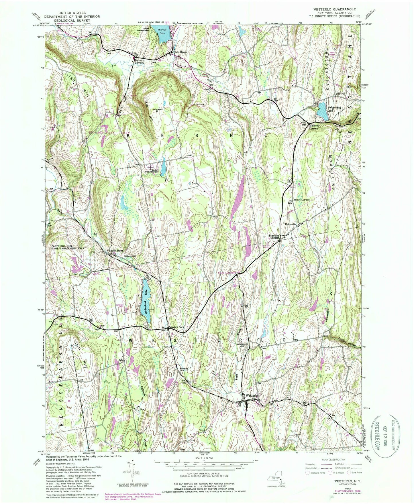
Classic USGS Westerlo New York 7.5'x7.5' Topo Map
Couldn't load pickup availability
Historical USGS topographic quad map of Westerlo in the state of New York. Map scale may vary for some years, but is generally around 1:24,000. Print size is approximately 24" x 27"
This quadrangle is in the following counties: Albany.
The map contains contour lines, roads, rivers, towns, and lakes. Printed on high-quality waterproof paper with UV fade-resistant inks, and shipped rolled.
Contains the following named places: Bensons Corners, Berne Fire District 3 Station 2, Bramans Corners, Camp Orinsekwa, Camp Woodstock, Cole Hill, East Berne, East Berne Post Office, Filkin Hill, Grippy Quarry, Heldeberg Airstrip, Helderberg, Helderberg Ambulance Squad, Helderberg Lake, Helderberg Mountains, Irish Hill, Mallorys Corners, Morning Fog Farm, Mountain View Farm, Onderdonk Lake, Reidsville, Reidsville Cemetery, School Number 11, School Number 7, School Number 9, Snyder Cemetery, Snyders Corners, South Berne, South Berne Rural Cemetery, Still Hill, Town of Berne, Van Leuvans School, Waxwing Airport, WCDA-FM (Voorheesville), Westerlo, Westerlo Airport, Westerlo Cemetery, Westerlo Post Office, Westerlo Volunteer Fire Company Station 1, Wolf Hill, WXXA-TV (Albany), ZIP Codes: 12059, 12193