MyTopo
Classic USGS Westerville Nebraska 7.5'x7.5' Topo Map
Couldn't load pickup availability
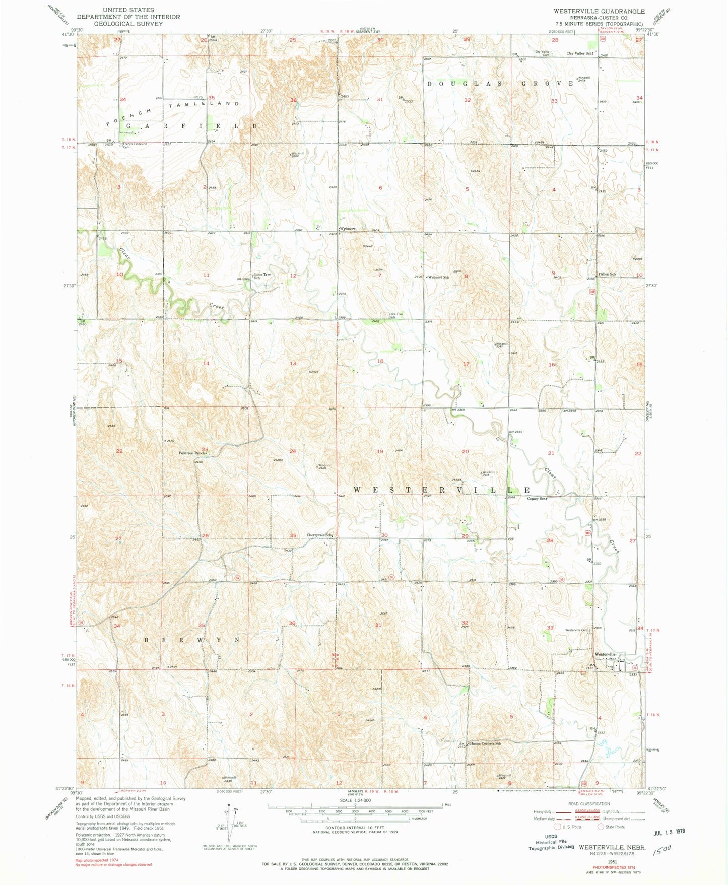
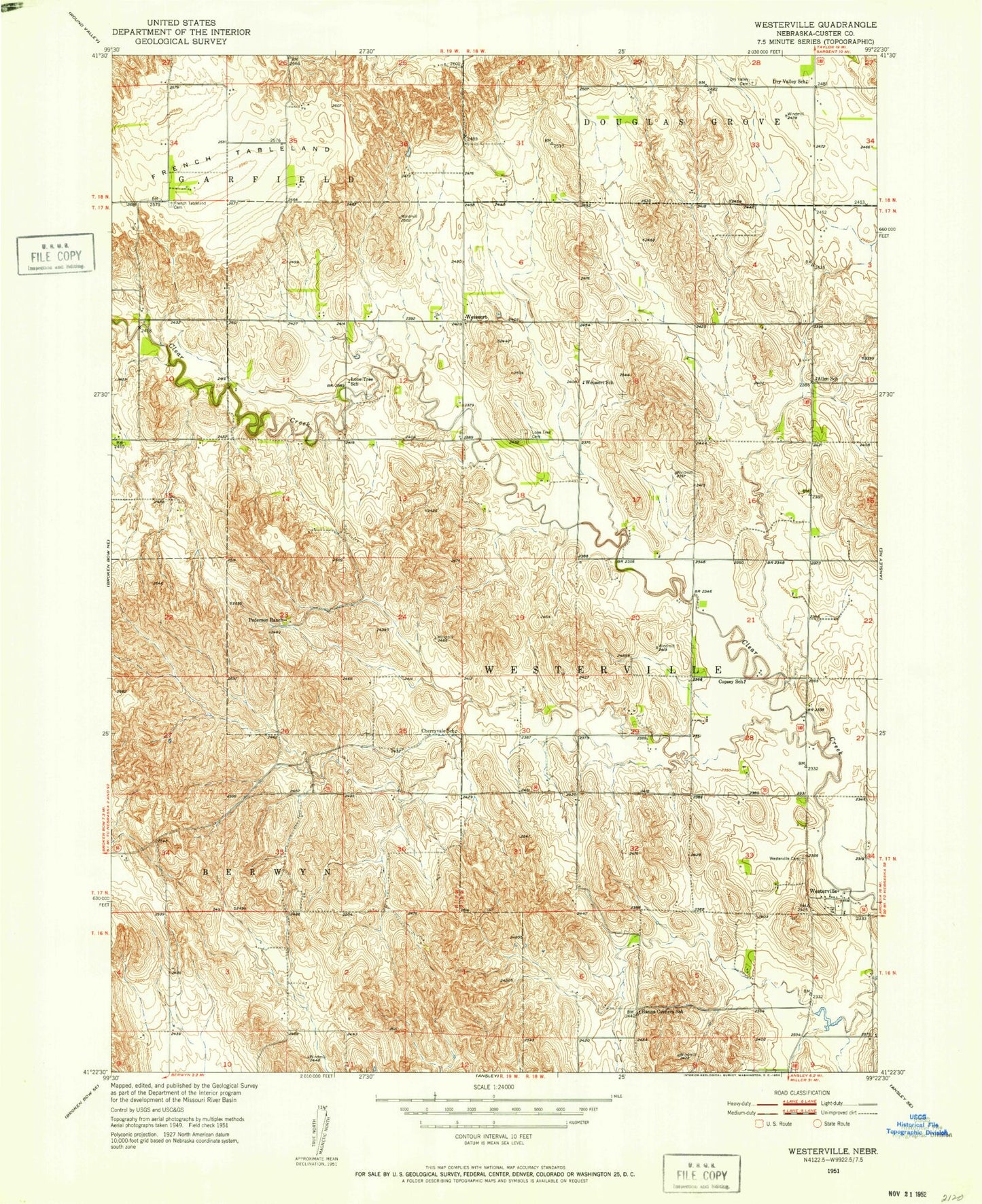
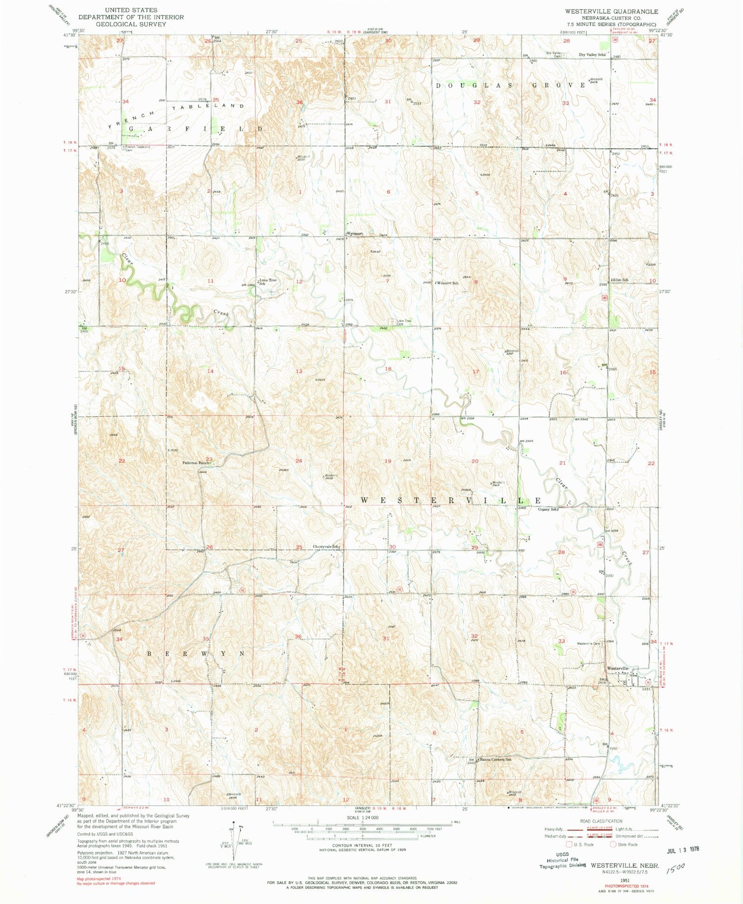
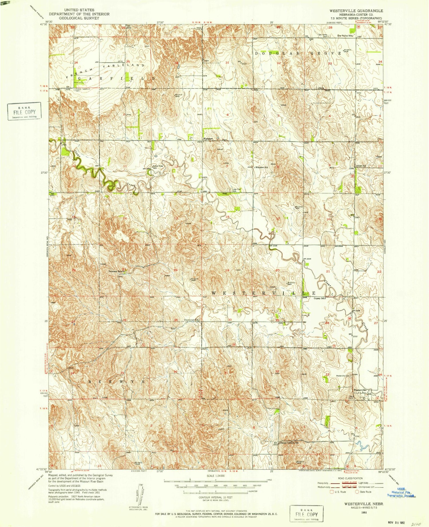
Historical USGS topographic quad map of Westerville in the state of Nebraska. Map scale may vary for some years, but is generally around 1:24,000. Print size is approximately 24" x 27"
This quadrangle is in the following counties: Custer.
The map contains contour lines, roads, rivers, towns, and lakes. Printed on high-quality waterproof paper with UV fade-resistant inks, and shipped rolled.
Contains the following named places: Allen School, Cherryvale School, Copsey School, Dry Valley Cemetery, Dry Valley School, French Tableland, French Tableland Cemetery, Hanna Corners School, Lone Tree Cemetery, Lone Tree School, Pederson Ranch, Township of Westerville, United Methodist Church, Weissert, Weissert Church of God, Weissert Post Office, Weissert School, Westerville, Westerville Cemetery, Westerville Census Designated Place, Westerville Historical Marker, Westerville Post Office, Westerville School