MyTopo
Classic USGS Westfall Kansas 7.5'x7.5' Topo Map
Regular price
$16.95
Regular price
Sale price
$16.95
Unit price
per
Couldn't load pickup availability
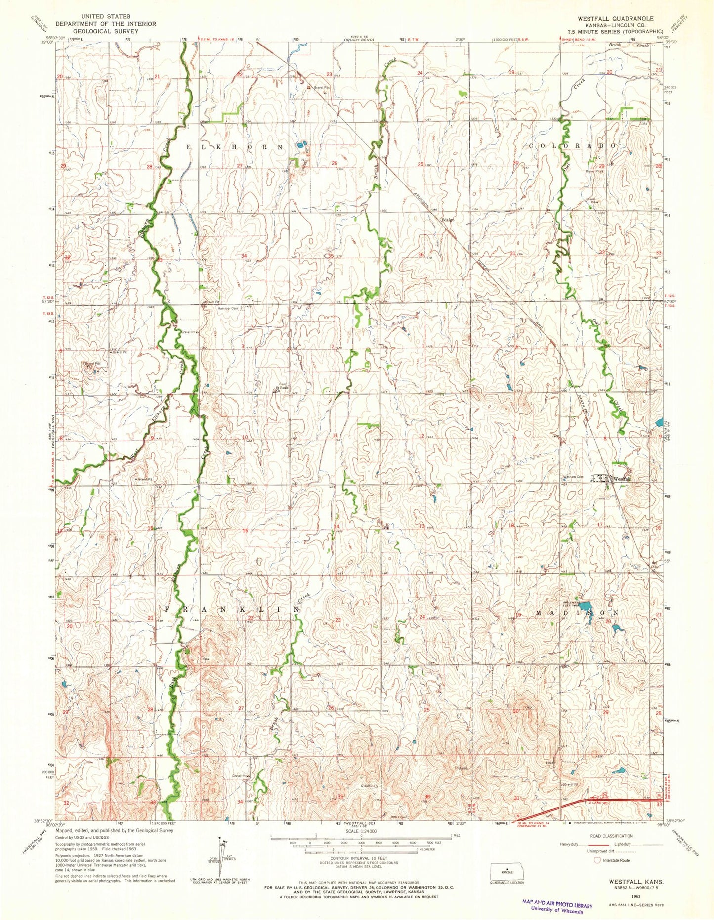
Historical USGS topographic quad map of Westfall in the state of Kansas. Map scale may vary for some years, but is generally around 1:24,000. Print size is approximately 24" x 27"
This quadrangle is in the following counties: Lincoln.
The map contains contour lines, roads, rivers, towns, and lakes. Printed on high-quality waterproof paper with UV fade-resistant inks, and shipped rolled.
Contains the following named places: Agmark Grain Elevator Number 20, Barton, East Elkhorn Creek, Edalgo, Hammer Cemetery, Saint Pauls Lutheran Cemetery, Saint Paul's Lutheran Church, Sylvan Public Use Area, Topsy, Towerspring, Township of Franklin, Washam Cemetery, West Elkhorn Creek, Westfall, Westfall Fire Department