MyTopo
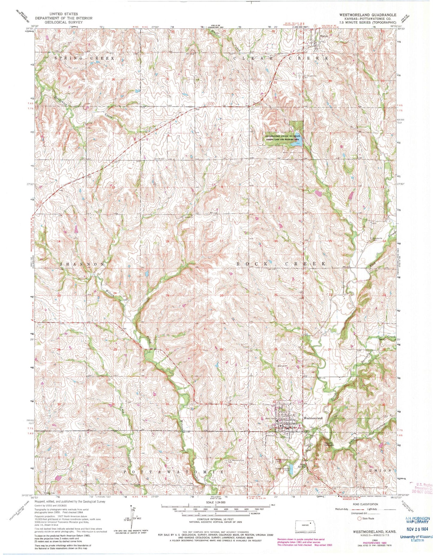
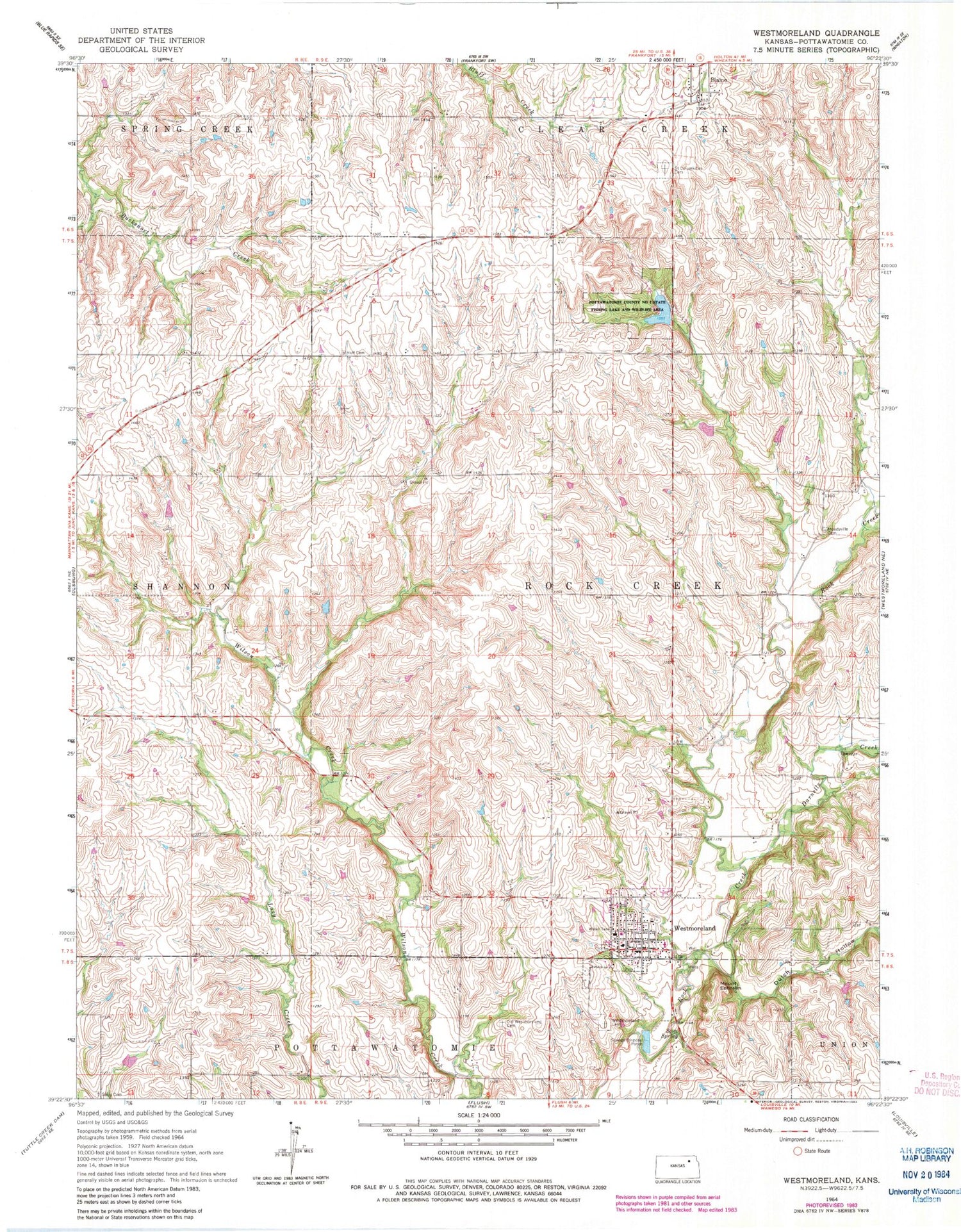
Classic USGS Westmoreland Kansas 7.5'x7.5' Topo Map
Couldn't load pickup availability
Historical USGS topographic quad map of Westmoreland in the state of Kansas. Map scale may vary for some years, but is generally around 1:24,000. Print size is approximately 24" x 27"
This quadrangle is in the following counties: Pottawatomie.
The map contains contour lines, roads, rivers, towns, and lakes. Printed on high-quality waterproof paper with UV fade-resistant inks, and shipped rolled.
Contains the following named places: Blaine, City of Westmoreland, Darnells Creek, Dutch Hollow, Huff Cemetery, Moodyville, Moodyville Cemetery, Mount Calvary Catholic Cemetery, Mount Ephraim, Old Westmoreland Cemetery, Pottawatomie County Courthouse, Pottawatomie County Health Department, Pottawatomie County Jail, Pottawatomie County Sheriff's Office, Pottawatomie County State Park Number One, Pottawatomie Number One State Fishing Lake and Wildlife Area, Pottawatomie Wabaunsee Regional Library Westmoreland Mini Branch, Rock Creek Unified School District Office, Rock Creek Valley Historical Society Museum, Sales Cemetery, Scott Spring, Seven Township and Westmoreland Fire Department, Township of Rock Creek, Westmoreland, Westmoreland Cemetery, Westmoreland City Hall, Westmoreland Elementary School, Westmoreland Post Office, Westmoreland Wastewater Treatment Facility, ZIP Code: 66549