MyTopo
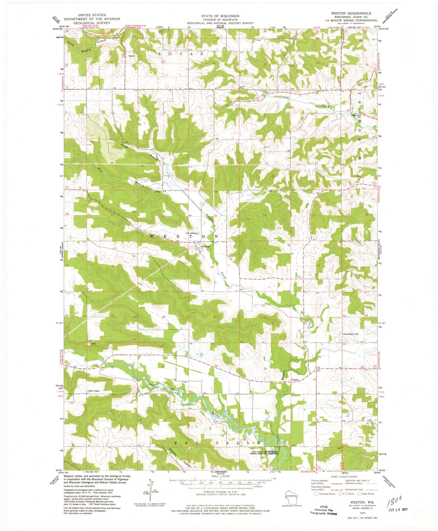
Classic USGS Weston Wisconsin 7.5'x7.5' Topo Map
Couldn't load pickup availability
Historical USGS topographic quad map of Weston in the state of Wisconsin. Map scale may vary for some years, but is generally around 1:24,000. Print size is approximately 24" x 27"
This quadrangle is in the following counties: Dunn.
The map contains contour lines, roads, rivers, towns, and lakes. Printed on high-quality waterproof paper with UV fade-resistant inks, and shipped rolled.
Contains the following named places: 0.60 Reservoir, 3.0 Reservoir, 3.00 Reservoir, Birthman School, Comfort, Connell's Sunridge Orchard, Dunkard Church, Eau Galle River State Public Hunting Grounds, Fairview School, Highland School, Howison School, Irvine Creek Cemetery, Knights Creek, Knights Creek 1 E4242 Dam, Knights Creek 4 E4242 Dam, Knights Creek 5 E4242 Dam, Lower Weston Cemetery, Lower Weston Church, Morton Hill School, Nippersink School, North Branch Knights Creek, Palmer School, Starkey School, Town of Weston, West Branch Knights Creek, Weston