
MyTopo
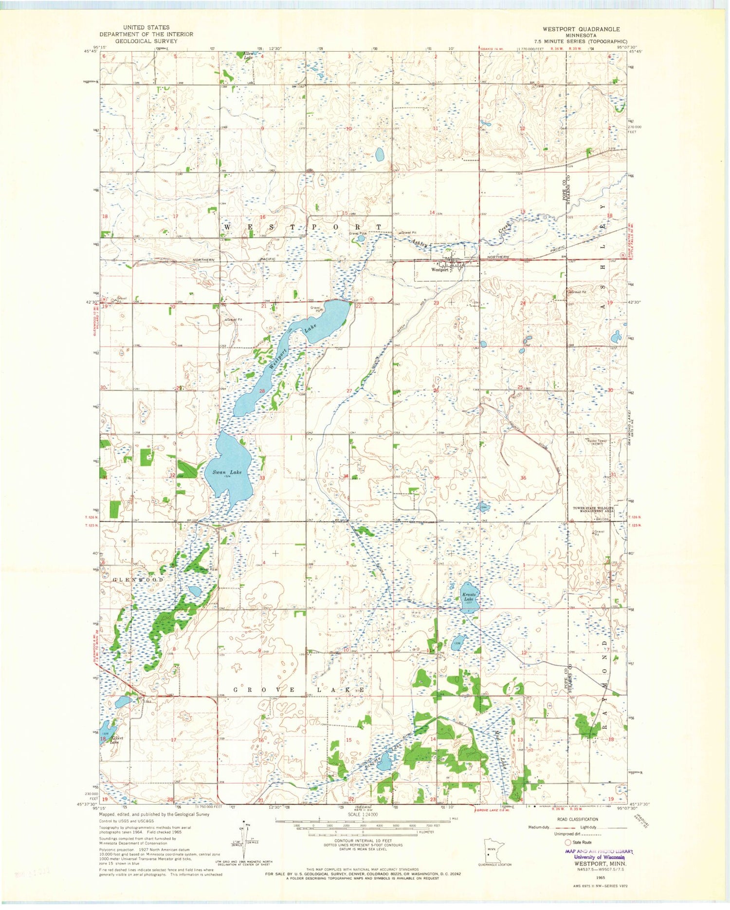
Classic USGS Westport Minnesota 7.5'x7.5' Topo Map
Couldn't load pickup availability
Historical USGS topographic quad map of Westport in the state of Minnesota. Map scale may vary for some years, but is generally around 1:24,000. Print size is approximately 24" x 27"
This quadrangle is in the following counties: Pope, Stearns.
The map contains contour lines, roads, rivers, towns, and lakes. Printed on high-quality waterproof paper with UV fade-resistant inks, and shipped rolled.
Contains the following named places: City of Westport, County Ditch Number Eleven, County Ditch Number Six, Judicial Ditch Number One, KCCO-TV (Alexandria), KIKV-FM (Alexandria), Krantz Lake, KSAX-TV (Alexandria), Lincoln Lake, Swan Lake, Tower State Wildlife Management Area, Township of Grove Lake, Township of Westport, Westport, Westport Lake, Westport Post Office, ZIP Code: 56385


