MyTopo
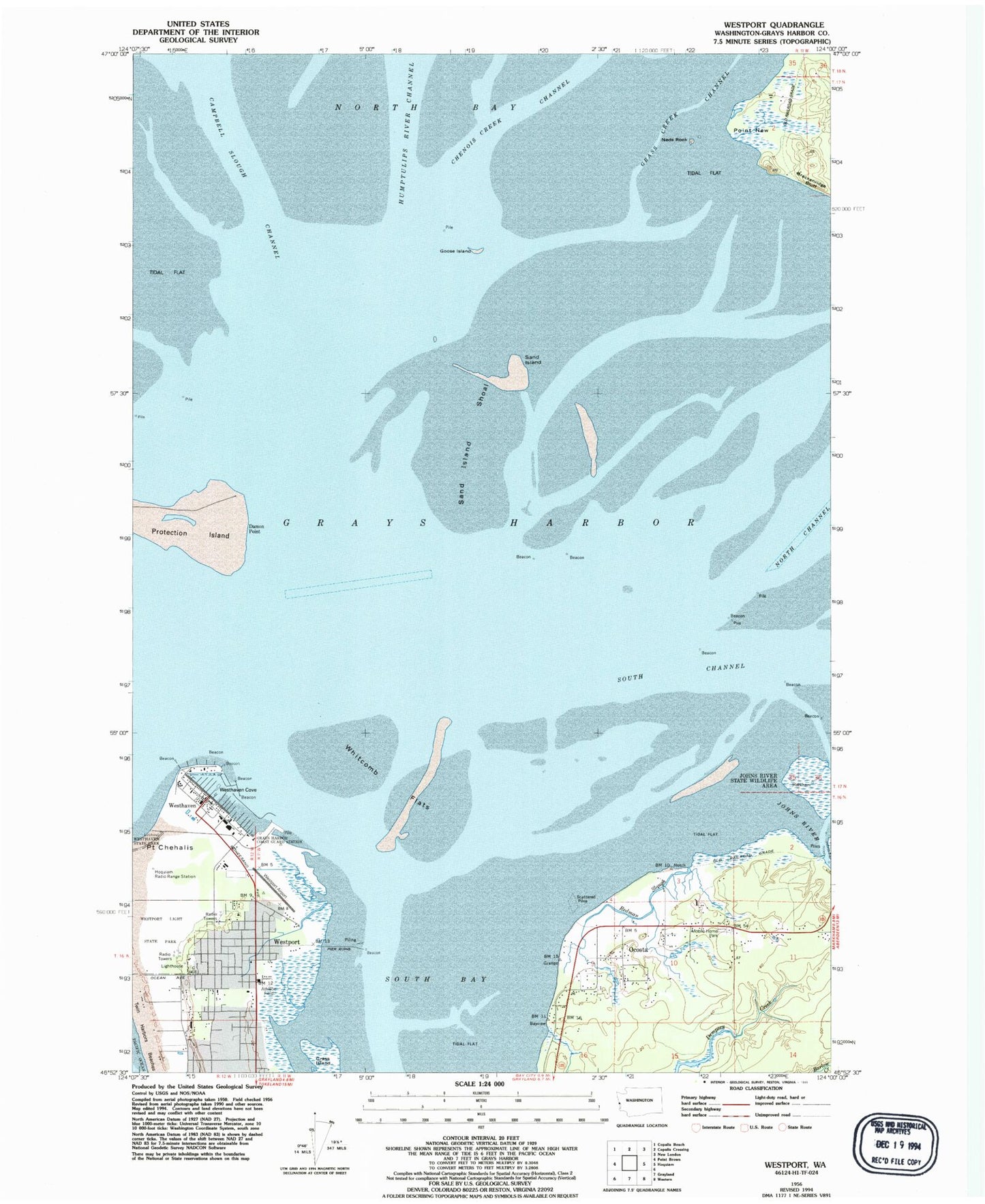
Classic USGS Westport Washington 7.5'x7.5' Topo Map
Couldn't load pickup availability
Historical USGS topographic quad map of Westport in the state of Washington. Map scale may vary for some years, but is generally around 1:24,000. Print size is approximately 24" x 27"
This quadrangle is in the following counties: Grays Harbor.
The map contains contour lines, roads, rivers, towns, and lakes. Printed on high-quality waterproof paper with UV fade-resistant inks, and shipped rolled.
Contains the following named places: Armstrong Bay, Brackenridge Bluff, Chenois Creek Channel, City of Westport, City of Westport Fire Department, Coast Guard Station Grays Harbor, Damon Point, Goose Island, Grass Creek Channel, Grass Island, Grays Harbor, Grays Harbor CG, Grays Harbor Lighthouse, Hoquiam Radio Range Station, Johns River, Kingdom Hall of Jehovahs Witnesses, Lone Tree, Neds Rock, North Bay, Ocosta, Ocosta Census Designated Place, Point New, Redman Slough, Saint Christopher Episcopal Church, Sand Island, Sand Island Shoal, South Bay, South Beach Ambulance Service, Traitors Islet, Twin Harbor Baptist Church, Westhaven, Westhaven Cove, Westport, Westport Airport, Westport City Hall, Westport Light State Park, Westport Marina, Westport Maritime Museum, Westport Police Department, Westport Post Office, Westport Timberland Library, Westport Wastewater Treatment Plant, Whitcomb Flats, ZIP Code: 98595