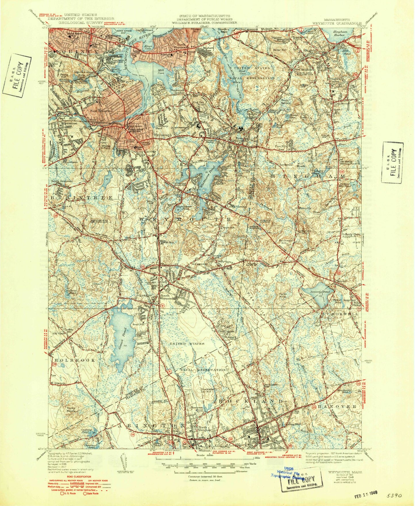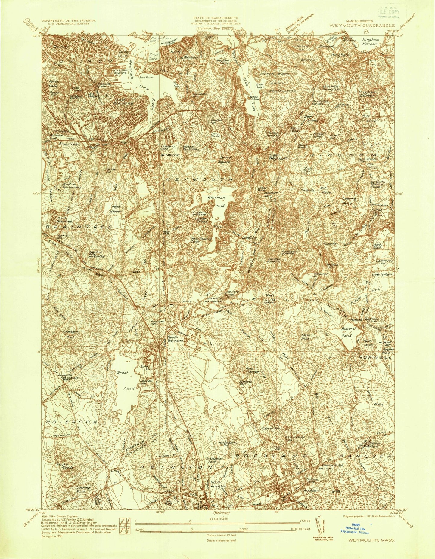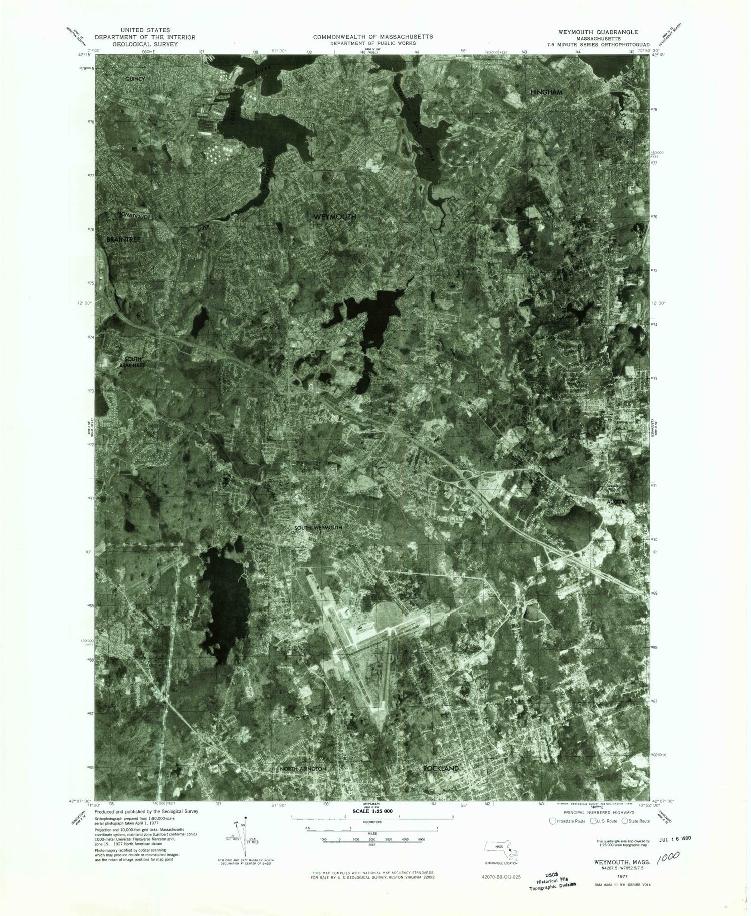

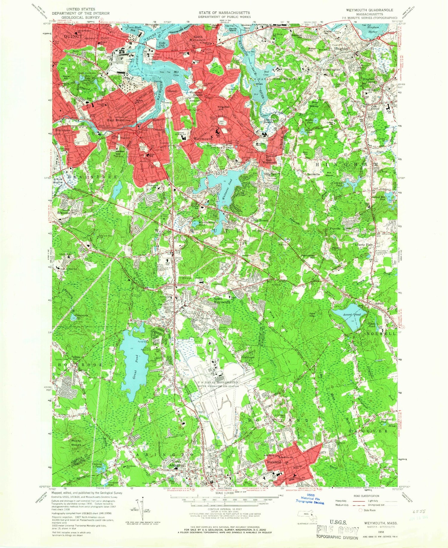
MyTopo
Classic USGS Weymouth Massachusetts 7.5'x7.5' Topo Map
Couldn't load pickup availability
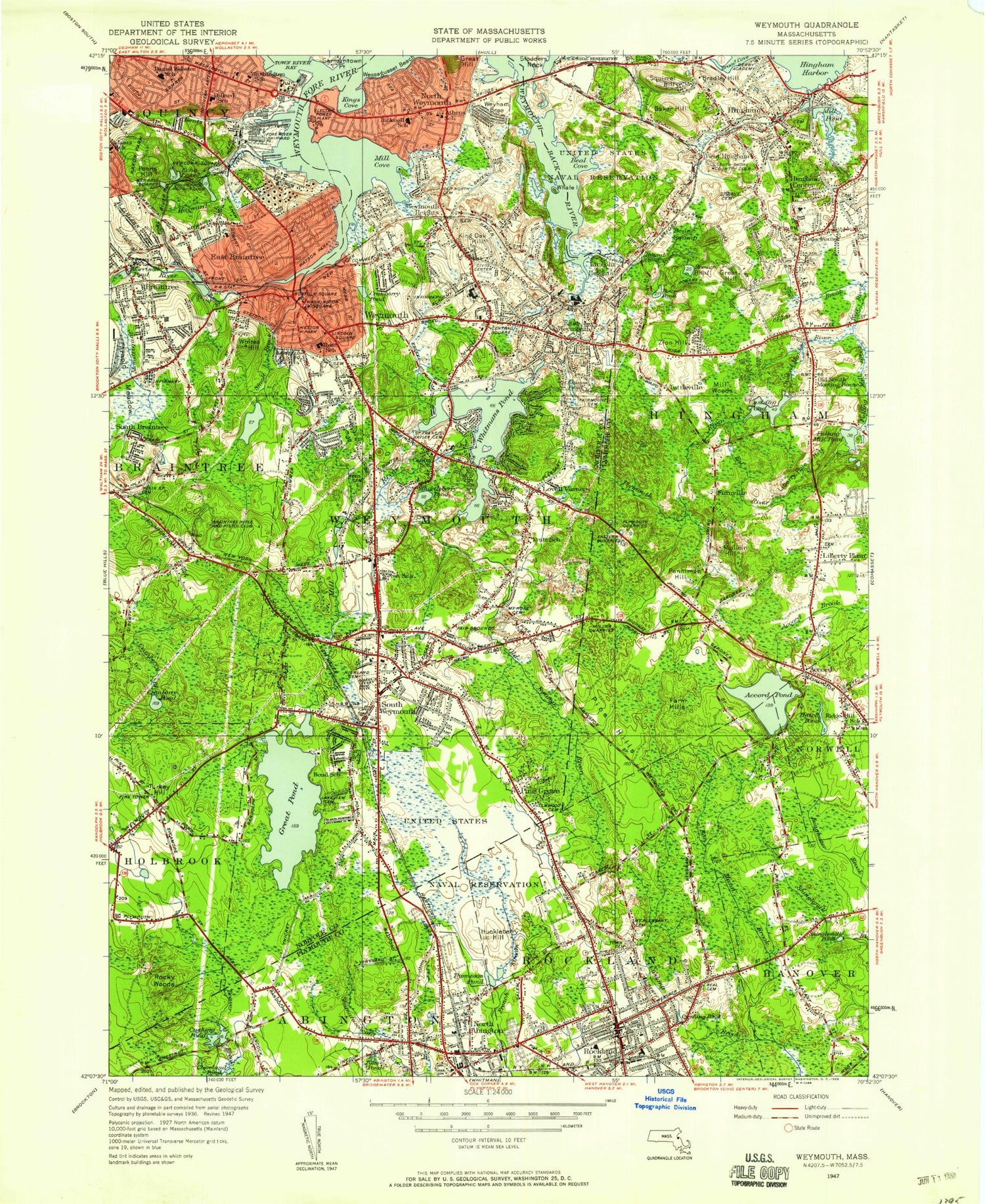
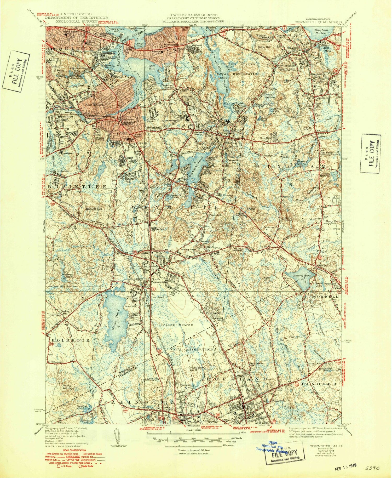
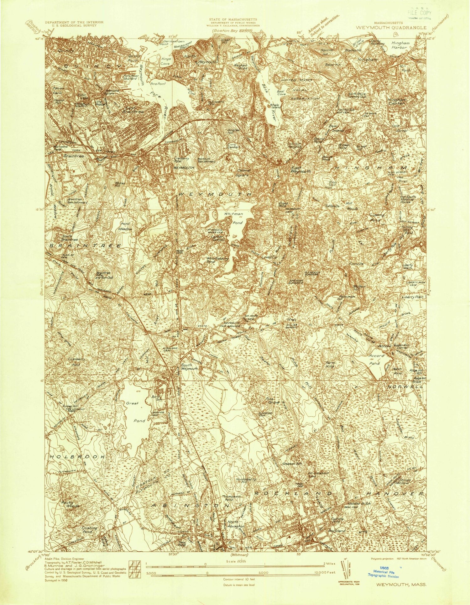
Historical USGS topographic quad map of Weymouth in the state of Massachusetts. Typical map scale is 1:24,000, but may vary for certain years, if available. Print size: 24" x 27"
This quadrangle is in the following counties: Norfolk, Plymouth.
The map contains contour lines, roads, rivers, towns, and lakes. Printed on high-quality waterproof paper with UV fade-resistant inks, and shipped rolled.
Contains the following named places: Fogg Library, Faxon Park, Victory Park, Penniman School, Saint Thomas Mores School, Lincoln School, Perkins School, Saint Josephs School, Frederick C Murphy School, Pollard School, Watson School, Webb Park, Watson Park, Sacred Heart School, Archie T Morrison School, Liberty School, South Middle School, Homestead School, Reed Cemetery, Saint Francis Xavier Cemetery, William Seach School, Ralph Talbot School, Mount Hope Cemetery, Highland Cemetery, Nash School, Nevin School, Tirrell Playground, Saint Francis Xavier School, South High School, South Weymouth Junior High School, Pratt School, Negus Playground, Lakeview Cemetery, Union Street School, Elmwood Cemetery, Alice Fulton School, Woodsdale School, Ames Nowell State Park, North School, Rockland Junior High School, Rockland High School, Lincoln School, Maplewood Cemetery, Hanover Junior High School, Beal Cemetery, Holy Family School, McKinley School, Mount Pleasant Cemetery, South Junior High School, Notre Dame Academy, South School, Grace Farrar Cole School, Hingham Shopping Plaza, Plymouth River School, Fort Hill Cemetery, Saint Paul's Cemetery, South Shore Country Club, Hingham Center Central Junior High School, Old South Meetinghouse, Lincoln School, Cole Corner High School, Talbot Field, Derby Academy, High Street Cemetery, Saint Pauls School, Saint Jeromes School, Bicknell School, Beals Park, Johnson School, Old North Cemetery, John Adams School, Legion Field, Weymouth High School, Weymouth High School, Weymouth Townhall, Academy Avenue School, Weymouth Central Junior High School, Jefferson School, Libby Field, Humphrey School, Lawrence W Pingree School, Washington School, John McCulloch School, Fairmount Cemetery, Quincy Point Junior High School, Adams School, Braintree East Junior High School, Eldridge School, Weston Park, Hunt School, Village Cemetery, North Abington Station (historical), Rockland Station (historical), Hingham Station (historical), West Hingham Station (historical), Weymouth Fore River Marshes, Weir River Marshes, Weymouth Back River Marshes, Pleasant Shops Shopping Center, South Shore Consumers Mall, Weymouth Village, Harborlight Mall, Tedeschi Shopping Center, Cushing Pond Dam, Hackett Pond Dam, Weymouth Great Pond Dam, Accord Pond Dam, Fulling Millpond Dam, Cushing Pond Dam, Pond Meadow Lake Reservoir, Smelt Brook Dam, Whitmans Pond Dam, John F Kennedy School, Braintree, South Braintree, Accord, Accord Pond, Arnold Meadow, Baker Hill, Bear Swamp, Ben Mann Brook, Bouve Pond, Bradley Hill, Brewer Pond, Cole Corner, Cranberry Pond, Cranberry Pond, Crooked Meadow River, Cushing Pond, Cushing Pond, Davids Island, East Braintree, East Weymouth, Echo Lake, Eel River, Elias Pond, Farm Hills, Finnville, Fresh River, Fulling Mill Brook, Great Hill, Hatch Pond, Hayward Creek, Hingham, Hingham Center, Home Meadows, Idlewell, King Oak Hill, Liberty Plain, Liberty Pole Hill, Lincoln Heights, Lovell Corners, Mill Woods, Mullein Hill, North Abington, North Weymouth, Old Swamp River, Penniman Hill, Penns Hill, Pine Grove, Pine Hills, Plymouth River, Quincy Point, Rockland, Rocky Woods, Shinglemill Pond, Shipyard Point, Smelt Brook, South Commons, South Weymouth, Squirrel Hill, Tims Pond, Tower Brook, Town River Bay, Turkey Hill, Tuttleville, Wessagusset Beach, West Hingham, Weymouth, Weymouth Great Pond, Weymouth Heights, Whale Island, Whites Hill, Whitmans Pond, Whortleberry Pond, Zion Hill, Broad Cove, Stodders Neck, Bents Creek, Germantown Point, Mill River, Pine Point, Fort Hill, Hatherly, Ferry Point, Hunt Hill Point, Old Spain, Weymouth Landing, Whites Neck, Wyman Hill, Monatiquot River, Old Boat Point, Quincy Neck, Town of Hingham, Town of Rockland, Beal Cove, Kings Cove, Mill Cove, Hatherly Post Office (historical), West Hingham Post Office (historical), Hingham Center Post Office (historical), South Hingham Post Office (historical), Clean Harbors Heliport, Naval Air Station South Weymouth (historical), City of Weymouth Town, WRPS-FM (Rockland), Abigal Adams House Museum, Alberto Eldridge School, Bradford Hawes Park, Clapp Memorial Park, East Junior High School, East Middle School, East Weymouth Post Office, Eatons Pond, Ellias Pond, Fulling Millpond, Gagnon Park, Harbor Light Mall Shopping Center, Holbrook Post Office, House Rock Park, Immaculate Conception School, Lovell Playground, Newell Playground, North Senior High School, North Weymouth Cemetery, North Weymouth Post Office