MyTopo
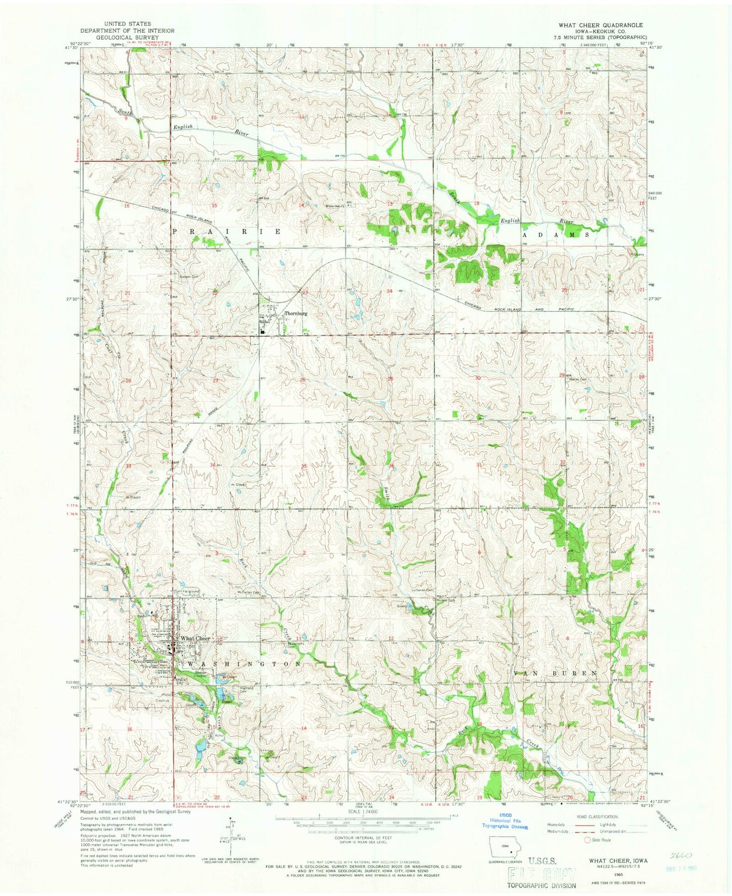
Classic USGS What Cheer Iowa 7.5'x7.5' Topo Map
Couldn't load pickup availability
Historical USGS topographic quad map of What Cheer in the state of Iowa. Map scale may vary for some years, but is generally around 1:24,000. Print size is approximately 24" x 27"
This quadrangle is in the following counties: Keokuk.
The map contains contour lines, roads, rivers, towns, and lakes. Printed on high-quality waterproof paper with UV fade-resistant inks, and shipped rolled.
Contains the following named places: Aurora Post Office, Bailey Cemetery, Christian Church Disciples, City of Thornburg, City of What Cheer, Cory, Cory Post Office, Griffin Park, Highland Cemetery, Humes Cemetery, Jamestown, McFarlan Cemetery, Milan, Milan Post Office, Pecks Post Office, Rosetta, Saint Josephs Cemetery, Saint Martin Evangelical Lutheran Cemetery, Sixteen Cemetery, Smith Creek, Thornburg, Thornburg Post Office, Township of Prairie, Township of Washington, Tri - County Community School, Tri - County Elementary School, Tri - County Junior High School, United Methodist Church, Vulcan, What Cheer, What Cheer Brick School Museum, What Cheer Christian Church, What Cheer Fire Department, What Cheer Police Department, What Cheer Post Office, What Cheer Public Library, White Oak Church, ZIP Codes: 50136, 50255, 50268