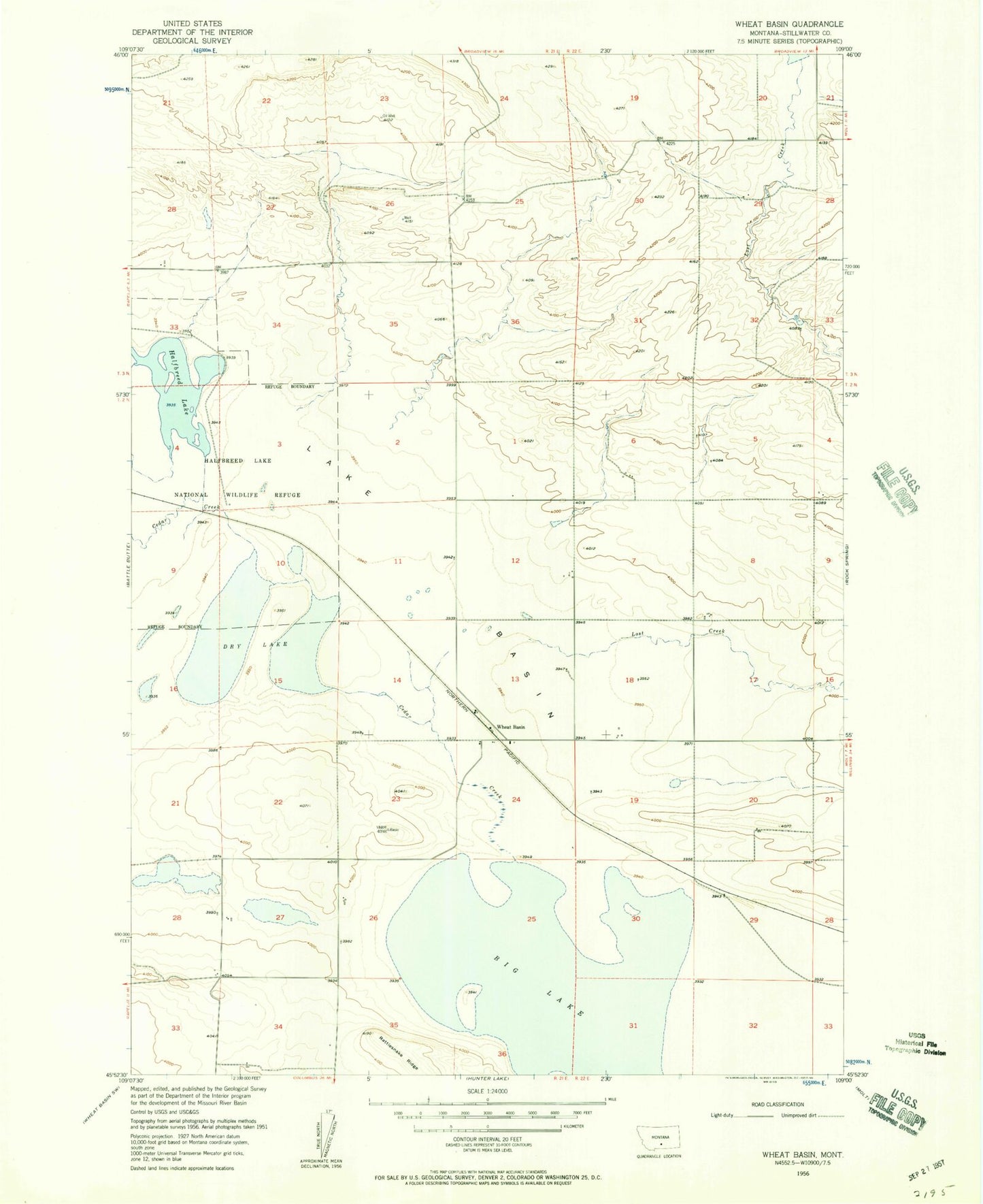
MyTopo
Classic USGS Wheat Basin Montana 7.5'x7.5' Topo Map
Regular price
$16.95
Regular price
Sale price
$16.95
Unit price
per
Couldn't load pickup availability
Historical USGS topographic quad map of Wheat Basin in the state of Montana. Map scale may vary for some years, but is generally around 1:24,000. Print size is approximately 24" x 27"
This quadrangle is in the following counties: Stillwater.
The map contains contour lines, roads, rivers, towns, and lakes. Printed on high-quality waterproof paper with UV fade-resistant inks, and shipped rolled.
Contains the following named places: 02N21E34CBDD01 Well, Big Lake, Cedar Creek, Dry Lake, Eastlake Pond/Big Lake Waterfowl Management Area, Grass Lake National Wildlife Refuge, Halfbreed Lake, Lake Basin, Lost Creek, Rattlesnake Ridge, Stillwater Post Office, Wheat Basin, Wheat Basin Post Office