MyTopo
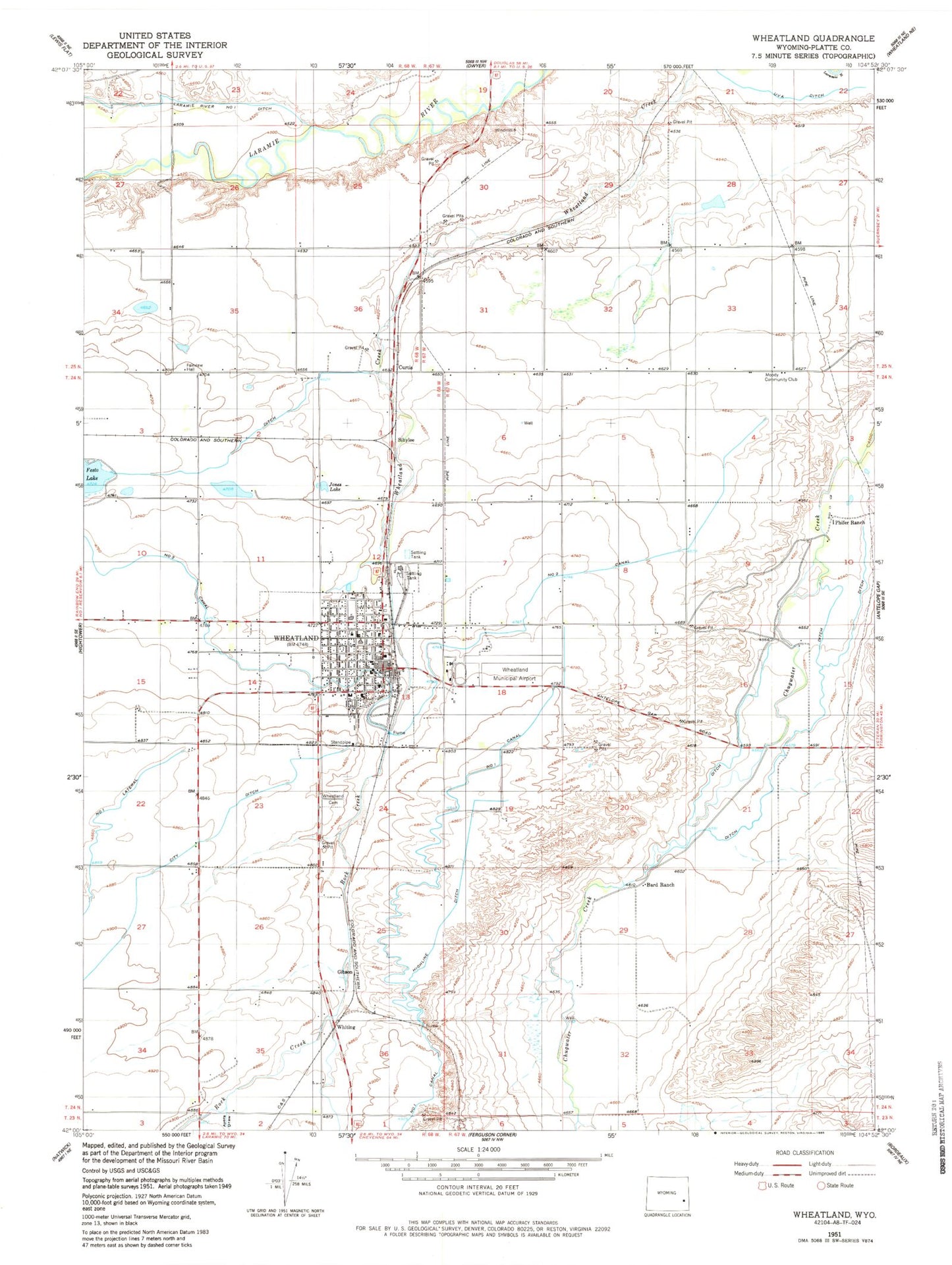
Classic USGS Wheatland Wyoming 7.5'x7.5' Topo Map
Couldn't load pickup availability
Historical USGS topographic quad map of Wheatland in the state of Wyoming. Map scale may vary for some years, but is generally around 1:24,000. Print size is approximately 24" x 27"
This quadrangle is in the following counties: Platte.
The map contains contour lines, roads, rivers, towns, and lakes. Printed on high-quality waterproof paper with UV fade-resistant inks, and shipped rolled.
Contains the following named places: Ayers Draw, Bard Ranch, Chugcreek, Chugcreek Census Designated Place, City Ditch, Cottonwood School, Curtis, Eastern Wyoming Ambulance, Festo Lake, Gibson, Highline Ditch, Jones Lake, KYCN-AM (Wheatland), KYCN-FM (Wheatland), Lakeview North Census Designated Place, Laramie River Ditch Number 1, Libbey School, Mbpp Raw Water Storage Dam, MBPP Storm Runoff Retention Reservoir, Meadowlark Maison Hospital, Moody Community Club, Number 2 Canal, Phifer Airfield, Phifer Ranch, Platte County Memorial Hospital, Platte County Memorial Nursing Home, Platte County Sheriff's Office, Roath Dam, Roath Reservoir, Rock Creek, Sibylee, Sibylee School, Timber Canyon Ranch School, Town of Wheatland, Uva Ditch, West School, Wheatland, Wheatland Cemetery, Wheatland High School, Wheatland Junior High School, Wheatland Police Department, Wheatland Post Office, Wheatland Volunteer Fire Department, Whiting, Whiting Census Designated Place, Y-O Ranch, Y-O Ranch Census Designated Place


