
MyTopo
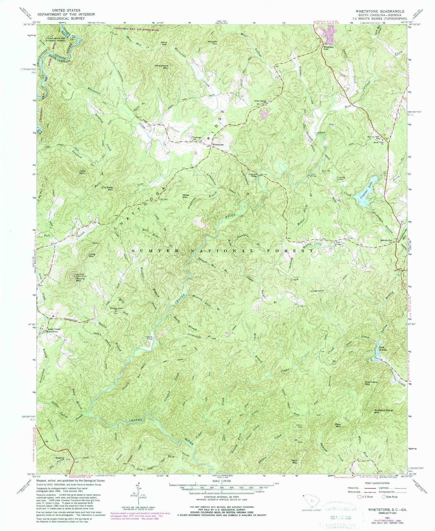
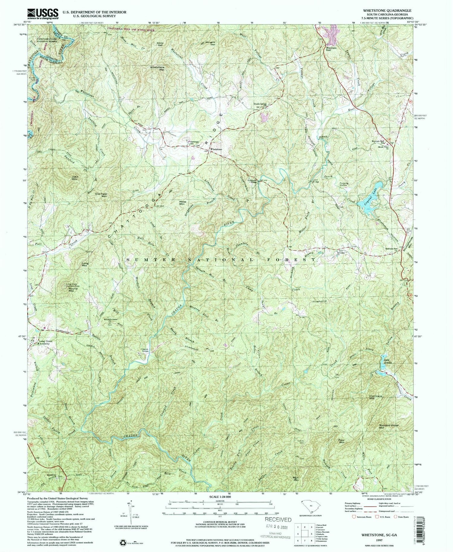
Classic USGS Whetstone South Carolina 7.5'x7.5' Topo Map
Couldn't load pickup availability
Historical USGS topographic quad map of Whetstone in the states of South Carolina, Georgia. Typical map scale is 1:24,000, but may vary for certain years, if available. Print size: 24" x 27"
This quadrangle is in the following counties: Oconee, Rabun.
The map contains contour lines, roads, rivers, towns, and lakes. Printed on high-quality waterproof paper with UV fade-resistant inks, and shipped rolled.
Contains the following named places: Baker Branch, Blackwell Bridge, Bone Camp Creek, Buzzard Roost Mountain, Cassidy Bridge, Cedar Creek, Chambers Branch, Chattooga School, Collins Cemetery, Coppermine Branch, Crooked Creek, Crystal Lake, Doran Creek, Double Branch, Double Springs Church, Flint Creek, Grapevine Branch, Harts Branch, Hell Hole Creek, Hickory Flat Branch, Lake Jemike, Land Bridge, Laurel Creek, Limestone Creek, Long Branch, Long Creek Academy (historical), Long Mountain, Mill Creek, Miller Field Branch, Moss Mountain, Mountain Rest, Old Field Mountain, Orchard Branch, Orrs Mill Creek, Otter Creek, Poor Mountain, Rhoda Branch, Rocky Gap, Sand Branch, Sawyer Branch, Shingle Mill Branch, Spider Valley Creek, Spy Rock Creek, Swaford Creek, Tyler Branch, Village Creek, West Village Creek, Whetstone Mountain, Woodall Branch, Yellow Branch, Whetstone, Jerry Creek, Mongold Gap, Yellow Branch Campground, Andrew Pickens Ranger Station, Cassidy Bridge Campground, Hurricane Mountain, John Mountain, Rich Mountain, Round Mountain, Lake Leroy Dam D-1639, Crystal Lake Dam D-1645, Crystal Lake, Lake Jemike Number One Dam D-1648, South Carolina Noname 37030 D-1644 Dam, Lake Jemike Number Two Dam D-1649, Long Creek Lookout Tower, Bethlehem School (historical), Long Creek School (historical), Mountain Grove School (historical), Poplar Springs School (historical), Rich Mountain School (historical), Round Mountain Church (historical), Round Mountain School (historical), Tunnel Hill, Belmont Cemetery, Brasstown Baptist Church Graveyard, Monte Vista Baptist Church Graveyard, Mountain Grove Baptist Church Graveyard, Monte Vista Baptist Church, Belmont Baptist Church, Brasstown Baptist Church, Double Springs Baptist Church, East Village Creek, Mountain Grove Baptist Church, Mountain Rest Baptist Church, Mountain Rest School, Stumphouse Mountain Tunnel, Taylor Creek, Whetstone Creek, Lake Leroy, Chauga River Scenic Area, Cedar Creek Rifle Range, Long Creek Division, Oconee County Emergency Services Mountain Rest Fire Station 4, Double Springs Methodist Church Graveyard, Rock Creek, Sandy Ford, Dicks Creek