MyTopo
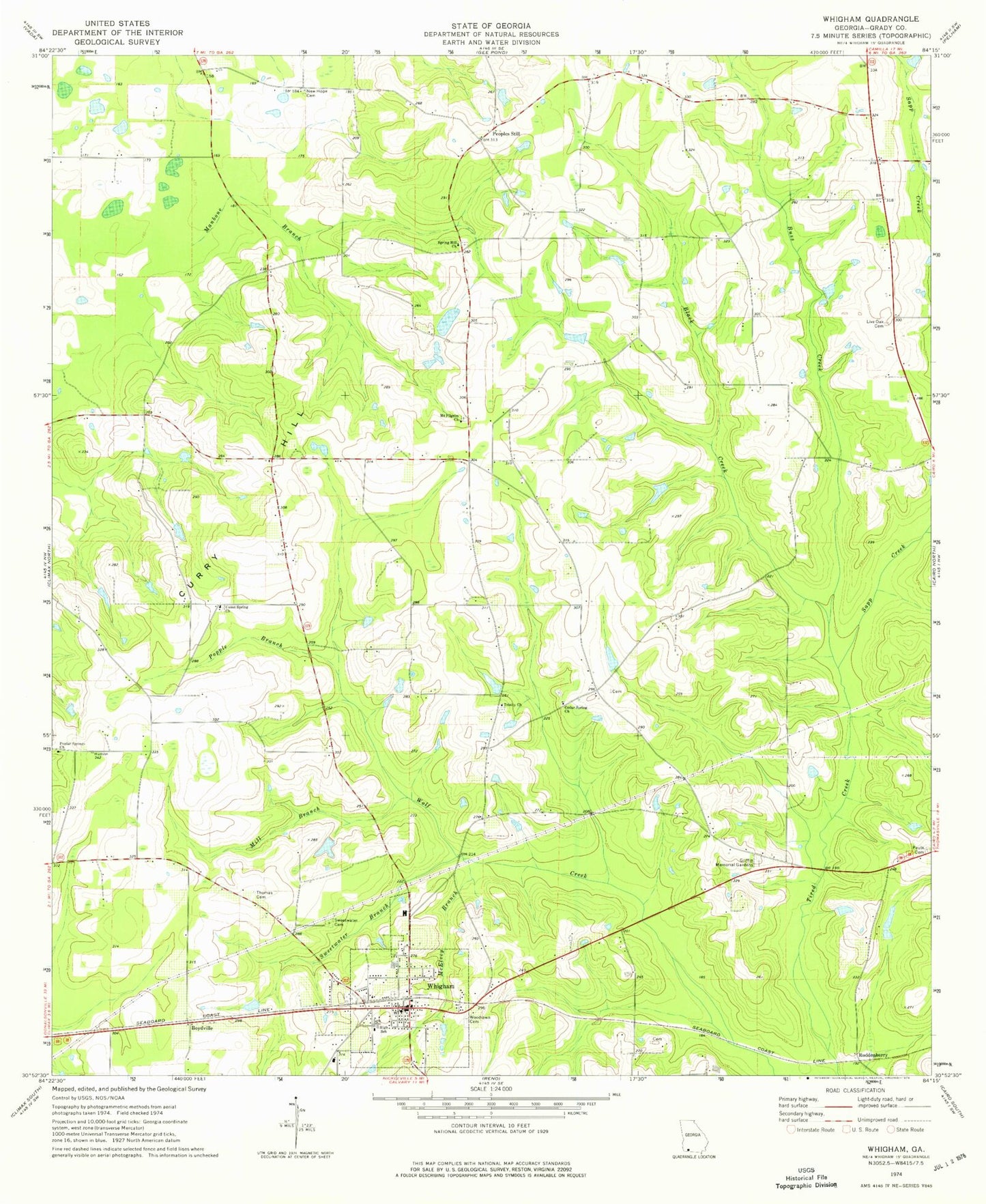
Classic USGS Whigham Georgia 7.5'x7.5' Topo Map
Couldn't load pickup availability
Historical USGS topographic quad map of Whigham in the state of Georgia. Map scale may vary for some years, but is generally around 1:24,000. Print size is approximately 24" x 27"
This quadrangle is in the following counties: Grady.
The map contains contour lines, roads, rivers, towns, and lakes. Printed on high-quality waterproof paper with UV fade-resistant inks, and shipped rolled.
Contains the following named places: Bearden Lake, Bearden Lake Dam, Black Creek, Boydville, Buss Creek, Cedar Spring Church, City of Whigham, Connells School, Curry Hill, Ezell Lake, Ezell Lake Dam, Grady County Volunteer Fire Department Pine Level Station, Grady County Volunteer Fire Department Whigham Station, Griffin Memorial Gardens, Live Oak Cemetery, Live Oak School, Manbone Branch, McElvey Branch, Mill Branch, Mount Pilgrim Church, New Hope Cemetery, New Hope Church, Paulk Cemetery, Peoples Still, Poplar Springs Cemetery, Poplar Springs Church, Popple Branch, Roddenberry, Sapp Creek, Spring Hill Church, Springhill Church Cemetery, Sweetwater Branch, Sweetwater Cemetery, Terrell Lake, Terrell Lake Dam, Thomas Cemetery, Trinity Church, Trinity Church Cemetery, Union Spring Church, Union Springs Church Cemetery, Wayside School, Whigham, Whigham Cemetery, Whigham Division, Whigham Police Department, Whigham Post Office, Whigham School, Woodlawn Cemetery, ZIP Code: 39897