MyTopo
Classic USGS Whiskey Dick Mountain Washington 7.5'x7.5' Topo Map
Couldn't load pickup availability
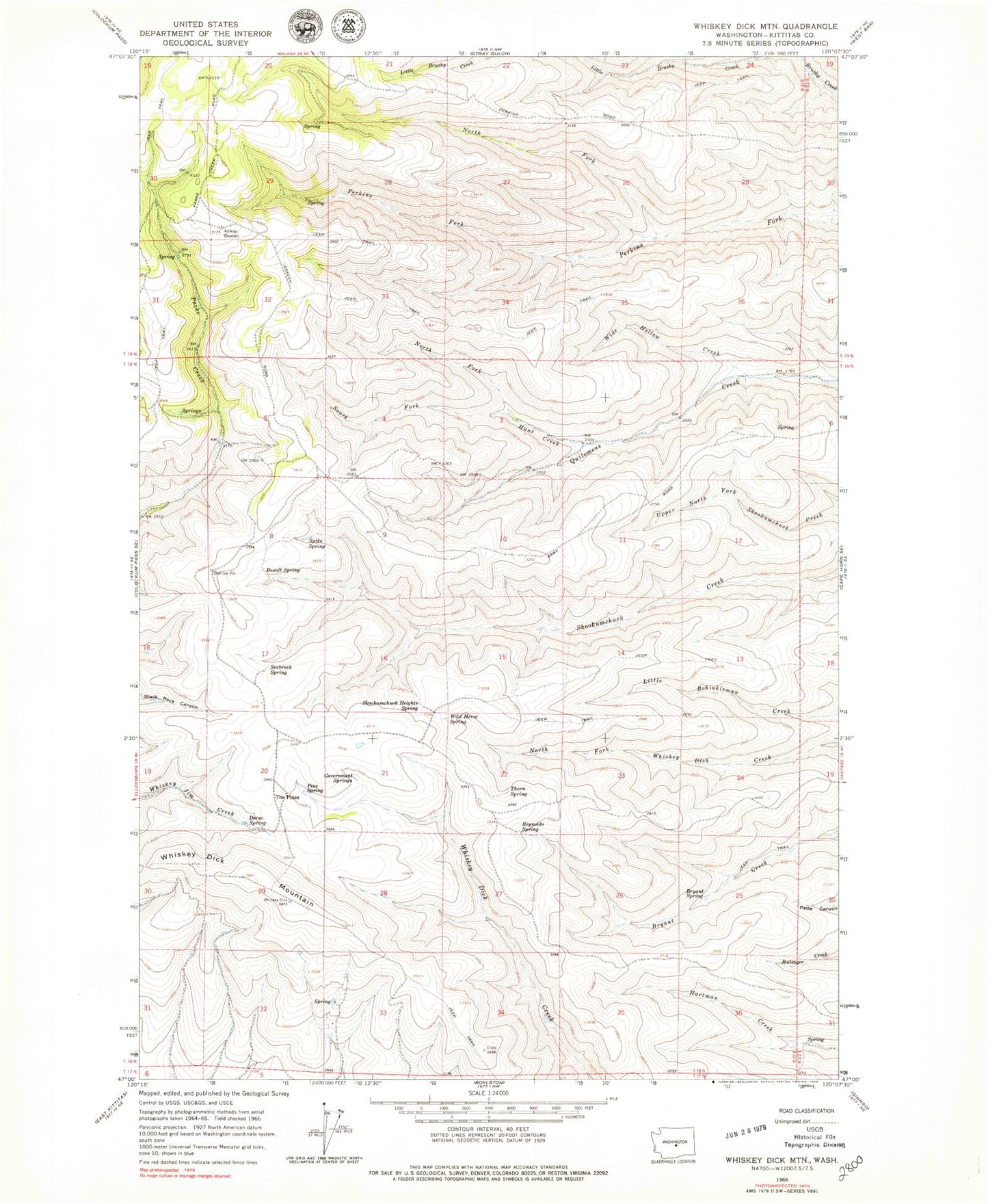
Historical USGS topographic quad map of Whiskey Dick Mountain in the state of Washington. Map scale may vary for some years, but is generally around 1:24,000. Print size is approximately 24" x 27"
This quadrangle is in the following counties: Kittitas.
The map contains contour lines, roads, rivers, towns, and lakes. Printed on high-quality waterproof paper with UV fade-resistant inks, and shipped rolled.
Contains the following named places: Basalt Spring, Bryant Spring, Dorse Spring, Government Springs, Hunt Creek, North Fork Hunt Creek, North Fork Perkins Fork, Pine Spring, Quilomene Wildlife Recreation Area, Reynolds Spring, Seabrock Spring, Skookumchuck Heights Spring, South Fork Hunt Creek, Spike Spring, The Pines, Thorn Spring, Whiskey Dick Mountain, Wide Hollow Creek, Wild Horse Spring