MyTopo
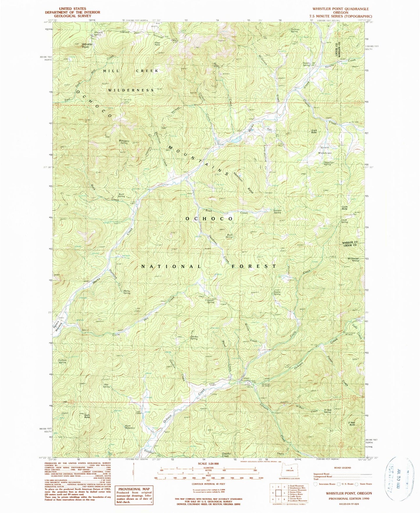
Classic USGS Whistler Point Oregon 7.5'x7.5' Topo Map
Couldn't load pickup availability
Historical USGS topographic quad map of Whistler Point in the state of Oregon. Map scale may vary for some years, but is generally around 1:24,000. Print size is approximately 24" x 27"
This quadrangle is in the following counties: Crook, Wheeler.
The map contains contour lines, roads, rivers, towns, and lakes. Printed on high-quality waterproof paper with UV fade-resistant inks, and shipped rolled.
Contains the following named places: Bandit Spring, Bandit Spring Safety Rest Area, Buck Creek, Buck Spring, Canyon Creek, Claypool Spring, Cornez Creek, Cougar Forest Camp, Cougar Rock, Cox Reservoir, Coyle Butte, Coyle Creek, Coyle Spring, Crystal Creek, Deadman Creek, Douthit Creek, Downs Spring, Fisher Creek, Garden Creek, Garden Spring, Grant Butte, Grant Meadows, Halfway Spring, Hamilton Butte, Hamilton Creek, Hamilton Spring, Hon Spring, Judy Creek, Koch Butte, Koch Reservoir, Little Hay Creek, Long Hollow Creek, Mahogany Spring, Marks Creek Lodge, Marks Lake, Marks Lake Dam, Marks Spring, McGinnis Creek, Mercury Creek, Metal Creek, Mount Bachelor Academy, Nature Creek, Ochoco Divide Research Area, Ochoco Mountains, Ochoco Recreation Site, O'Neil Butte, O'Neil Creek, O'Neil Spring, Pothole Spring, Rail Creek, Reilly Creek, Rush Creek, Rush Spring, Scissors Creek, Section Eight Reservoir, Shamrock Creek, Spears Meadow, Stewart Spring, Thorn Creek, View Point, Whistler Point, Whistler Recreation Site, Whistler Spring, Whitney Creek, Whitney Reservoir, Wickheiser Spring, Wildcat Creek, Willow Creek