
MyTopo
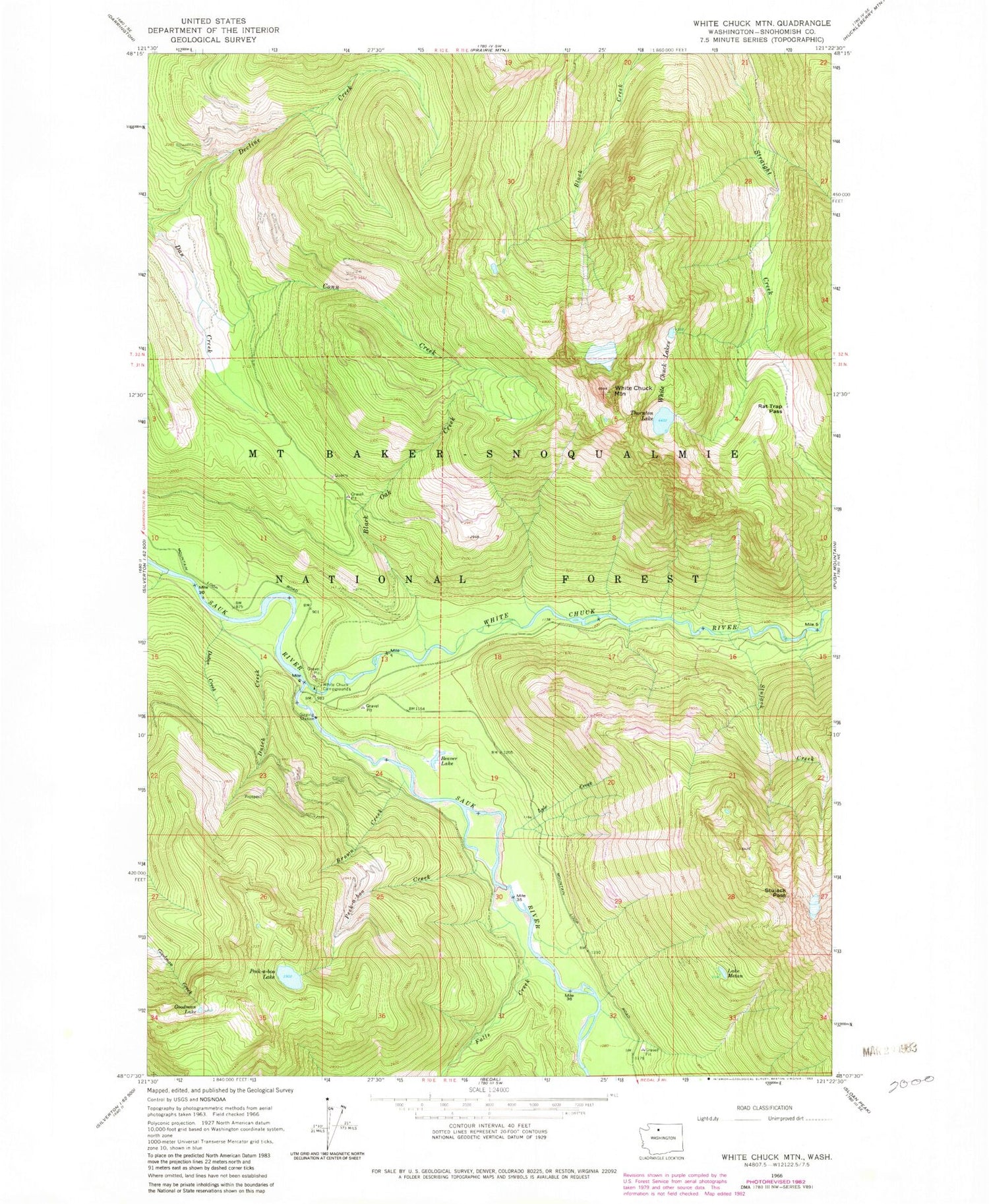
Classic USGS White Chuck Mountain Washington 7.5'x7.5' Topo Map
Couldn't load pickup availability
Historical USGS topographic quad map of White Chuck Mountain in the state of Washington. Map scale may vary for some years, but is generally around 1:24,000. Print size is approximately 24" x 27"
This quadrangle is in the following counties: Snohomish.
The map contains contour lines, roads, rivers, towns, and lakes. Printed on high-quality waterproof paper with UV fade-resistant inks, and shipped rolled.
Contains the following named places: Beaver Lake, Black Oak Creek, Brown Creek, Conn Creek, Darrington Division, Dubor Creek, Dutch Creek, Falls Creek, Goodman Creek, Goodman Lake, Lake Metam, Mount Baker National Forest, Peek-a-boo Creek, Peek-a-boo Lake, Rat Trap Pass, Stujack Creek, Stujack Pass, Thornton Lake, White Chuck Campground, White Chuck Lakes, White Chuck Mountain, White Chuck River, Whitewater Launch


