MyTopo
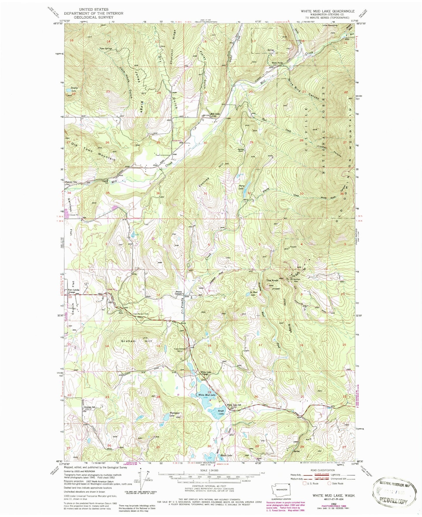
Classic USGS White Mud Lake Washington 7.5'x7.5' Topo Map
Couldn't load pickup availability
Historical USGS topographic quad map of White Mud Lake in the state of Washington. Map scale may vary for some years, but is generally around 1:24,000. Print size is approximately 24" x 27"
This quadrangle is in the following counties: Stevens.
The map contains contour lines, roads, rivers, towns, and lakes. Printed on high-quality waterproof paper with UV fade-resistant inks, and shipped rolled.
Contains the following named places: Aladdin Pit, Blue Bird Canyon, Colville Division, Colville Gun Club, Coonrad Hill, Crusher Canyon, De Hart Lake, Douglass Lake, Dry Gulch, Finley Gulch, Fort Colville Grange, Graham Hill, Graham School, Grevit Creek, Hawkins Quarry, Hull Creek, Jack Hook Gulch, Joes Ridge, Jones Ridge, Keogh Lake, Middle Fork Mill Creek, Mill Creek School, North Fork Mill Creek, Old Dominion Mine, Old Town Mountain, Peery Lake, Prouty Corners, Prouty Creek, Rosanna Lake Dam, Saint John's Episcopal Church, Smith Airport, South Fork Mill Creek, Tepee Springs, The Knob, Thompson Lake, Three Forks, Truman Wood Creek, Tulare Dolomite Quarry, White Lake, White Lake Grange, White Lake School, White Mud Lake, White Rock Canyon