MyTopo
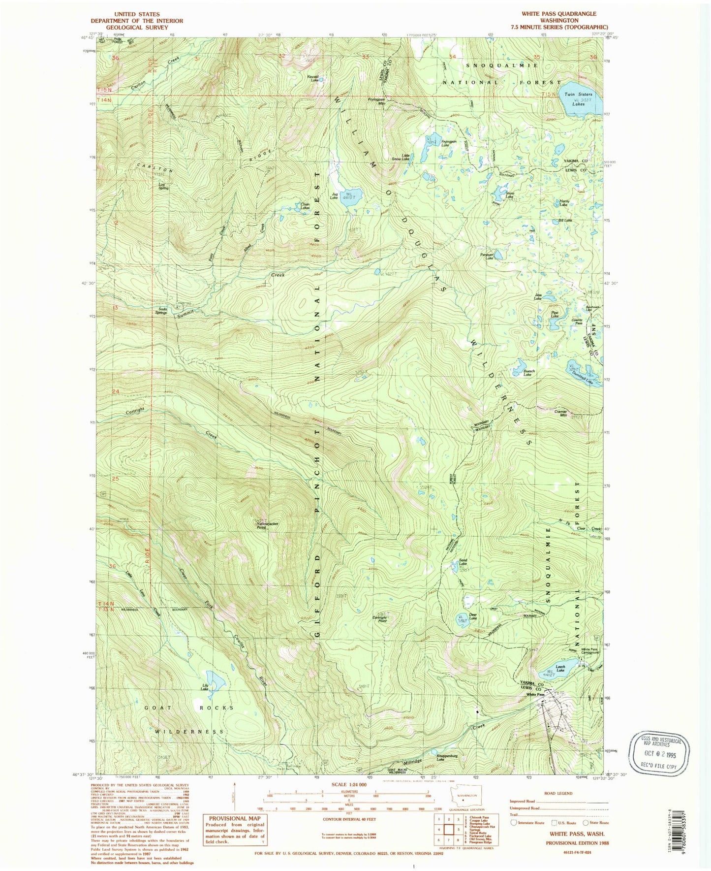
Classic USGS White Pass Washington 7.5'x7.5' Topo Map
Couldn't load pickup availability
Historical USGS topographic quad map of White Pass in the state of Washington. Typical map scale is 1:24,000, but may vary for certain years, if available. Print size: 24" x 27"
This quadrangle is in the following counties: Lewis, Yakima.
The map contains contour lines, roads, rivers, towns, and lakes. Printed on high-quality waterproof paper with UV fade-resistant inks, and shipped rolled.
Contains the following named places: Allred Creek, Bill Lake, Carlton Ridge, Chain Lakes, Clear Fork Trail, Cortright Creek Trail, Cortright Point, Cowlitz Pass, Cowlitz Trail, Cramer Mountain, Dark Meadows Trail, Deer Lake, Dumbbell Lake, Fryingpan Lake, Fryingpan Mountain, Ginnette Lake, Henry Lake, Jess Lake, Jug Lake, Jug Lake Trail, Kincaid Lake, Kincaid Trail, Knuppenburg Lake, Leech Lake, Lily Lake, Little Snow Lake, Log Spring, Millridge Creek, Penoyer Lake, Pipe Lake, Pony Creek, Sand Lake, Sand Lake Trail, Skeelter Shelter, Snow Lake, Soda Springs Campground, Twin Sisters Lakes, White Pass, White Pass Campground, Lake Trail, Skeeter Shelter, White Pass X Country Ski Area, White Pass Ski Area, Deerhead Lake, Cowlitz Trailhead, Knuppenburg Lake Campground, Sand Lake Shelter, Benchmark Lake, Beusch Lake