MyTopo
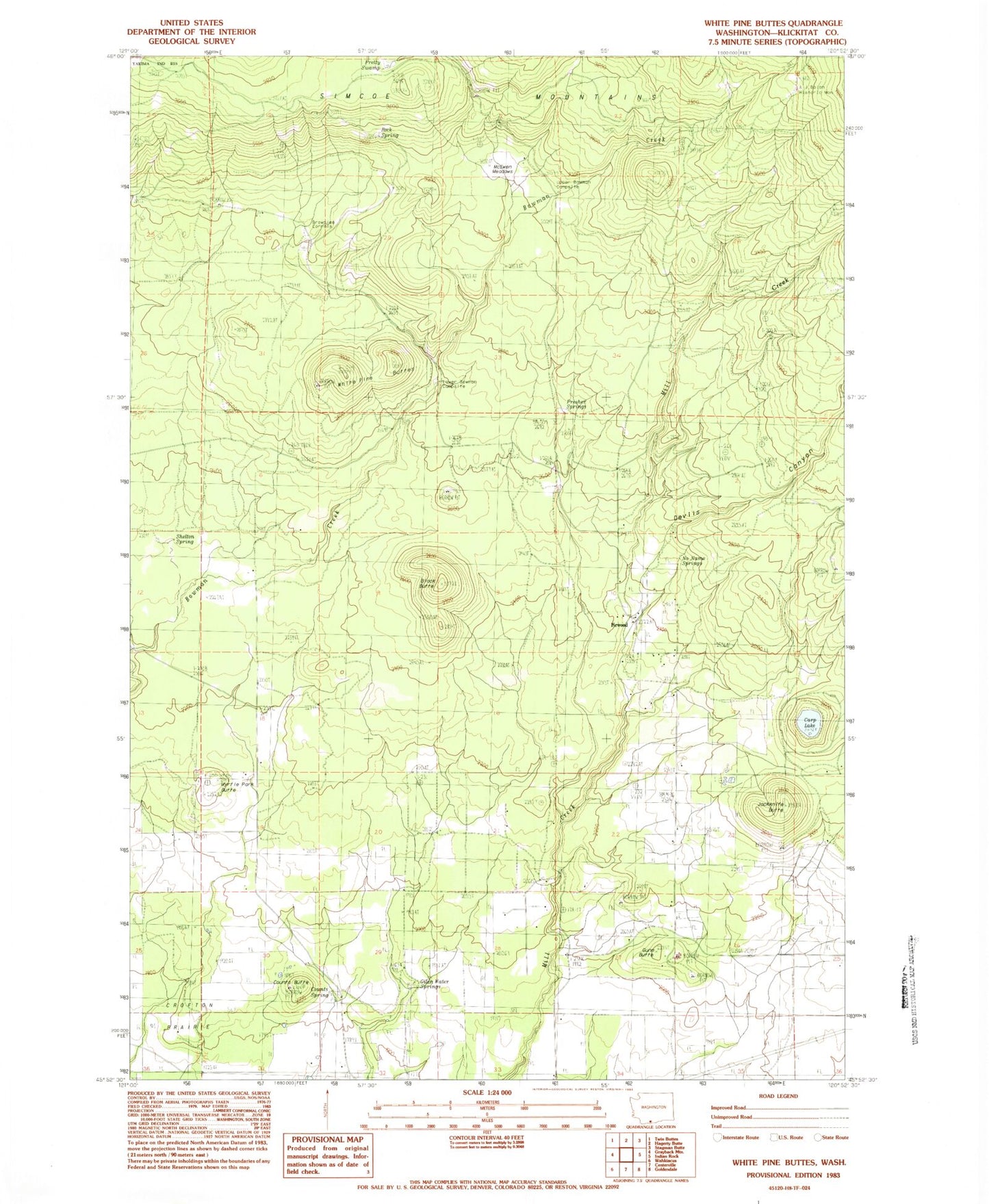
Classic USGS White Pine Buttes Washington 7.5'x7.5' Topo Map
Couldn't load pickup availability
Historical USGS topographic quad map of White Pine Buttes in the state of Washington. Map scale may vary for some years, but is generally around 1:24,000. Print size is approximately 24" x 27"
This quadrangle is in the following counties: Klickitat.
The map contains contour lines, roads, rivers, towns, and lakes. Printed on high-quality waterproof paper with UV fade-resistant inks, and shipped rolled.
Contains the following named places: A J Bolon Historic Monument, Black Butte, Brownlee Corrals, Carp Lake, Case Ranch, Counts Butte, Counts Spring, Devils Canyon, Firwood, Firwood School, Gilen Water Springs, Gunn Butte, Jackknife Butte, Lower Bowman Campsite, McEwen Meadows, Myrtle Park Butte, No Name Spring, Presher Springs, Pretty Swamp, Rock Spring, Shelton Spring, Upper Bowman Campsite, White Pine Buttes