MyTopo
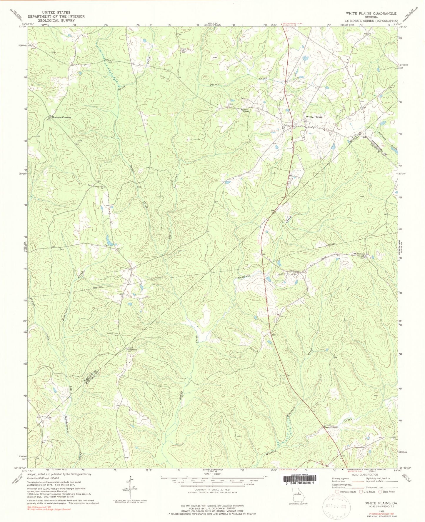
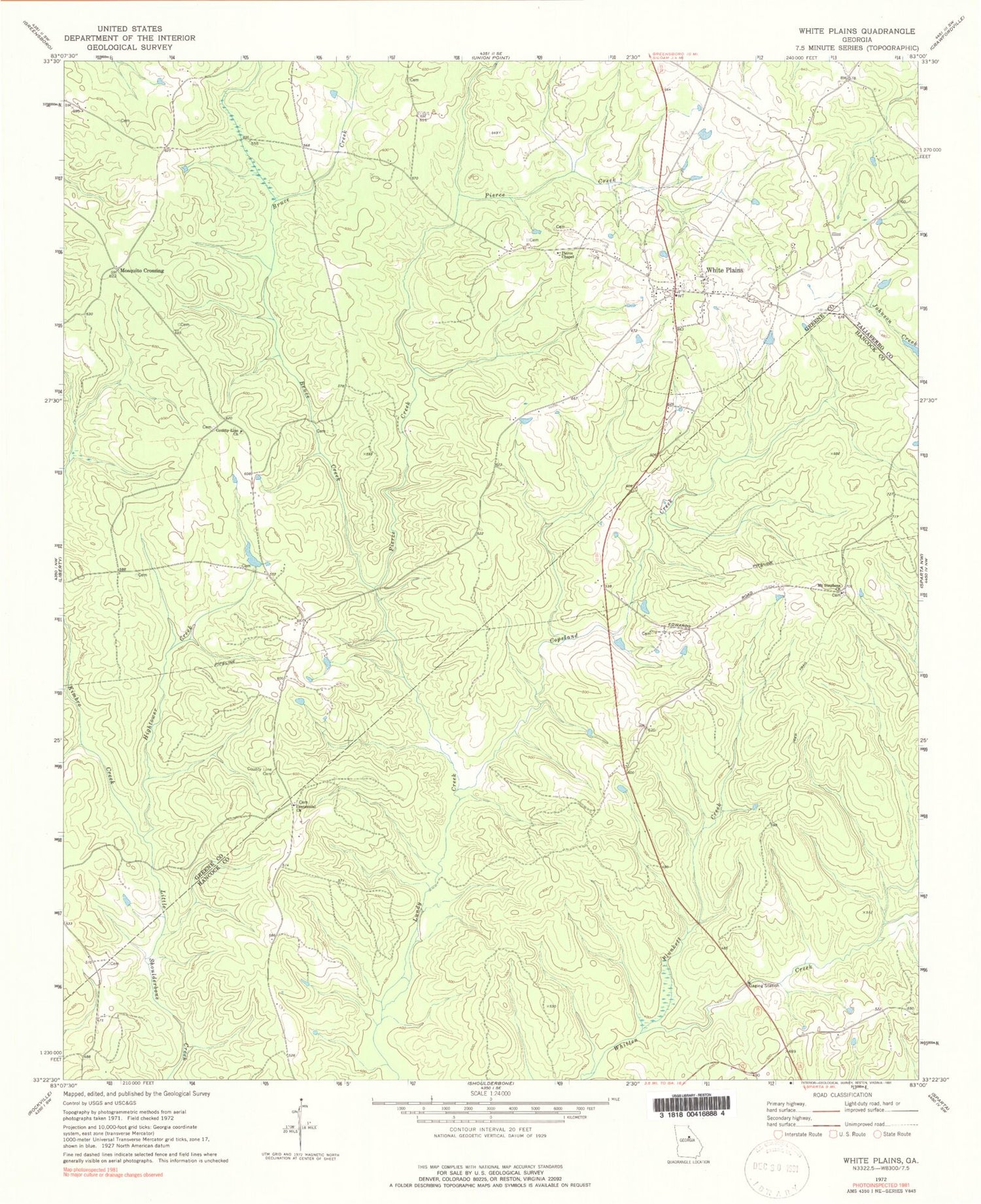
Classic USGS White Plains Georgia 7.5'x7.5' Topo Map
Couldn't load pickup availability
Historical USGS topographic quad map of White Plains in the state of Georgia. Typical map scale is 1:24,000, but may vary for certain years, if available. Print size: 24" x 27"
This quadrangle is in the following counties: Greene, Hancock, Taliaferro.
The map contains contour lines, roads, rivers, towns, and lakes. Printed on high-quality waterproof paper with UV fade-resistant inks, and shipped rolled.
Contains the following named places: Bruce Creek, Copeland Creek, County Line Cemetery, County Line Church, Hightower Creek, Kimbro Creek, Mount Stephens Church, Pierce Chapel, Pierce Creek, Plunkett Creek, Mosquito Crossing, Big House Field, Gum Hill, Mount Gilead Church (historical), Mount Stephens Cemetery, Mount Stephens School (historical), The Blue Hole, Copelans Store (historical), County Line Church (historical), Fuller School (historical), Lewis Cemetery, Moons Academy (historical), Second Baptist Church, Smiths School (historical), Swaggy Valley, Thompson Cemetery, White Plains Baptist Church, White Plains Cemetery, White Plains Methodist Church, White Plains School (historical), Centennial Church, White Plains, Bruce Cemetery, Chapman Cemetery, Chapman Cemetery, Jackson Cemetery, Moons Academy Cemetery, Rowland Cemetery, White Plains Post Office, Wright Cemetery, Barnhart - Owens Cemetery, Centennial Cemetery, White Plains Division, Baugh Family Cemetery, Clark - Webb - Simmons Family Cemetery, Copelin Family Cemetery, City of White Plains, White Plains Volunteer Fire Department