MyTopo
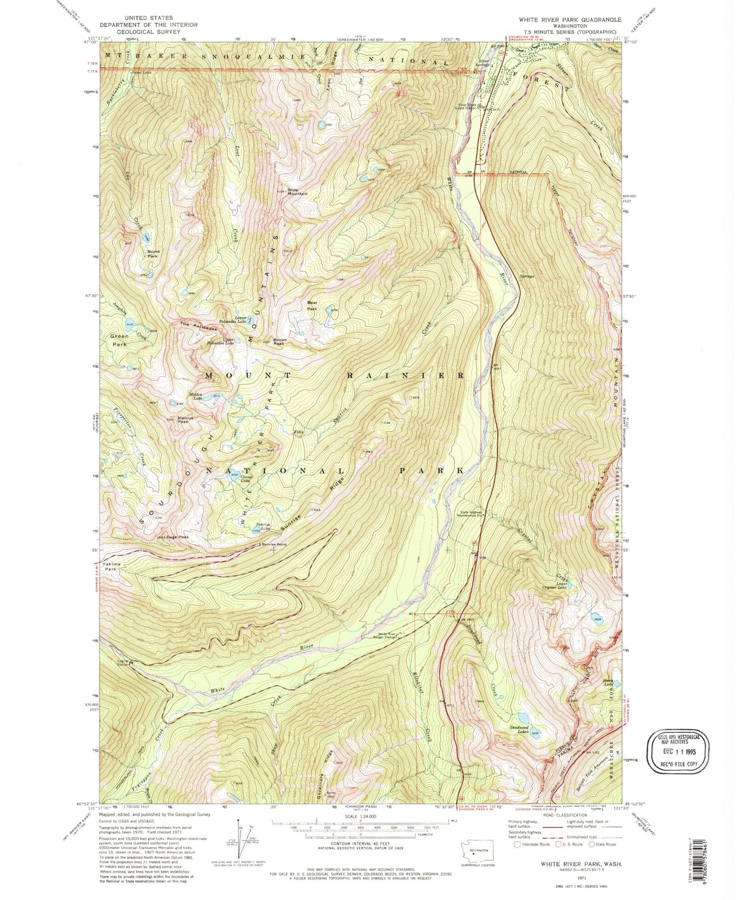
Classic USGS White River Park Washington 7.5'x7.5' Topo Map
Couldn't load pickup availability
Historical USGS topographic quad map of White River Park in the state of Washington. Typical map scale is 1:24,000, but may vary for certain years, if available. Print size: 24" x 27"
This quadrangle is in the following counties: Pierce, Yakima.
The map contains contour lines, roads, rivers, towns, and lakes. Printed on high-quality waterproof paper with UV fade-resistant inks, and shipped rolled.
Contains the following named places: Bear Park, Brown Peak, Burnt Park, Clover Lake, Crystal Creek, Crystal Lake, Crystal Mountain, Deadwood Creek, Dege Peak, Fawn Ridge, Goat Creek, Governors Ridge, Green Park, Hidden Lake, Klickitat Creek, Lower Crystal Lake, Lower Palisades Lake, Marcus Peak, Shaw Creek, Sheep Lake, Silver Creek, Silver Creek Guard Station, Silver Springs, Slide Mountain, Sourdough Gap, Sunrise Creek, Sunrise Lake, Sunrise Point, Sunrise Ridge, The Palisades, Upper Palisades Lake, White River Park, White River Ranger Station, Wright Creek, Silver Springs Campground, Parkway, Deadwood Lakes, Fryingpan Creek, Bear Lake