MyTopo
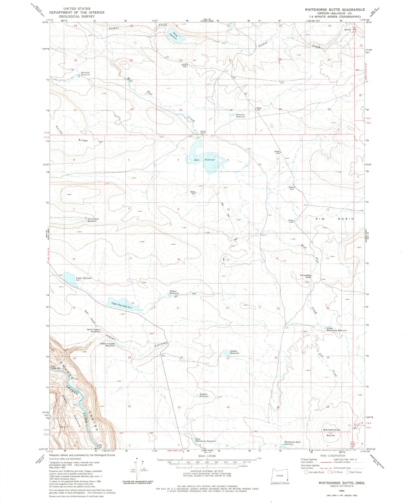
Classic USGS Whitehorse Butte Oregon 7.5'x7.5' Topo Map
Couldn't load pickup availability
Historical USGS topographic quad map of Whitehorse Butte in the state of Oregon. Map scale may vary for some years, but is generally around 1:24,000. Print size is approximately 24" x 27"
This quadrangle is in the following counties: Malheur.
The map contains contour lines, roads, rivers, towns, and lakes. Printed on high-quality waterproof paper with UV fade-resistant inks, and shipped rolled.
Contains the following named places: Arritola Ranch, Deary Dam, Deary Pasture, Deary Reservoir, Flat Creek, Groundhog Falls, Indian Canyon, Indian Canyon Reservoir, Jaca Dam, Jaca Reservoir, Joaquin Reservoir, Mud Flat Creek, North Whitehorse Reservoir, Rim Basin, Rock Creek, Rock Creek Reservoir, Seldom Reservoir, Short Canyon, Short Canyon Reservoir, Short Creek Reservoir, Slipper Reservoir, Spring Branch Creek, Subsoiler Reservoir, Upper Dry Lake Number 1, Upper Dry Lake Number 2, West Whitehorse Reservoir, Whitehorse Butte, Whitehorse Butte Reservoir