MyTopo
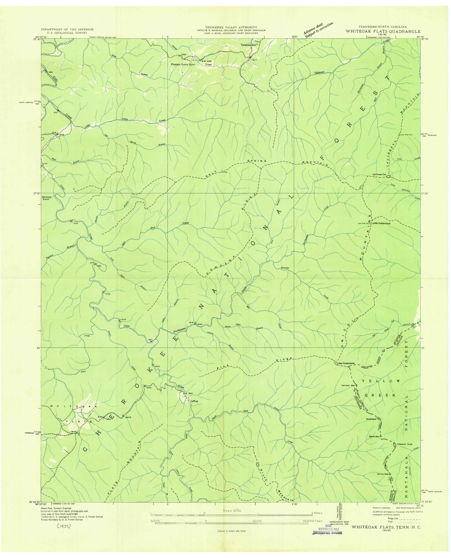
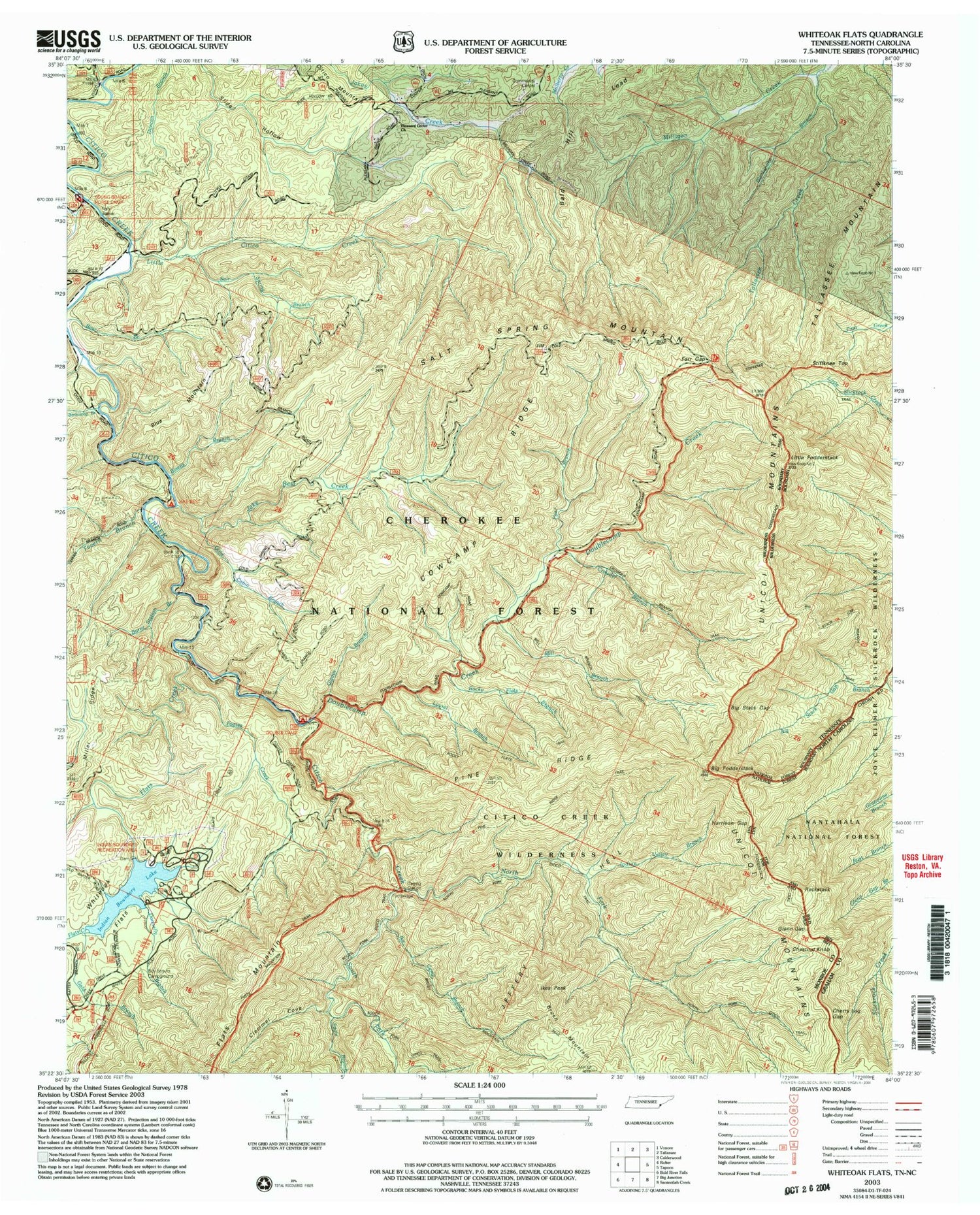
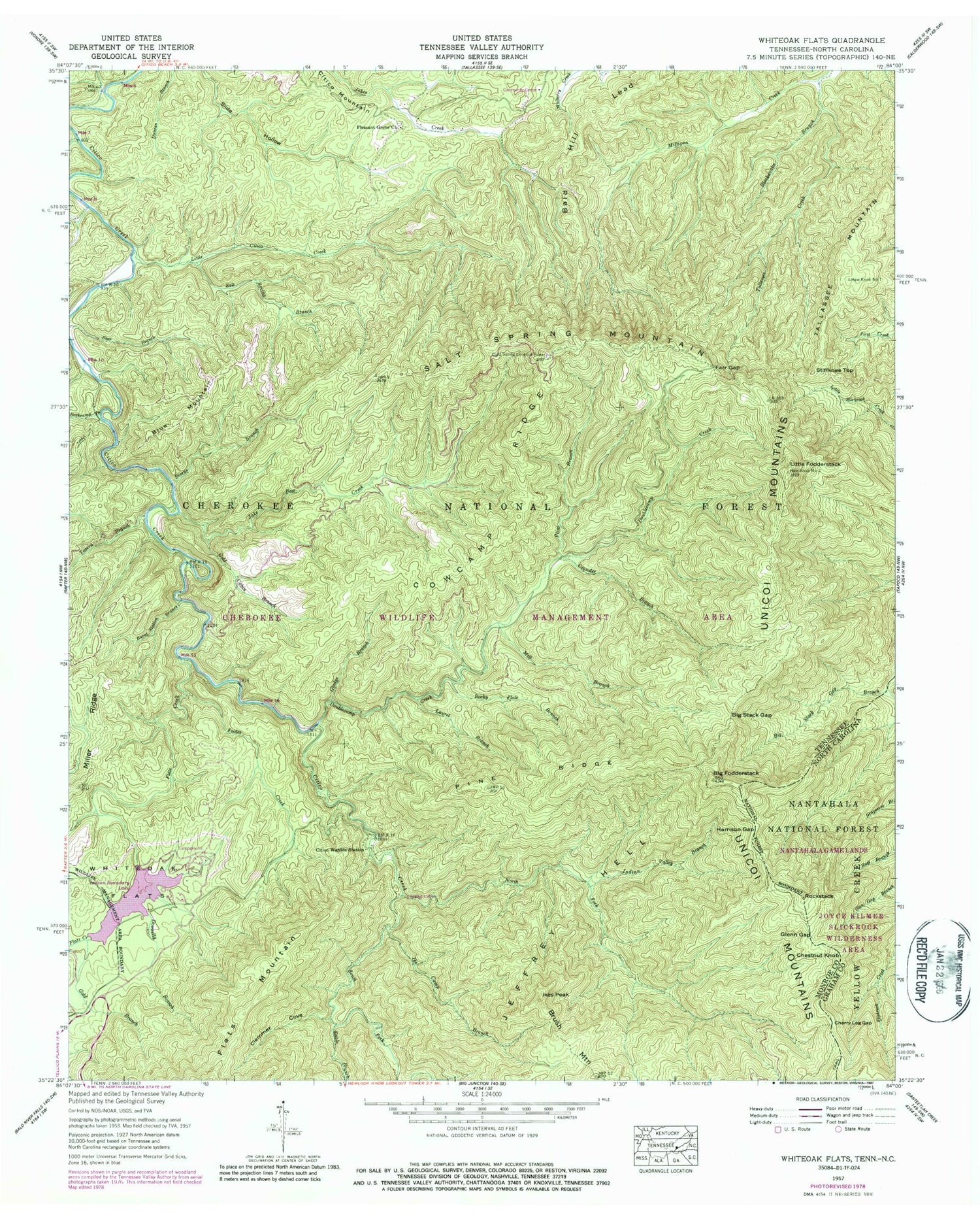
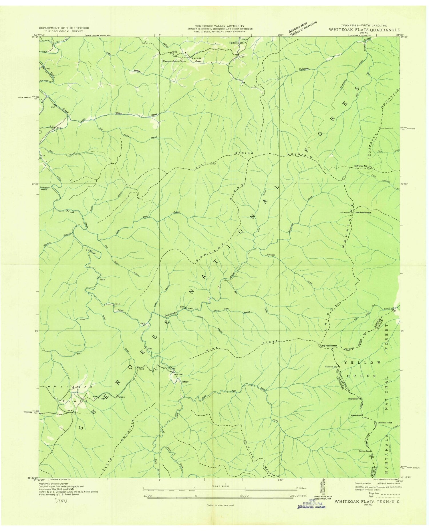
Classic USGS Whiteoak Flats Tennessee 7.5'x7.5' Topo Map
Couldn't load pickup availability
Historical USGS topographic quad map of Whiteoak Flats in the states of Tennessee, North Carolina. Typical map scale is 1:24,000, but may vary for certain years, if available. Print size: 24" x 27"
This quadrangle is in the following counties: Graham, Monroe.
The map contains contour lines, roads, rivers, towns, and lakes. Printed on high-quality waterproof paper with UV fade-resistant inks, and shipped rolled.
Contains the following named places: Rockstack, Bald Hill Lead, Bivens Branch, Jeffrey Hell, South Fork Citico Creek, Stiffknee Top, Tallassee Mountain, Tavern Branch, Water Tank Hollow, Whiteoak Flats, Barkcamp Branch, Bear Branch, Big Stack Gap, Big Stack Gap Branch, Bivens Branch, Blacksnake Branch, Blue Mountain, Burnt Station Branch, Caney Branch, Citico Warden Station, Clemmer Cove, Cowcamp Ridge, Donnelly Branch, Doublecamp Creek, Eagle Branch, Farr Gap, Flats Creek, Flats Creek, Flint Branch, Footes Creek, Gladys Branch, Gold Branch, Gold Cabin Branch, Haw Knob Number One, Little Fodderstack, Ike Camp Branch, Ikes Peak, Indian Boundary Lake, Indian Valley Branch, Jake Best Creek, Laurel Branch, Little Citico Creek, Mill Branch, Milligan Creek, North Fork Citico Creek, Pine Ridge, Pleasant Grove Church, Rocky Flats Branch, Salt Spring Branch, Salt Spring Mountain, Indian Boundary Lake, Indian Boundary Dam, Crowder Branch, Citico, Citico (historical), Jeffrey (historical), Tallassee School (historical), Tellico Wildlife Management Area, Citico Creek Wilderness, Jeffrey Hell, Citico Mountain, Indian Boundary Recreation Area, Jake Best Campground, Doublecamp Campground, Pleasant Grove Church, Clemmer Cove, Big Stock Gap Branch, Big Fodderstack, Cold Spring Lookout Tower, Big Stack Gap Branch Trail, Brush Mountain Trail, Crowder Branch Trail, Double Camp Recreation Area, Flats Mountain Trail, Fodderstack Trail, Good Fields, Indian Boundary Lake Recreation Area, Indian Boundary Lake Trail, Jake Best Campground, Mill Branch Trail, Moccasin Path Trail, North Fork Citico Trail, Pine Ridge Trail, Rocky Flats Trail, Stiffknee Trail, Cherry Log Gap, Glenn Gap, Harrison Gap, Chestnut Knob, Rockstack, Bald Hill Lead, Bivens Branch, Jeffrey Hell, South Fork Citico Creek, Stiffknee Top, Tallassee Mountain, Tavern Branch, Water Tank Hollow, Whiteoak Flats, Barkcamp Branch, Bear Branch, Big Stack Gap, Big Stack Gap Branch, Bivens Branch, Blacksnake Branch, Blue Mountain, Burnt Station Branch, Caney Branch, Citico Warden Station, Clemmer Cove, Cowcamp Ridge, Donnelly Branch, Doublecamp Creek, Eagle Branch, Farr Gap, Flats Creek, Flats Creek, Flint Branch, Footes Creek, Gladys Branch, Gold Branch, Gold Cabin Branch, Haw Knob Number One, Little Fodderstack, Ike Camp Branch, Ikes Peak, Indian Boundary Lake, Indian Valley Branch, Jake Best Creek, Laurel Branch, Little Citico Creek, Mill Branch, Milligan Creek, North Fork Citico Creek, Pine Ridge, Pleasant Grove Church, Rocky Flats Branch, Salt Spring Branch, Salt Spring Mountain, Indian Boundary Lake, Indian Boundary Dam, Crowder Branch, Citico, Citico (historical), Jeffrey (historical), Tallassee School (historical), Tellico Wildlife Management Area, Citico Creek Wilderness, Jeffrey Hell, Citico Mountain, Indian Boundary Recreation Area, Jake Best Campground, Doublecamp Campground, Pleasant Grove Church, Clemmer Cove, Big Stock Gap Branch, Big Fodderstack, Cold Spring Lookout Tower, Big Stack Gap Branch Trail, Brush Mountain Trail, Crowder Branch Trail, Double Camp Recreation Area, Flats Mountain Trail, Fodderstack Trail, Good Fields, Indian Boundary Lake Recreation Area, Indian Boundary Lake Trail, Jake Best Campground, Mill Branch Trail, Moccasin Path Trail, North Fork Citico Trail, Pine Ridge Trail, Rocky Flats Trail, Stiffknee Trail, Cherry Log Gap, Glenn Gap, Harrison Gap, Chestnut Knob