MyTopo
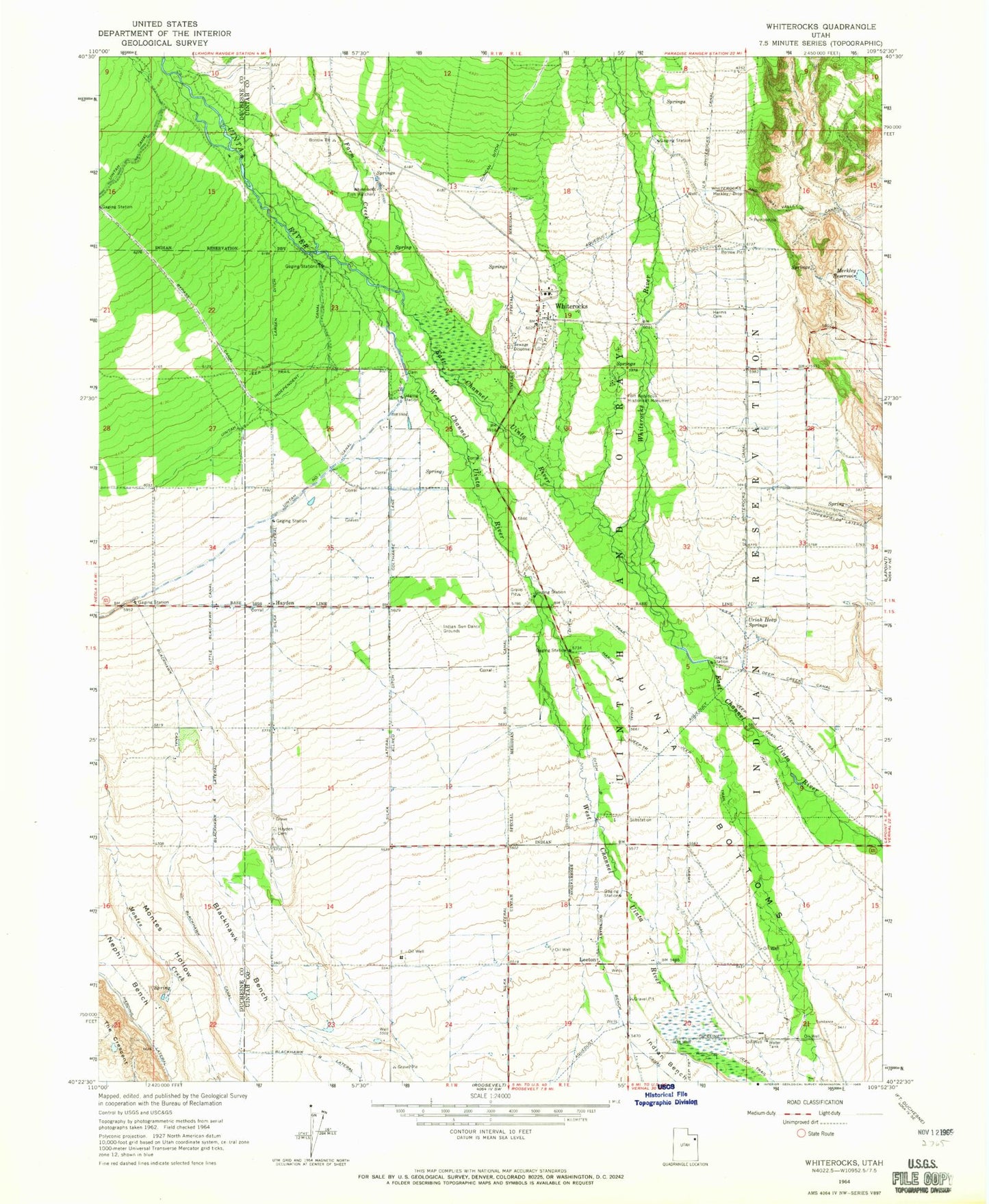
Classic USGS Whiterocks Utah 7.5'x7.5' Topo Map
Couldn't load pickup availability
Historical USGS topographic quad map of Whiterocks in the state of Utah. Map scale may vary for some years, but is generally around 1:24,000. Print size is approximately 24" x 27"
This quadrangle is in the following counties: Duchesne, Uintah.
The map contains contour lines, roads, rivers, towns, and lakes. Printed on high-quality waterproof paper with UV fade-resistant inks, and shipped rolled.
Contains the following named places: Allred Ditch, Big Six Canal, Blackhawk A Lateral, Blackhawk B Lateral, Blackhawk Bench, Blackhawk Canal, Bypass Canal, Copperfields Lateral, Ditch A, Ditch B, Ditch C, Ditch D, Duncan Ditch, Farm Creek, Fort Robidoux Historical Monument, Harms Canal, Harms Cemetery, Hayden, Hayden Cemetery, Indian Sun Dance Grounds, Larsen Ditch, Leeton, Little Blackhawk Canal, Merkley Drop, Merkley Reservoir, Nephi Bench, Silka Lateral, The Church of Jesus Christ of Latter Day Saints, Uinta Bottoms, Uintah Independent Canal, Uintah Meridian, Uintah Number 1 Canal, Uriah Heap Springs, White Rocks Cemetery, Whiterocks, Whiterocks Census Designated Place, Whiterocks Fish Hatchery, Whiterocks Post Office, Whiterocks River