MyTopo
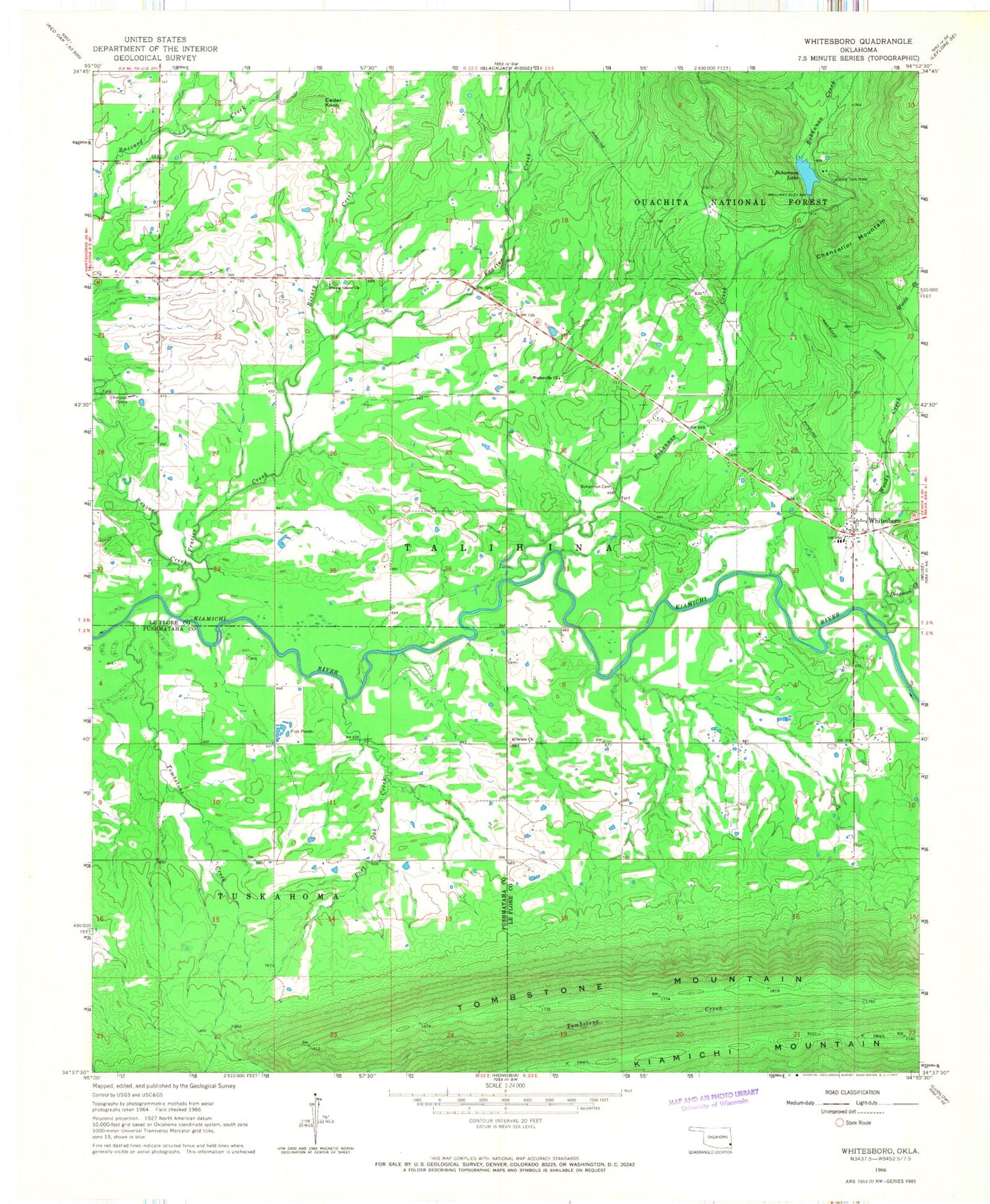
Classic USGS Whitesboro Oklahoma 7.5'x7.5' Topo Map
Couldn't load pickup availability
Historical USGS topographic quad map of Whitesboro in the state of Oklahoma. Map scale may vary for some years, but is generally around 1:24,000. Print size is approximately 24" x 27"
This quadrangle is in the following counties: Le Flore, Pushmataha.
The map contains contour lines, roads, rivers, towns, and lakes. Printed on high-quality waterproof paper with UV fade-resistant inks, and shipped rolled.
Contains the following named places: Birney Creek, Bohannon Cemetery, Bohannon Creek, Bohannon Lake, Bohannon Lake Dam, Buzzard Creek, Camp Tom Hale, Cedar Knob, Chancellor Mountain, Christs Church, Council House, County Line Cemetery, Deadman Creek, Frazier Creek, Post Oak Creek, Prairie Grove Cemetery, Prairie Grove Church, Tombstone Creek, Tombstone Mountain, Township of Talihina, Wadesville Church, Whitesboro, Whitesboro Cemetery, Whitesboro Census Designated Place, Whitesboro Elementary School, Whitesboro Fire Department, Whitesboro High School, Whitesboro Post Office, Woods Creek, ZIP Code: 74571