
MyTopo
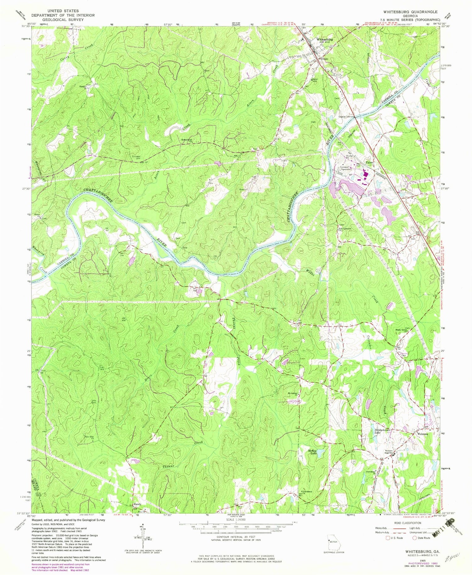
Classic USGS Whitesburg Georgia 7.5'x7.5' Topo Map
Couldn't load pickup availability
Historical USGS topographic quad map of Whitesburg in the state of Georgia. Typical map scale is 1:24,000, but may vary for certain years, if available. Print size: 24" x 27"
This quadrangle is in the following counties: Carroll, Coweta, Heard.
The map contains contour lines, roads, rivers, towns, and lakes. Printed on high-quality waterproof paper with UV fade-resistant inks, and shipped rolled.
Contains the following named places: Acorn Creek, Bridgehaven Lake, Cedar Creek, McKay Lake, Moore Creek, Mount Carmel Methodist Church, New Elim Church, New Lebanon Baptist Church, Providence Baptist Church, Providence Baptist Church, Rotherwood Church, Shady Grove Baptist Church, Shiloh Church, Snake Creek, Springer Cemetery, Thomas Creek, Vine Cemetery, Wahoo Creek, Western Elementary School, Whitesburg, Whooping Creek, Handy, Yates, Kimbrough Lake Dam, Kimbrough Lake, Allen Cemetery, Elim Church Cemetery, Elim School (historical), Homewood School (historical), Johnson Cemetery, Jones Bridge (historical), Lewis Lakes (historical), Mount Carmel Church Cemetery, Mount Carmel School (historical), New Ferry (historical), New Lebanon Cemetery, Providence Cemetery, Providence Church Cemetery, Providence School (historical), Shady Grove Church Cemetery, New Hope Church (historical), Rutherwood School (historical), Shiloh Cemetery, Shiloh School (historical), Springer School (historical), Whitesburg Baptist Church, Whitesburg Elementary School, Ephesus Cemetery, Cavender Creek, Elim Baptist Church, Ephesus Church, City of Whitesburg, Carroll County Fire / Rescue Station 8, Coweta County Fire Department Station 8, McIntosh Field, Whitesburg Police Department, Whitesburg Post Office, Rotherwood Cemetery


