MyTopo
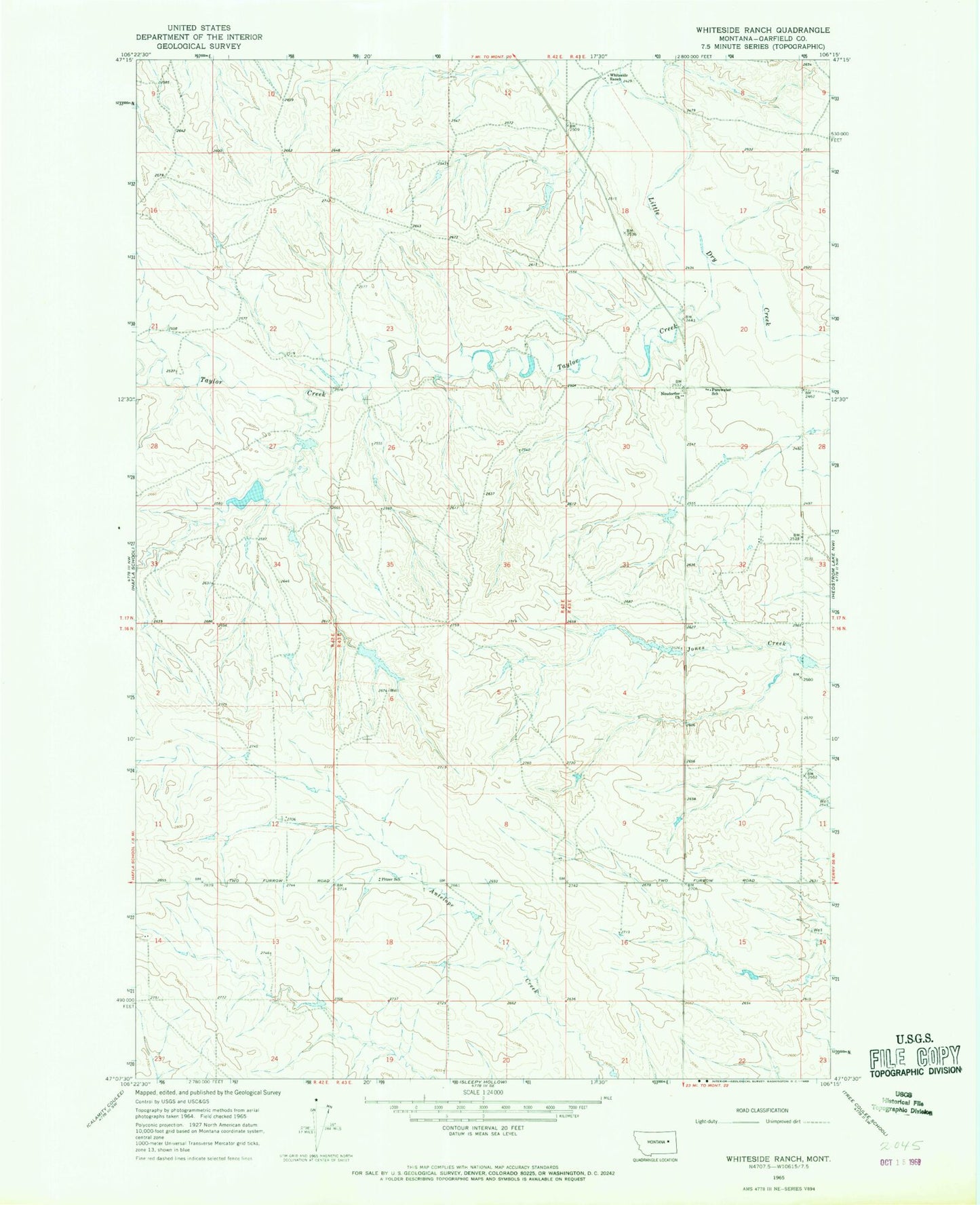
Classic USGS Whiteside Ranch Montana 7.5'x7.5' Topo Map
Regular price
$16.95
Regular price
Sale price
$16.95
Unit price
per
Couldn't load pickup availability
Historical USGS topographic quad map of Whiteside Ranch in the state of Montana. Map scale may vary for some years, but is generally around 1:24,000. Print size is approximately 24" x 27"
This quadrangle is in the following counties: Garfield.
The map contains contour lines, roads, rivers, towns, and lakes. Printed on high-quality waterproof paper with UV fade-resistant inks, and shipped rolled.
Contains the following named places: 17N43E07B___01 Well, Bank Dam, Garhart Dam, Neudorfer Church, Ol John Dam, Pitzer School, Purewater School, Steffins Number 1 Dam, Taylor Creek, Whiteside Ranch