MyTopo
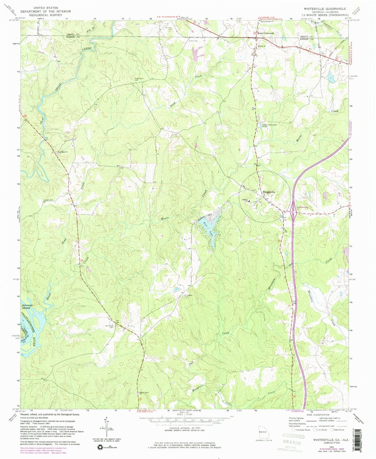
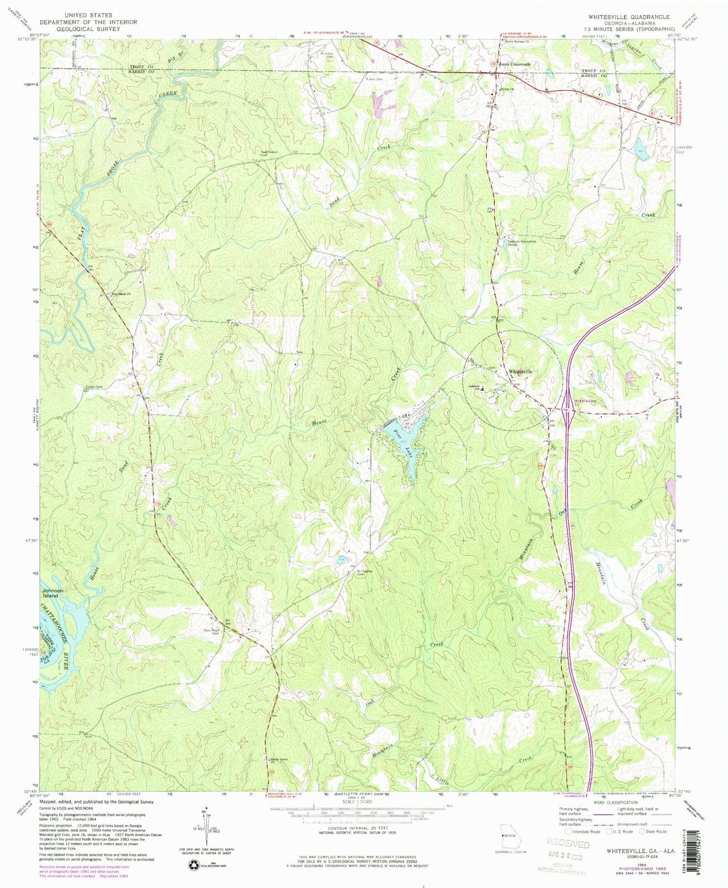
Classic USGS Whitesville Georgia 7.5'x7.5' Topo Map
Couldn't load pickup availability
Historical USGS topographic quad map of Whitesville in the state of Georgia. Typical map scale is 1:24,000, but may vary for certain years, if available. Print size: 24" x 27"
This quadrangle is in the following counties: Chambers, Harris, Troup.
The map contains contour lines, roads, rivers, towns, and lakes. Printed on high-quality waterproof paper with UV fade-resistant inks, and shipped rolled.
Contains the following named places: Big Branch, Billingslea Cemetery, Cooks Cemetery, Hutchinson Cemetery, Ingram Creek, Jackson Recreation Center, Johnson School, Little Creek, Mountain Creek, New Hope Cemetery, Pine Lake, Rivers Cemetery, Sand Creek, Shady Grove Church, Union Church, Whitesville, Williams Cemetery, Jones Crossroads, Avery Lake Dam, Avery Lake, Callaway Enterprises Lake Dam, Callaway Enterprises Lake, Flat Shoals Bridge, New Hope, New Hope Methodist Church (historical), Pearson Mill (historical), Pine Lake, Shady Grove, Shady Grove Church Cemetery, Flat Shoal Church, House Creek, Pine Mountain Division, Northwest Harris Volunteer Fire Department