MyTopo
Classic USGS Whitetail Reservoir Montana 7.5'x7.5' Topo Map
Regular price
$16.95
Regular price
Sale price
$16.95
Unit price
per
Couldn't load pickup availability
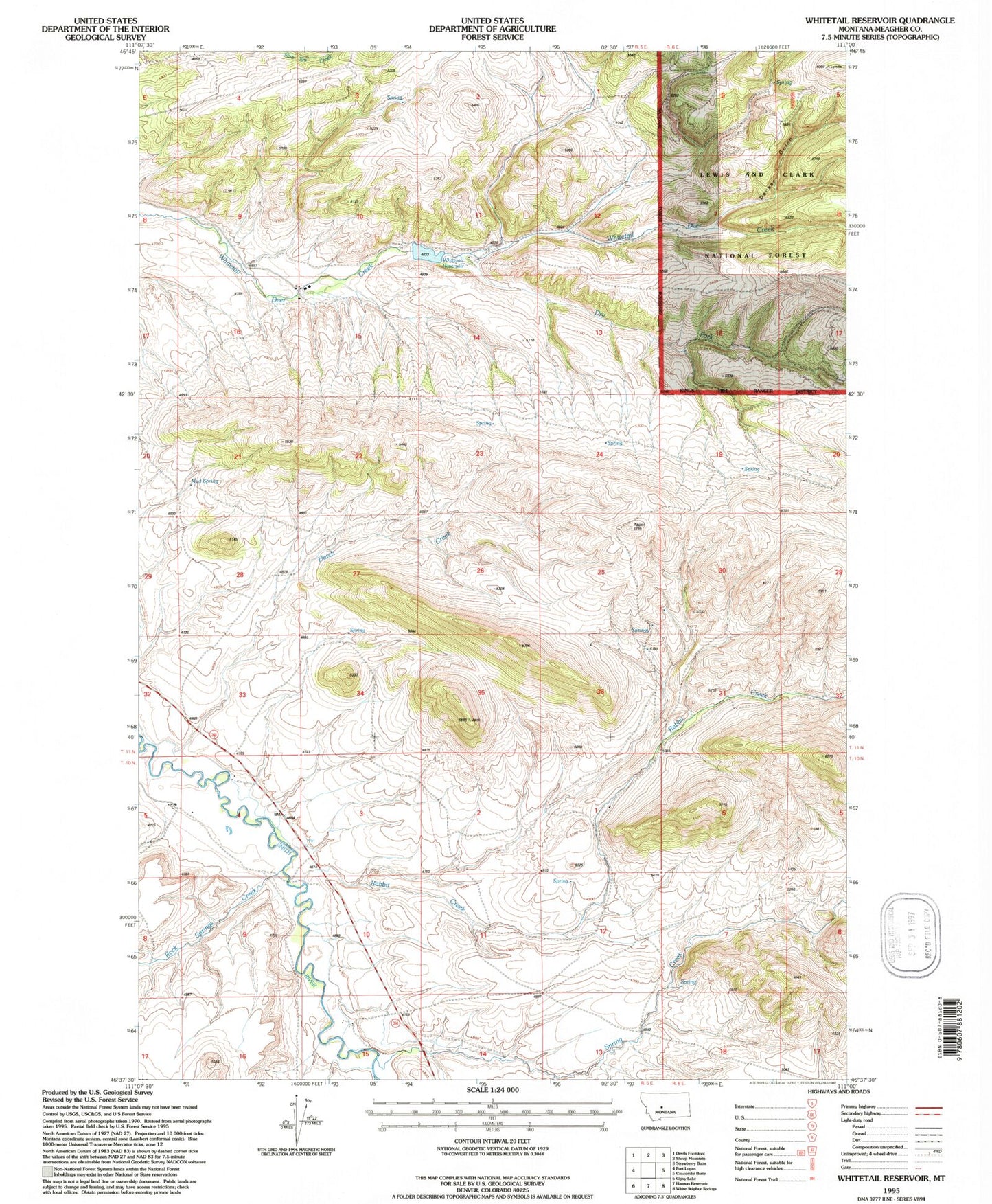
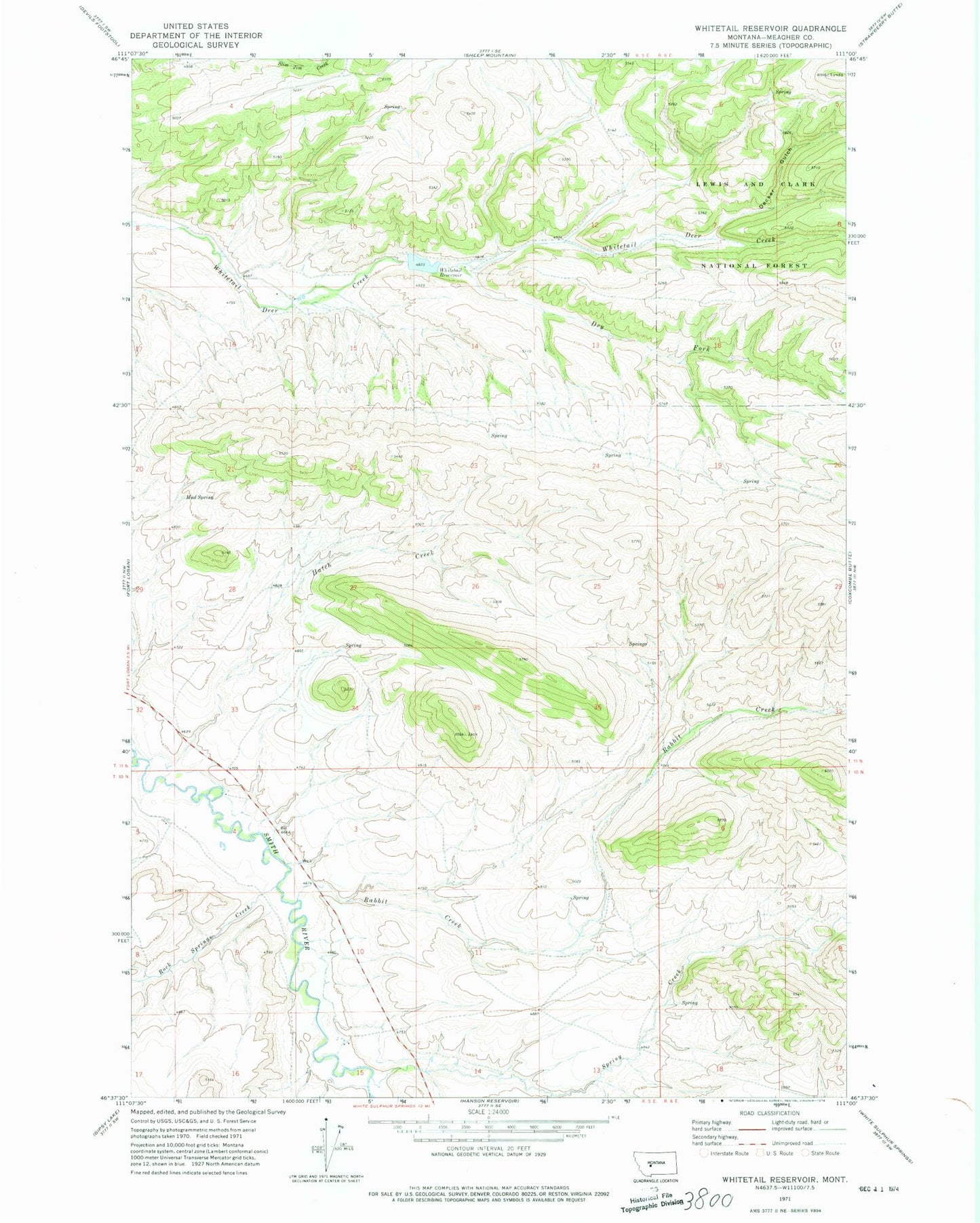
Historical USGS topographic quad map of Whitetail Reservoir in the state of Montana. Map scale may vary for some years, but is generally around 1:24,000. Print size is approximately 24" x 27"
This quadrangle is in the following counties: Meagher.
The map contains contour lines, roads, rivers, towns, and lakes. Printed on high-quality waterproof paper with UV fade-resistant inks, and shipped rolled.
Contains the following named places: 10N05E02C___01 Well, 10N05E04BA__01 Well, 10N05E05AD__01 Well, 59645, Decker Gulch, Dry Fork Whitetail Deer Creek, Hatch Creek, Mud Spring, Rabbit Creek, Rock Springs Creek, Spring Creek, White Sulphur Springs Division, Whitetail Dam, Whitetail Reservoir