MyTopo
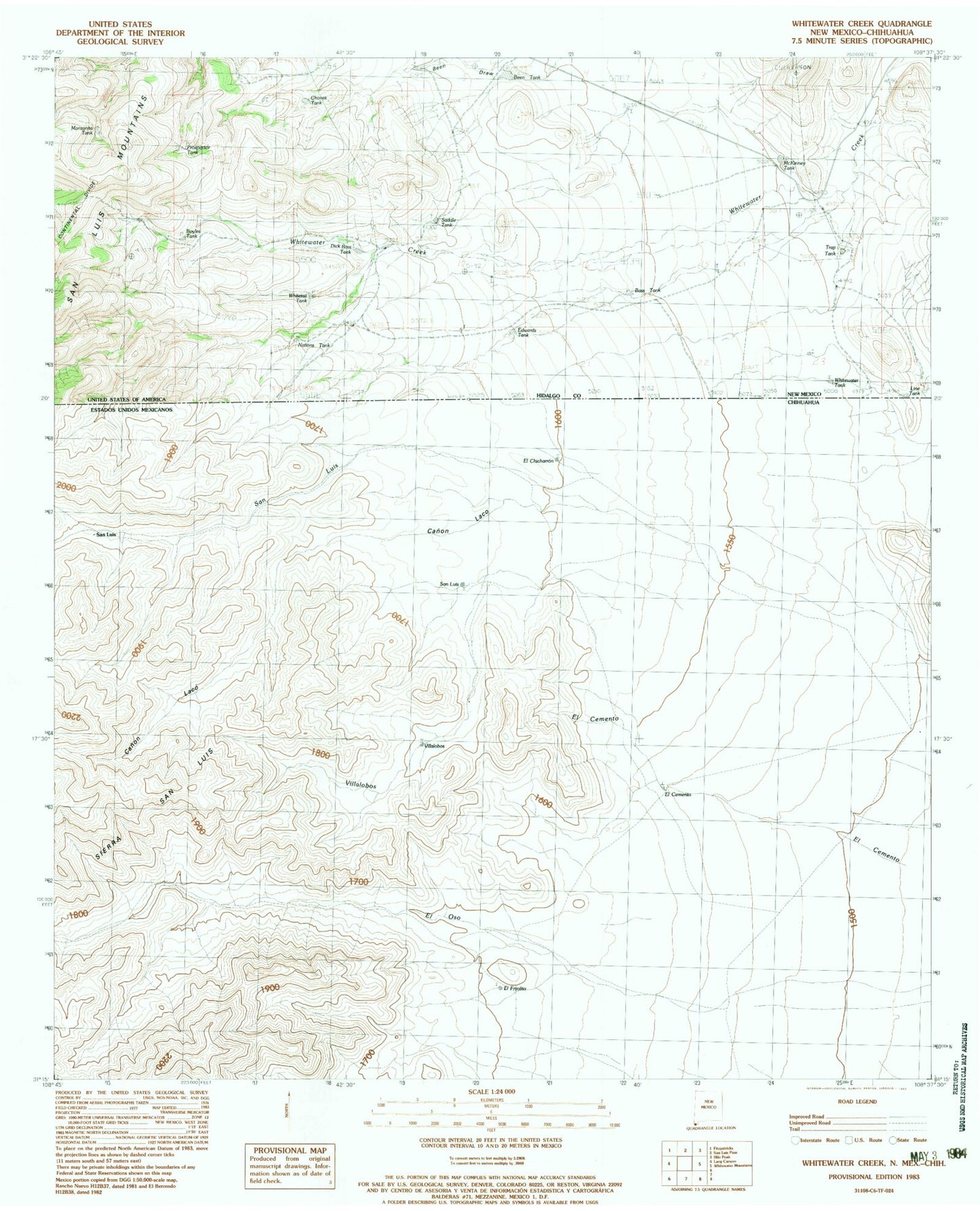
Classic USGS Whitewater Creek New Mexico 7.5'x7.5' Topo Map
Couldn't load pickup availability
Historical USGS topographic quad map of Whitewater Creek in the state of New Mexico. Map scale may vary for some years, but is generally around 1:24,000. Print size is approximately 24" x 27"
This quadrangle is in the following counties: Hidalgo.
The map contains contour lines, roads, rivers, towns, and lakes. Printed on high-quality waterproof paper with UV fade-resistant inks, and shipped rolled.
Contains the following named places: Bass Tank, Been Tank, Boyles Tank, Chavez Tank, Dick Bass Tank, Edwards Tank, Manzanita Tank, McKinney Tank, Nations Hut, Nations Tank, Packers Trail, Prospector Tank, R I Bass Ranch, Saddle Tank, T Pendleton Ranch, Trap Tank, W E Bass Ranch, Whitetail Tank, Whitewater Creek, Whitewater Tank