MyTopo
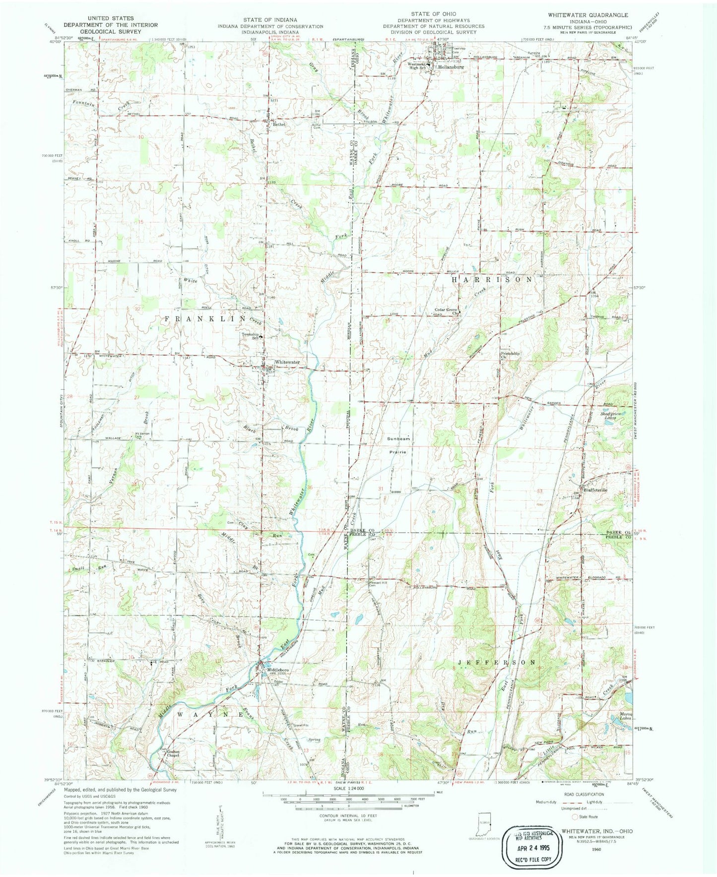
Classic USGS Whitewater Indiana 7.5'x7.5' Topo Map
Couldn't load pickup availability
Historical USGS topographic quad map of Whitewater in the states of Indiana, Ohio. Map scale may vary for some years, but is generally around 1:24,000. Print size is approximately 24" x 27"
This quadrangle is in the following counties: Darke, Preble, Wayne.
The map contains contour lines, roads, rivers, towns, and lakes. Printed on high-quality waterproof paper with UV fade-resistant inks, and shipped rolled.
Contains the following named places: Addleman Ditch, Bethel, Bethel Cemetery, Bethel Creek, Black Brook, Boro Brook, Braffetsville, Brinley Fork, Cedar Grove Cemetery, Cedar Grove Church of the Brethren, Clay Run, Dry Run, Evans Creek, Friendship Cemetery, Friendship Community Church, Goshen Chapel, Gray Brook, Halderman Farms, Hollansburg, Hollansburg Cemetery, Hollansburg Fire Department, Hollansburg Post Office, J V Farms, Jocqueway Creek, M and S Farms, Marva Lakes, Middle Brook, Middle Fork East Fork Whitewater River, Middleboro, Middleboro Stone Quarry, Moore Farm, Mount Vernon Cemetery, Mud Creek, New Centre Post Office, Pleasant Hill Cemetery, Ross Ditch, Shadyview Lakes, Spring Run, Sunbeam Prairie, Town of Whitewater, Township of Franklin, Township of Harrison, Village of Hollansburg, Westmont High School, White Creek, Whitewater, Wiley, Wiley Post Office, ZIP Codes: 45332, 45347