MyTopo
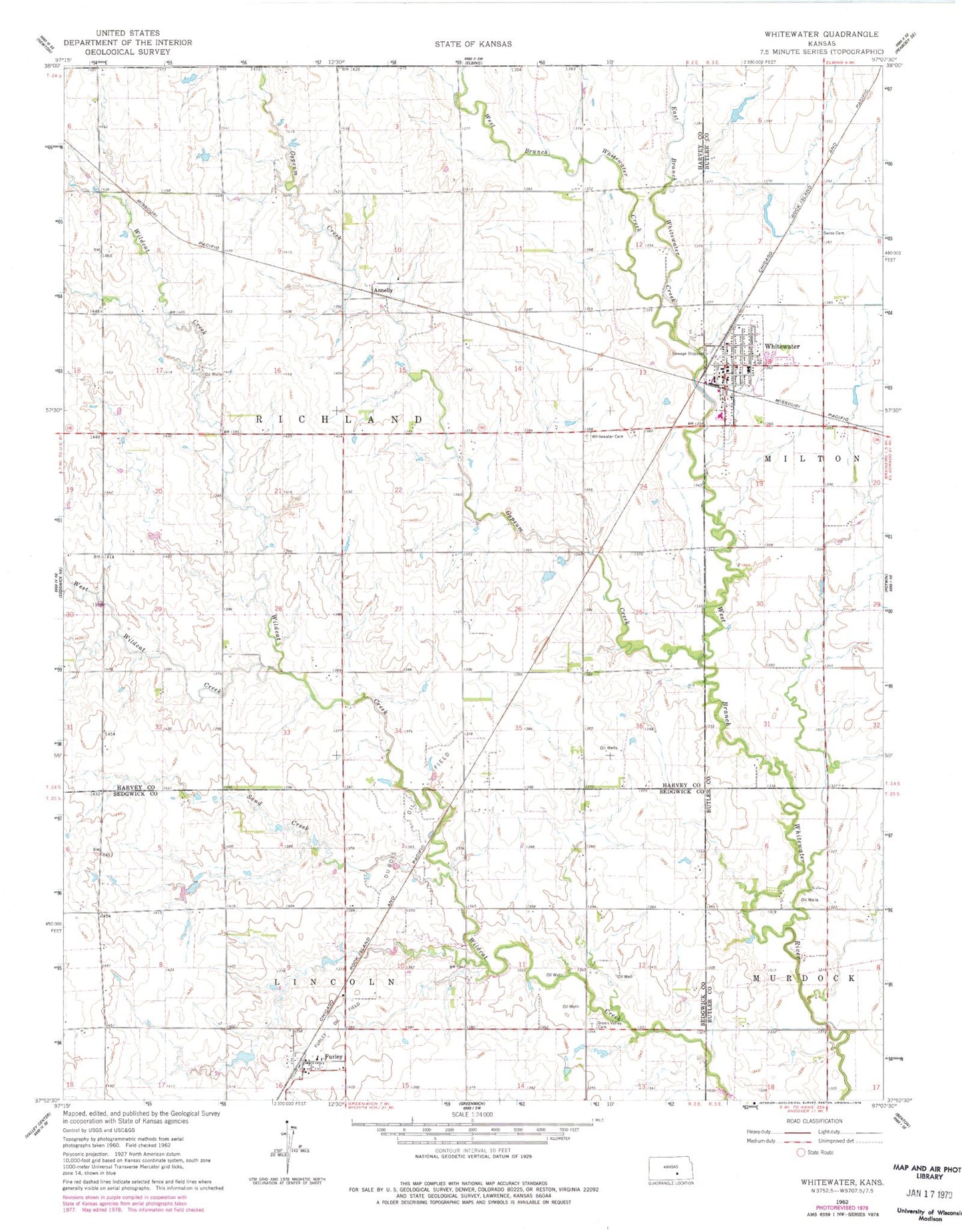
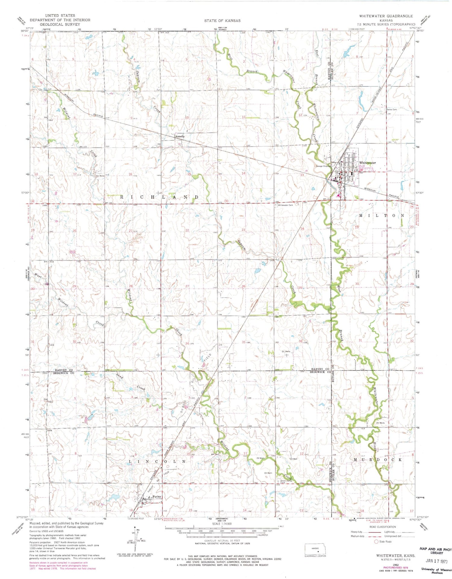
Classic USGS Whitewater Kansas 7.5'x7.5' Topo Map
Couldn't load pickup availability
Historical USGS topographic quad map of Whitewater in the state of Kansas. Map scale may vary for some years, but is generally around 1:24,000. Print size is approximately 24" x 27"
This quadrangle is in the following counties: Butler, Harvey, Sedgwick.
The map contains contour lines, roads, rivers, towns, and lakes. Printed on high-quality waterproof paper with UV fade-resistant inks, and shipped rolled.
Contains the following named places: Annelly, City of Whitewater, Dubois Oil Field, East Branch Whitewater Creek, Edgcomb, Federated Church, Furley, Furley Census Designated Place, Furley Oil Field, Grace Baptist Church, Green Valley Cemetery, Gypsum Creek, Remington Middle School, Sand Creek, Swiss Cemetery, Swiss Church, Team Marketing Alliance Grain Elevator Number 37, Township of Richland, West Branch Whitewater Creek, West Wildcat Creek, Whitewater, Whitewater Cemetery, Whitewater City Hall, Whitewater Memorial Library, Whitewater Post Office, Whitewater River Consolidated Fire District - Whitewater Station, Whitewater Wastewater Plant, ZIP Code: 67154