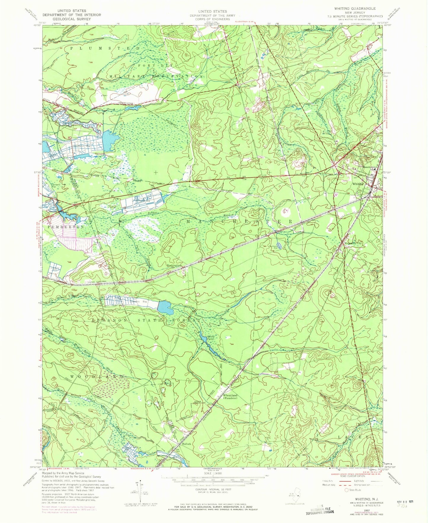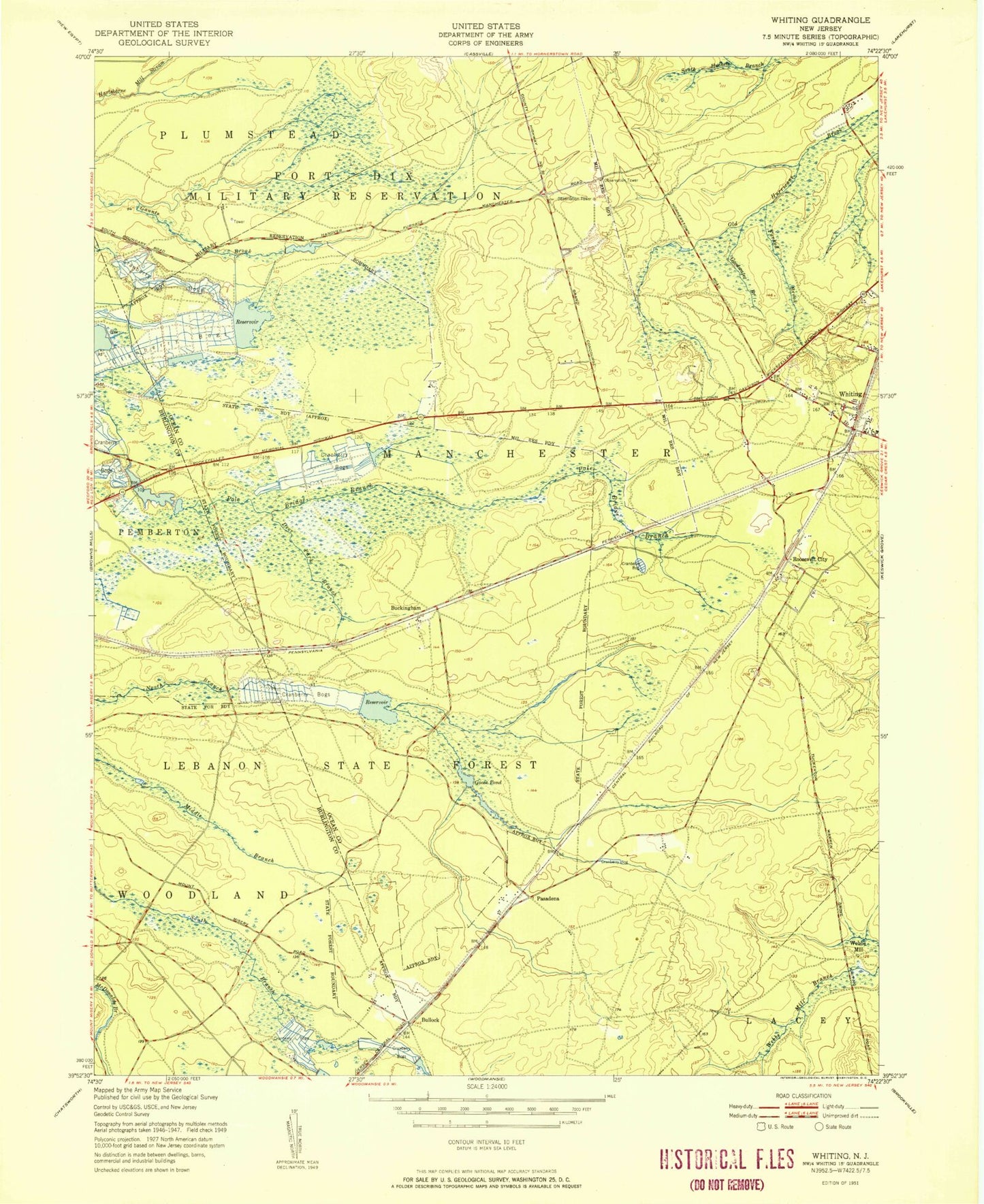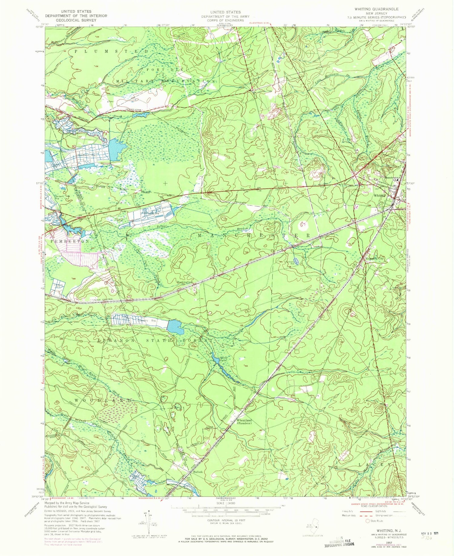
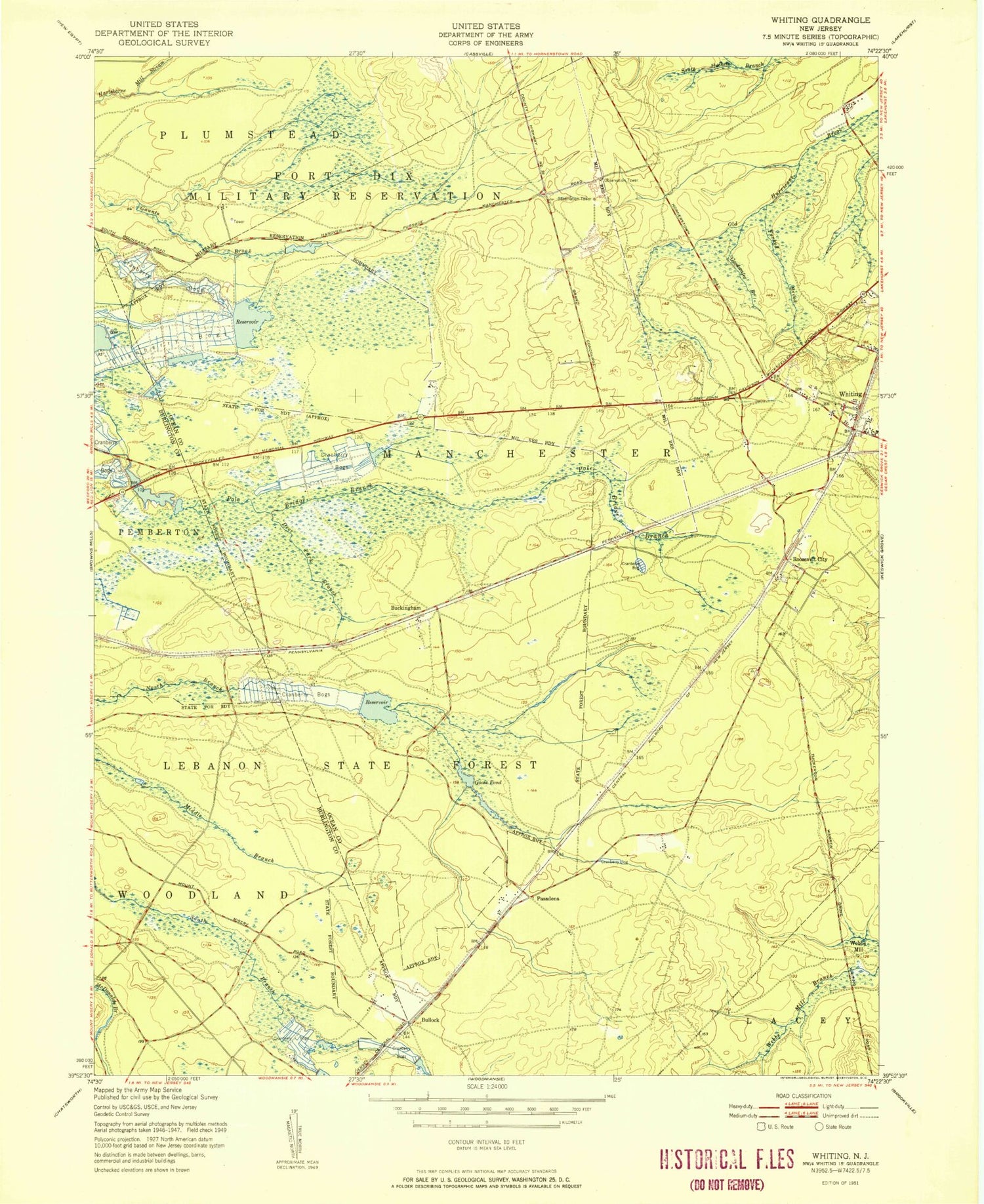
MyTopo
Classic USGS Whiting New Jersey 7.5'x7.5' Topo Map
Couldn't load pickup availability
Historical USGS topographic quad map of Whiting in the state of New Jersey. Typical map scale is 1:24,000, but may vary for certain years, if available. Print size: 24" x 27"
This quadrangle is in the following counties: Burlington, Ocean.
The map contains contour lines, roads, rivers, towns, and lakes. Printed on high-quality waterproof paper with UV fade-resistant inks, and shipped rolled.
Contains the following named places: Buckingham, Bullock, Deer Branch, Forked Brook, Goodwater Branch, Goose Pond, Lebanon State Forest, Little Hurricane Branch, Whiting Elementary School, Roosevelt City, Wheatland, Whiting, Hanover Pond, Boyds Hotel, Pasadena Wildlife Management Area, Manchester Wildlife Management Area, Deer Park Branch, Webbs Mill (historical), Hanover Dam, Cedar Glen Lakes, Saint Johns Church, Bay Shore Rod and Gun Club, East Trenton Rod and Gun Club, Field and Stream Gunning Club, Cedar Glen Lakes Census Designated Place, Whiting Volunteer Fire Company 1, Whiting Post Office