
MyTopo
Classic USGS Whitmore Hot Springs California 7.5'x7.5' Topo Map
Couldn't load pickup availability
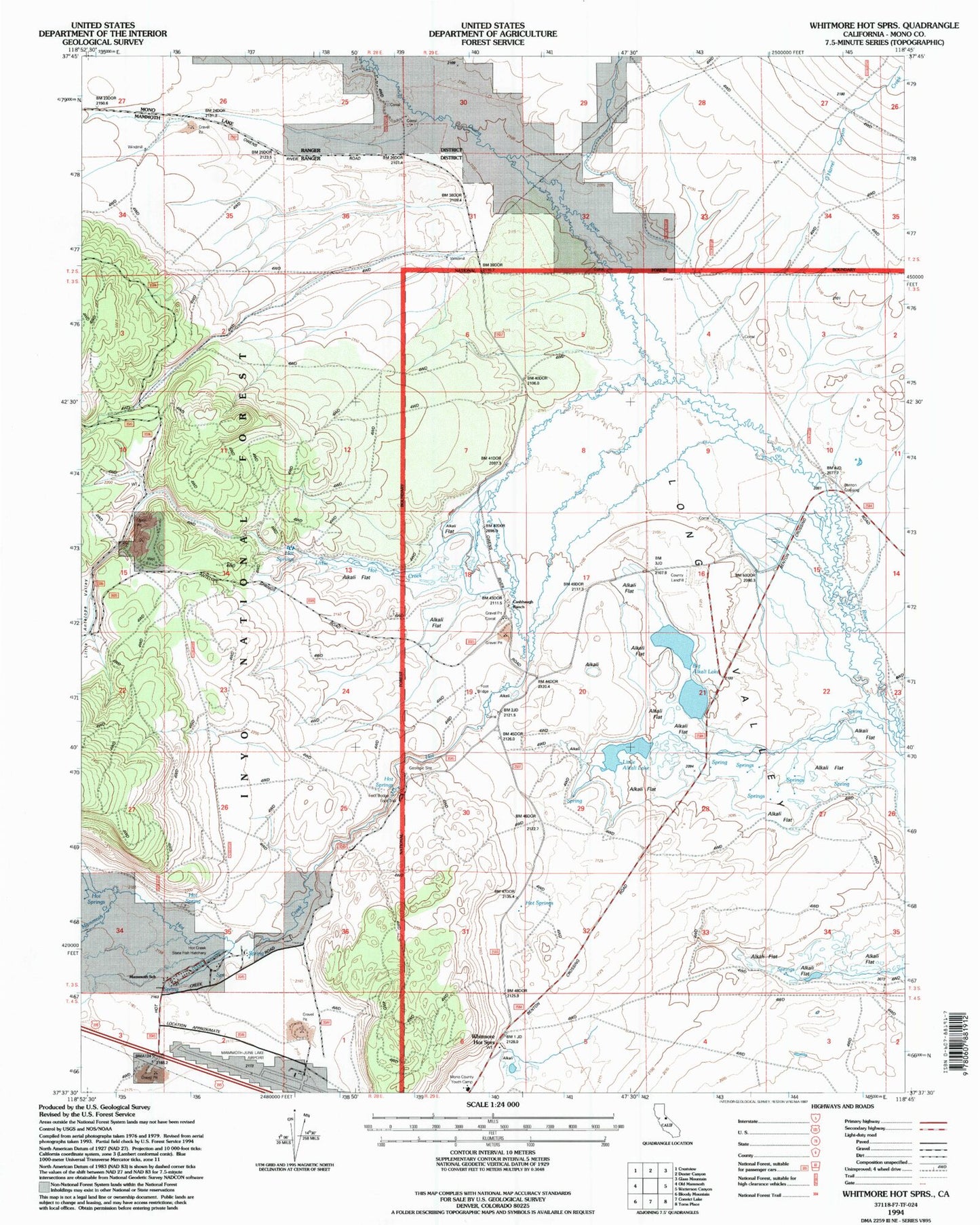
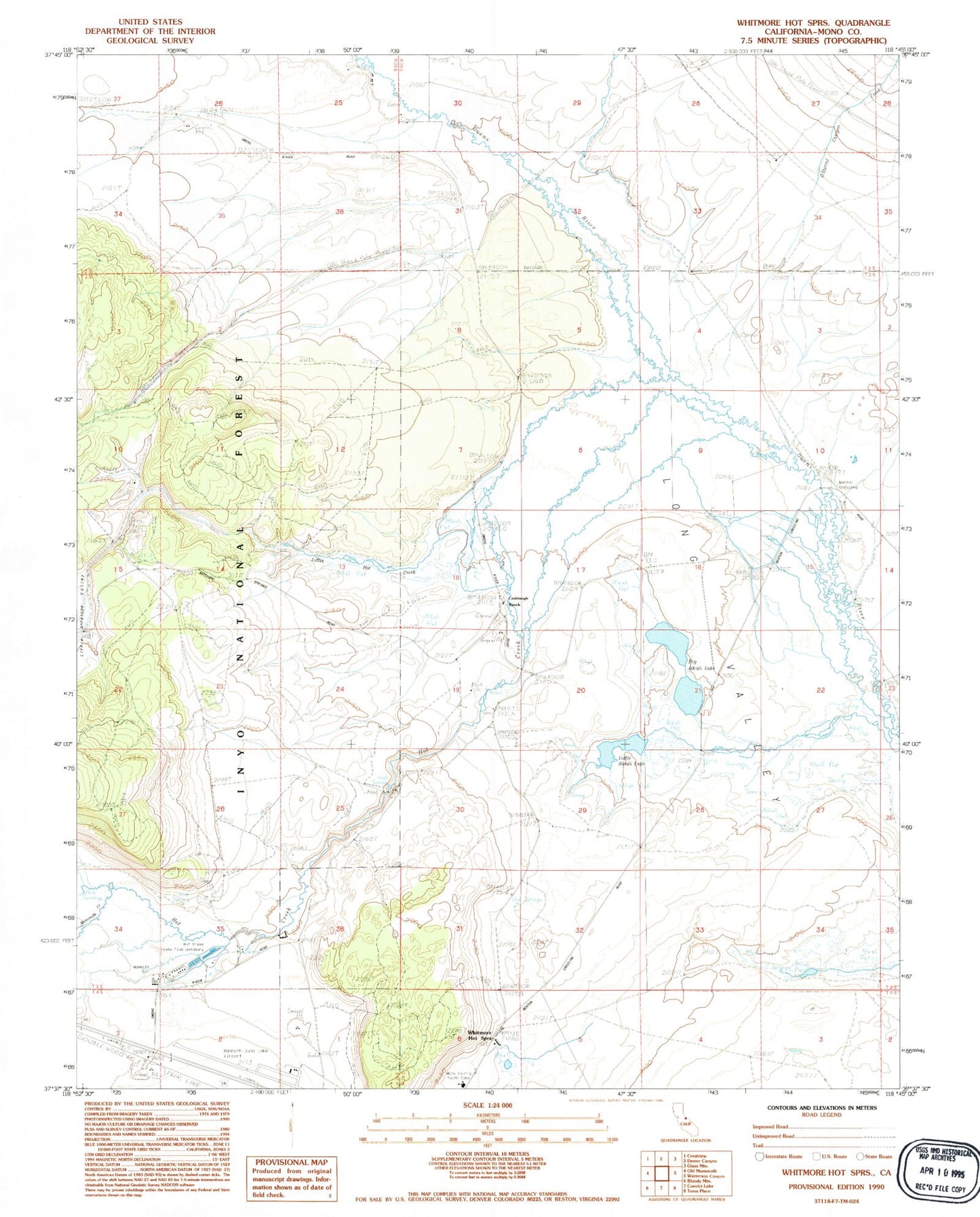
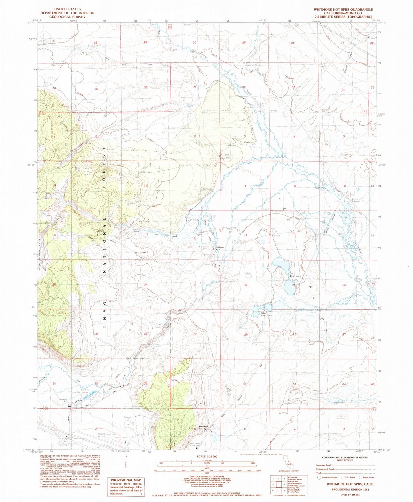
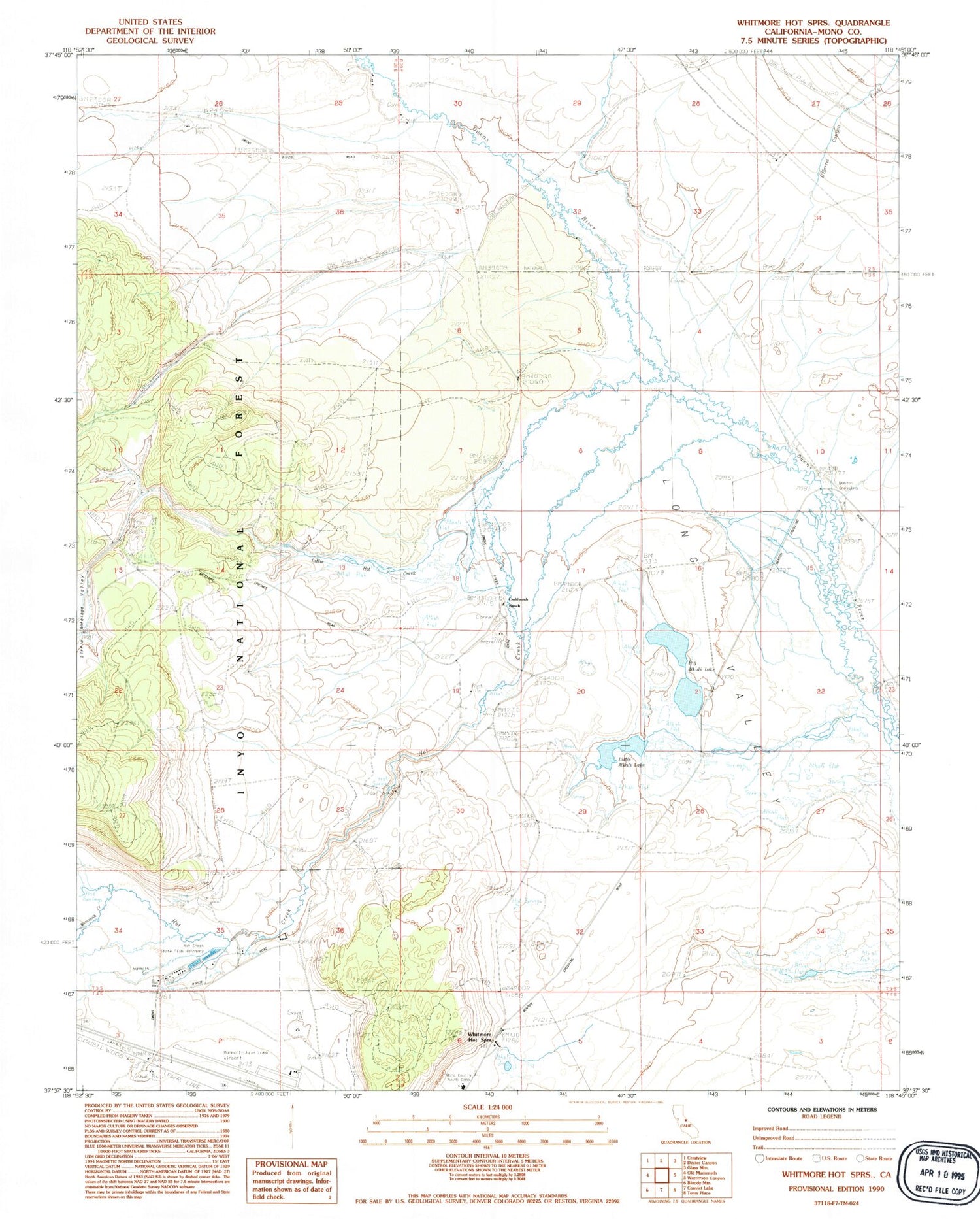
Historical USGS topographic quad map of Whitmore Hot Springs in the state of California. Typical map scale is 1:24,000, but may vary for certain years, if available. Print size: 24" x 27"
This quadrangle is in the following counties: Mono.
The map contains contour lines, roads, rivers, towns, and lakes. Printed on high-quality waterproof paper with UV fade-resistant inks, and shipped rolled.
Contains the following named places: Big Alkali Lake, Cashbaugh Ranch, Hot Creek, Hot Creek Ranch, Little Alkali Lake, Little Hot Creek, Mammoth School, O'Harrel Canyon Creek, Benton Crossing, Whitmore Hot Springs, Long Valley, Little Antelope Valley, Clay Pit Mine, Mammoth Yosemite Airport, Hot Creek State Fish Hatchery, Mono County Youth Camp, Ford Ranch, Turners Ranch (historical), Whitmore Tub, Hot Creek Interpretive Site, Long Valley Fire Protection District Station 2, Whitmore Regional Park, Big Alkali Lake, Cashbaugh Ranch, Hot Creek, Hot Creek Ranch, Little Alkali Lake, Little Hot Creek, Mammoth School, O'Harrel Canyon Creek, Benton Crossing, Whitmore Hot Springs, Long Valley, Little Antelope Valley, Clay Pit Mine, Mammoth Yosemite Airport, Hot Creek State Fish Hatchery, Mono County Youth Camp, Ford Ranch, Turners Ranch (historical), Whitmore Tub, Hot Creek Interpretive Site, Long Valley Fire Protection District Station 2, Whitmore Regional Park