MyTopo
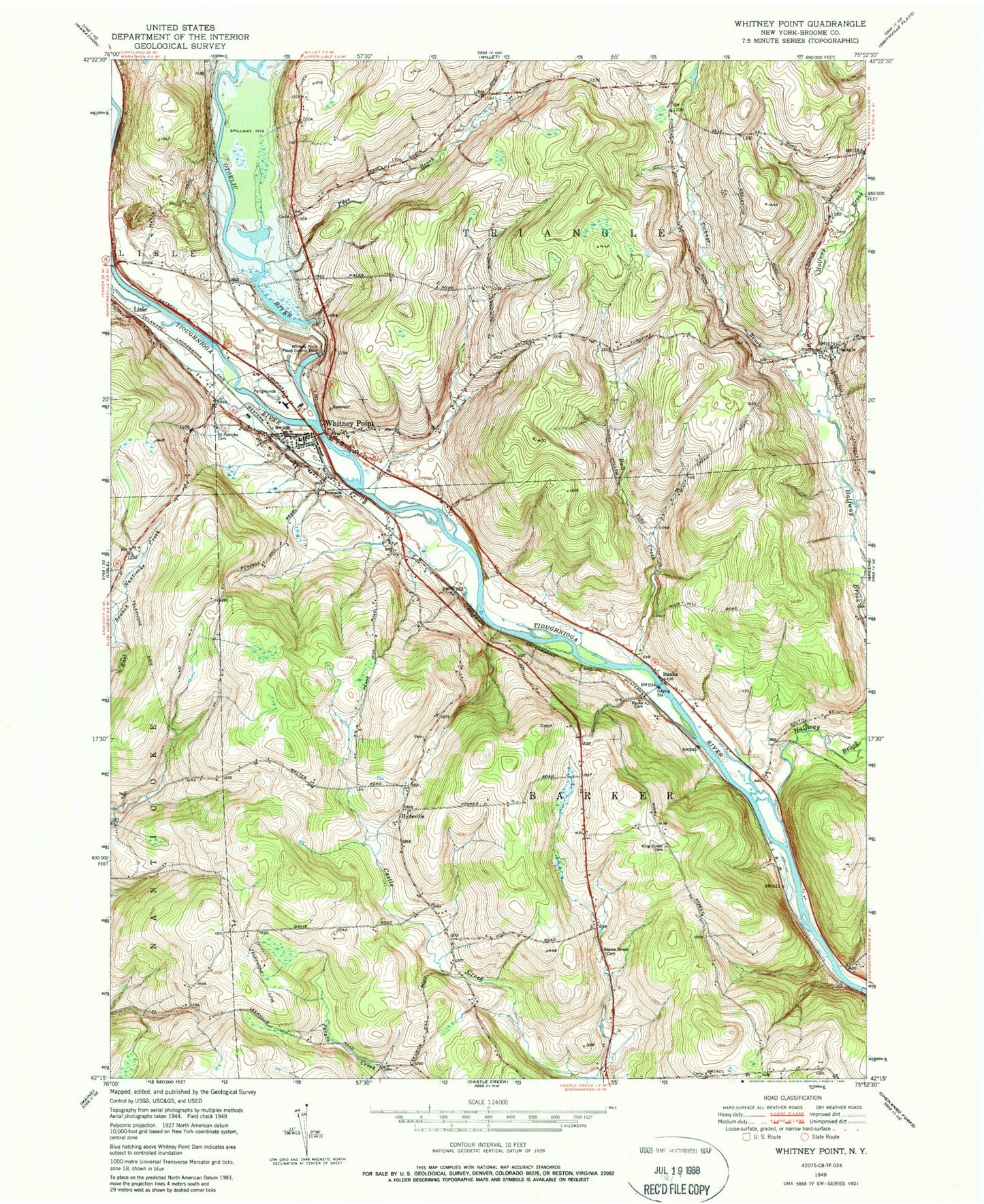
Classic USGS Whitney Point New York 7.5'x7.5' Topo Map
Couldn't load pickup availability
Historical USGS topographic quad map of Whitney Point in the state of New York. Map scale may vary for some years, but is generally around 1:24,000. Print size is approximately 24" x 27"
This quadrangle is in the following counties: Broome.
The map contains contour lines, roads, rivers, towns, and lakes. Printed on high-quality waterproof paper with UV fade-resistant inks, and shipped rolled.
Contains the following named places: Adams Street Cemetery, Bull Creek, Caryl E Adams Primary School, Countryside Christian Chapel, Dorchester Cemetery, Dorchester Estates, Ford Hill Country Club, Grace Episcopal Church, Green Cemetery, Halfway Brook, Hyde Street Cemetery, Hydeville, Itaska, Itaska Cemetery, King Street Cemetery, Lisle Cemetery, Mary Wilcox Memorial Library, Meadowbrooke Estates, Otselic River, Page Brook, Page Brook Cemetery, Riverside Cemetery, Saint Patrick Cemetery, Saint Patrick's Catholic Church, Strawberry Valley Pit, Taft Cemetery, Ticknor Brook, Tioughnioga River Bridge, Town of Barker, Town of Triangle, Triangle, Triangle Volunteer Fire Company, Valley Chapel Church, Village of Whitney Point, Whitney Point, Whitney Point Fire Department, Whitney Point Flood Control Dam, Whitney Point Intermediate School, Whitney Point Lake, Whitney Point Post Office, Whitney Point Rest Area, Whitney Point Senior High School, Whitney Point United Methodist Church, ZIP Codes: 13746, 13777, 13862