MyTopo
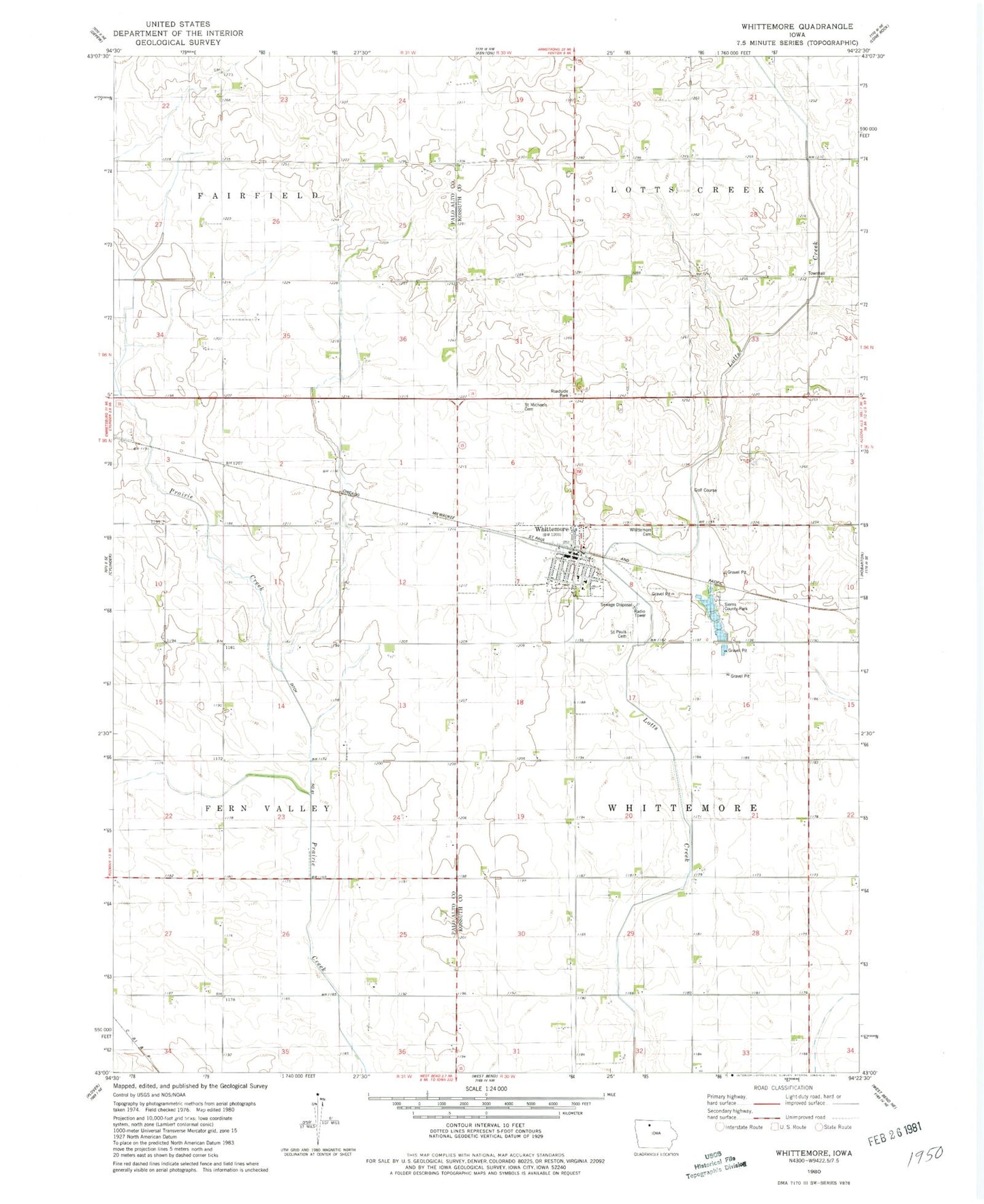
Classic USGS Whittemore Iowa 7.5'x7.5' Topo Map
Couldn't load pickup availability
Historical USGS topographic quad map of Whittemore in the state of Iowa. Map scale may vary for some years, but is generally around 1:24,000. Print size is approximately 24" x 27"
This quadrangle is in the following counties: Kossuth, Palo Alto.
The map contains contour lines, roads, rivers, towns, and lakes. Printed on high-quality waterproof paper with UV fade-resistant inks, and shipped rolled.
Contains the following named places: City of Whittemore, Ditch Number Sixty-One, Hatch Post Office, Lotts Creek Townhall, Plantation Wildlife Area, Saint Michael's Catholic Church, Saint Michaels Cemetery, Saint Pauls Cemetery, Saint Paul's Lutheran Church, Siems County Park, Township of Whittemore, West Bend Elevator Company Elevator, Whittemore, Whittemore Cemetery, Whittemore City Hall, Whittemore Golf Course, Whittemore Post Office, Whittemore Public Library, Whittemore Schools, Whittemore Volunteer Fire Department, ZIP Code: 50598