MyTopo
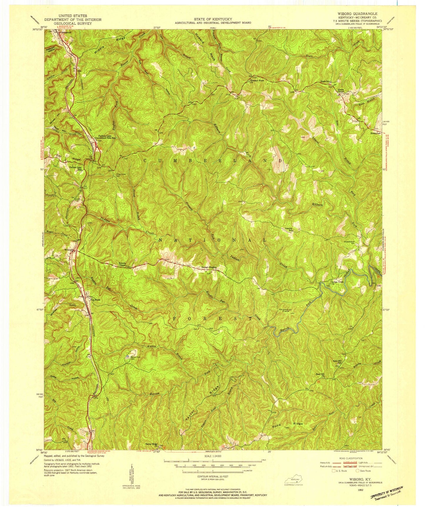
Classic USGS Wiborg Kentucky 7.5'x7.5' Topo Map
Couldn't load pickup availability
Historical USGS topographic quad map of Wiborg in the state of Kentucky. Typical map scale is 1:24,000, but may vary for certain years, if available. Print size: 24" x 27"
This quadrangle is in the following counties: McCreary.
The map contains contour lines, roads, rivers, towns, and lakes. Printed on high-quality waterproof paper with UV fade-resistant inks, and shipped rolled.
Contains the following named places: Barren Fork, Barren Fork Cemetery, Beulah Heights, Chestnut Flats, Coffey Hollow, Cogur Fork, Dead Man Hollow, Eagle School, Flat Rock, Franklin Hollow, Freeman Fork, Greenwood, Hickenbottom Cemetery, Hughes Cemetery, Indian Creek Church, Kilburn Fork, Laurel Fork, Maxewell Branch, Middle Ridge, Parkers Lake, Pigeon Roost Branch, Piney Grove Cemetery, Pleasant Knob Church, Pole Road Hollow, Pond Ridge, Railroad Fork, Roberts Chapel, Sand Hill Church, Spruce Hollow, Strunk Branch, Taylor Ridge, Taylor Ridge Church, Tom Fork, Wiborg, Stearns District Ranger Office, Big Swag Ridge, Parkers Lake Division, Four-H Camp (historical), Wiborg Fire Station, Eagle - Sawyer Fire Protection District Station 2, Daniel Boone National Forest Stearns Ranger District, Parkers Lake Post Office