MyTopo
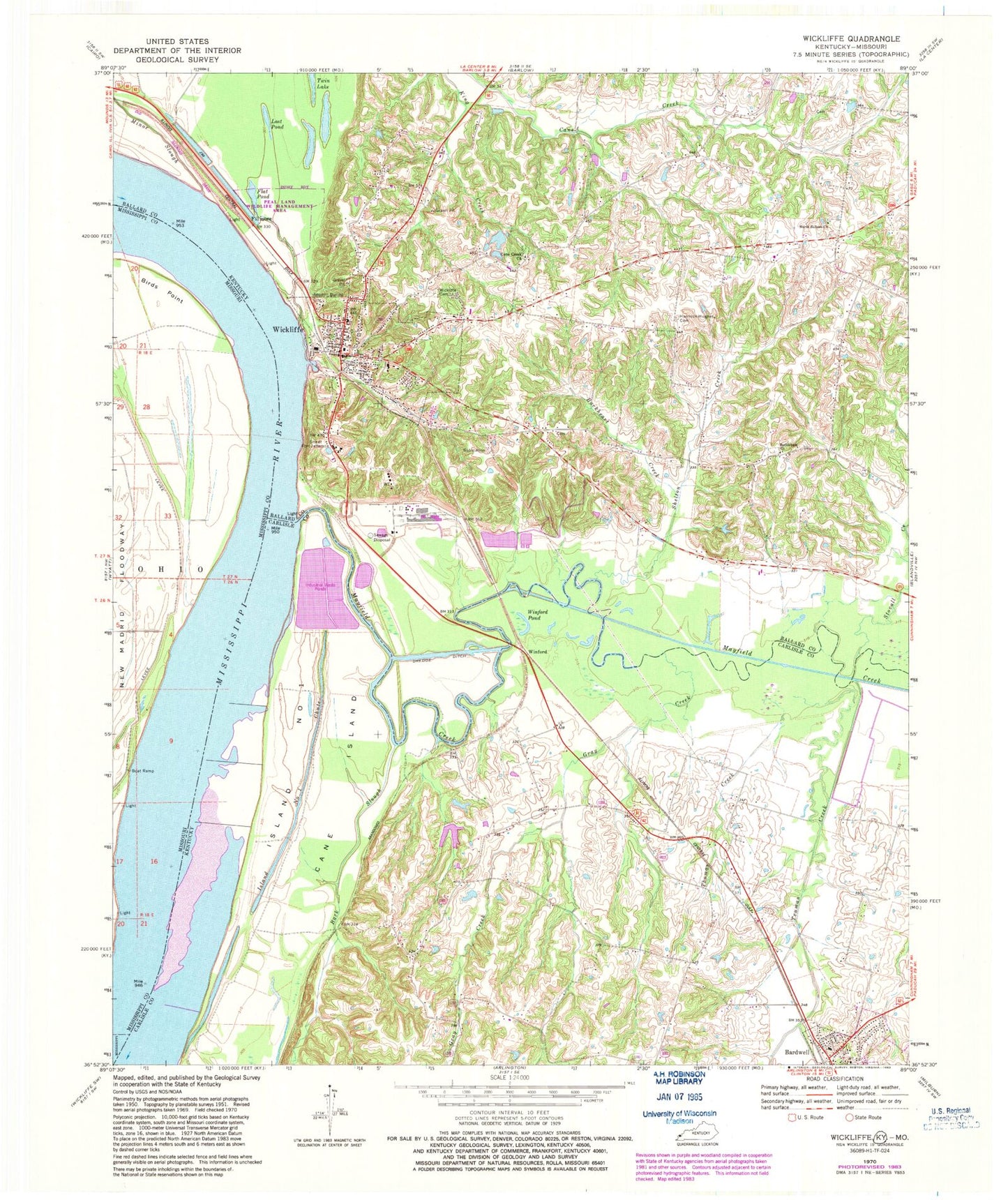
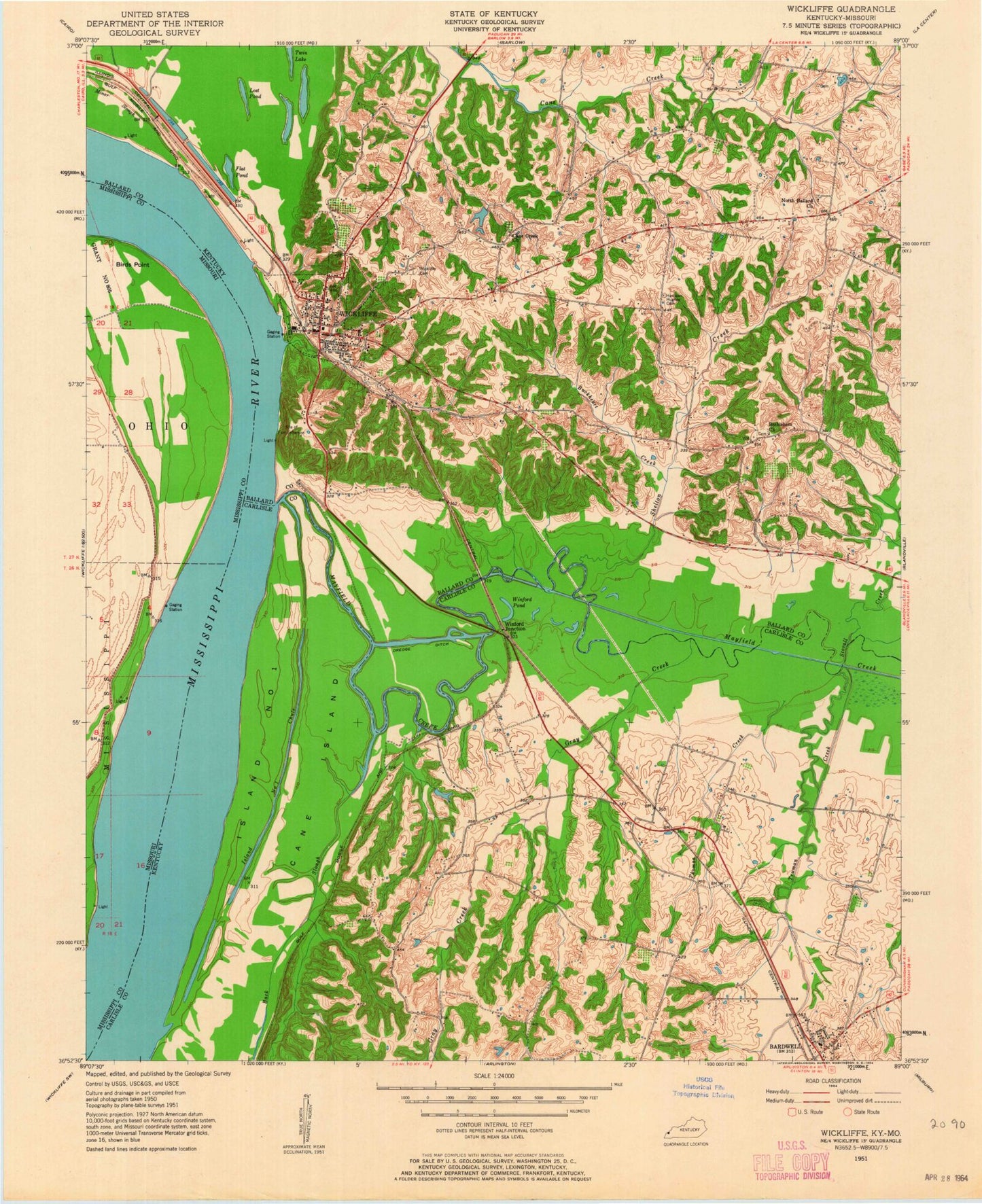
Classic USGS Wickliffe Kentucky 7.5'x7.5' Topo Map
Couldn't load pickup availability
Historical USGS topographic quad map of Wickliffe in the states of Kentucky, Missouri. Map scale may vary for some years, but is generally around 1:24,000. Print size is approximately 24" x 27"
This quadrangle is in the following counties: Ballard, Carlisle, Mississippi.
The map contains contour lines, roads, rivers, towns, and lakes. Printed on high-quality waterproof paper with UV fade-resistant inks, and shipped rolled.
Contains the following named places: Back Slough, Ballard County Sheriff's Office, Bethlehem Cemetery, Bethlehem Church, Birds Point, Buckheart Creek, Cane Island, Central Creek, City of Wickliffe, Cone Creek Cemetery, Cone Creek Church, Fillmore, Flat Pond, Gray Creek, Harrison - Hughes Cemetery, Island Number 1, Island Number 1 Chute, Lost Pond, Mayfield Creek, Norfolk, Norfolk Landing, North Ballard Church, Pritchard Landing, Pritchard Revetment, Shelton Creek, Stovall Creek, Thomas Creek, Towhead of Island Number One, Truman Creek, WBCE-AM (Wickliffe), Wickliffe, Wickliffe Cemetery, Wickliffe Fire Department, Wickliffe Police Department, Wickliffe Post Office, Winford, Winford Pond