MyTopo
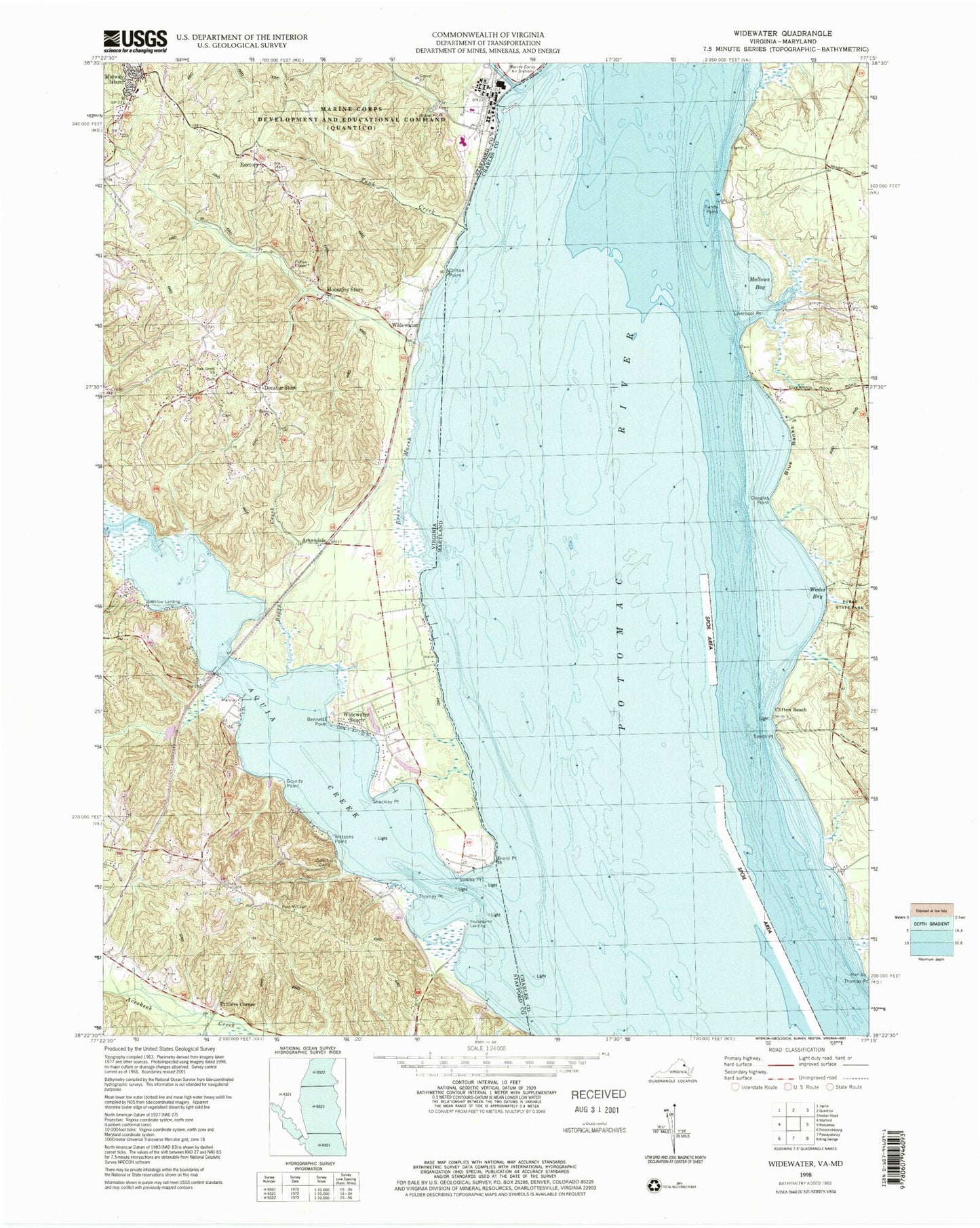
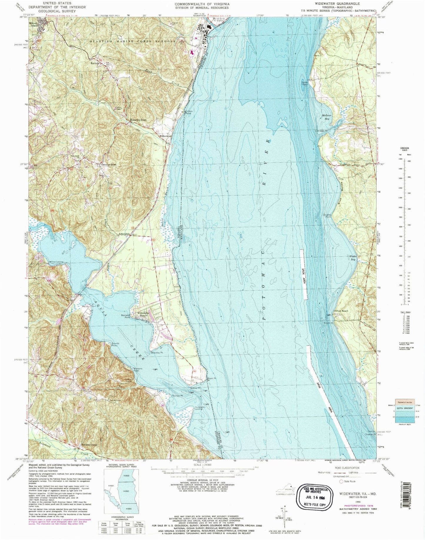
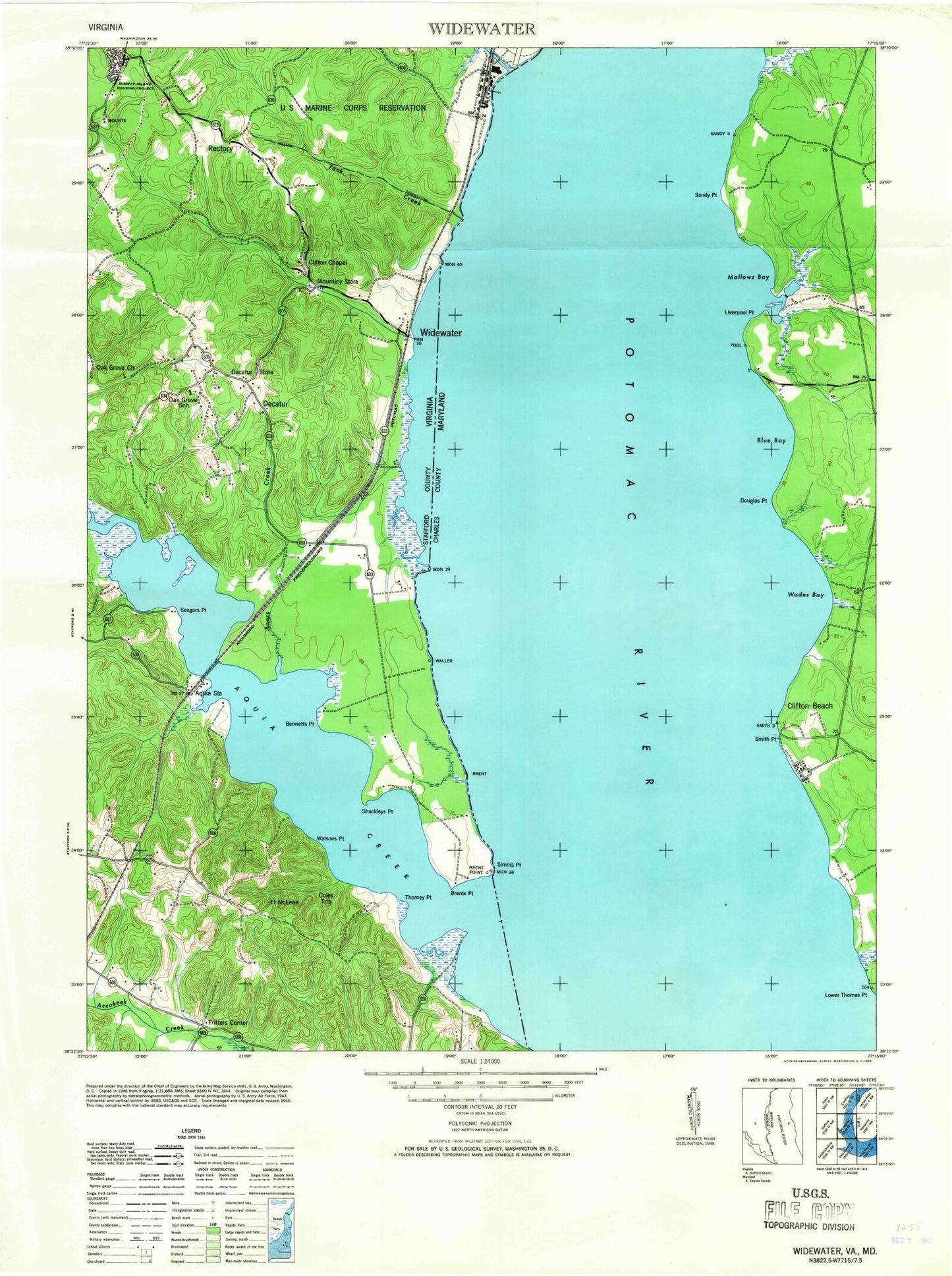
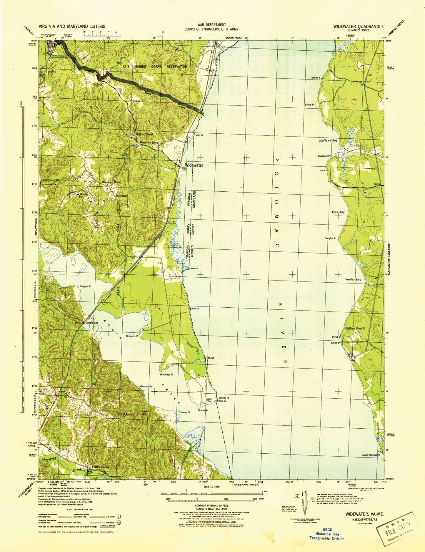
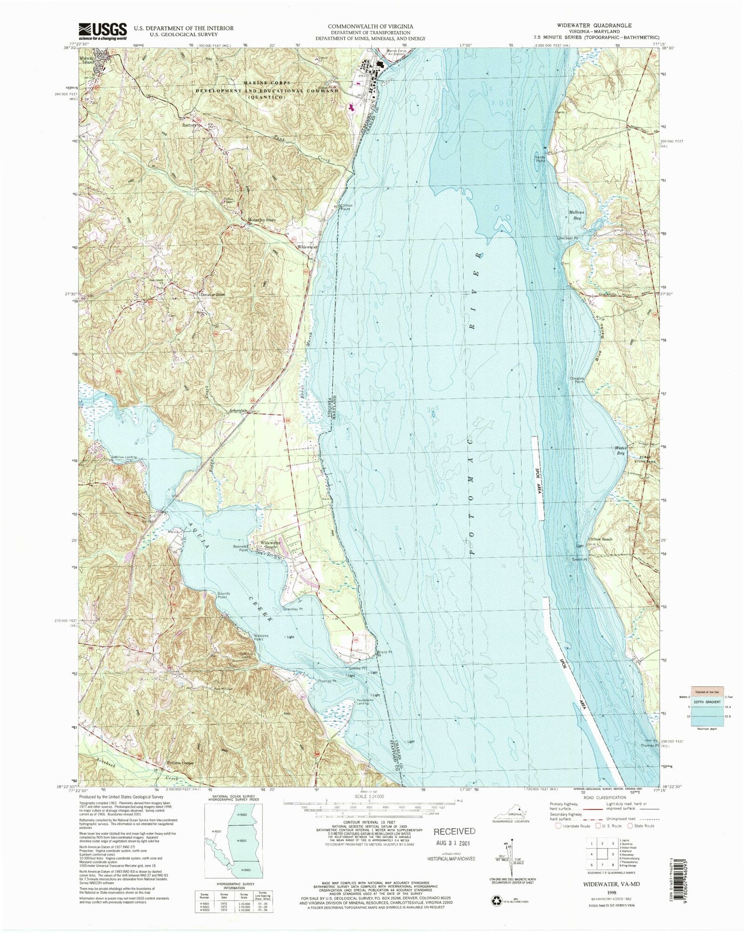
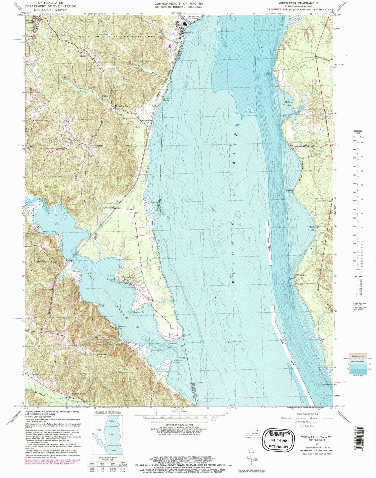
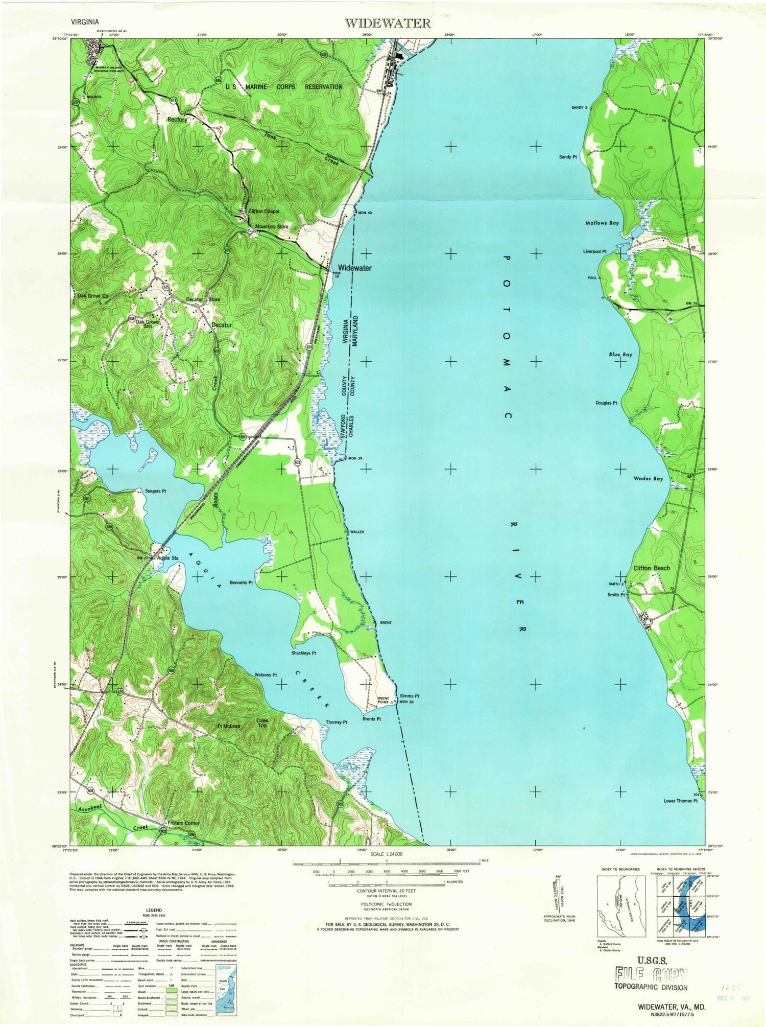
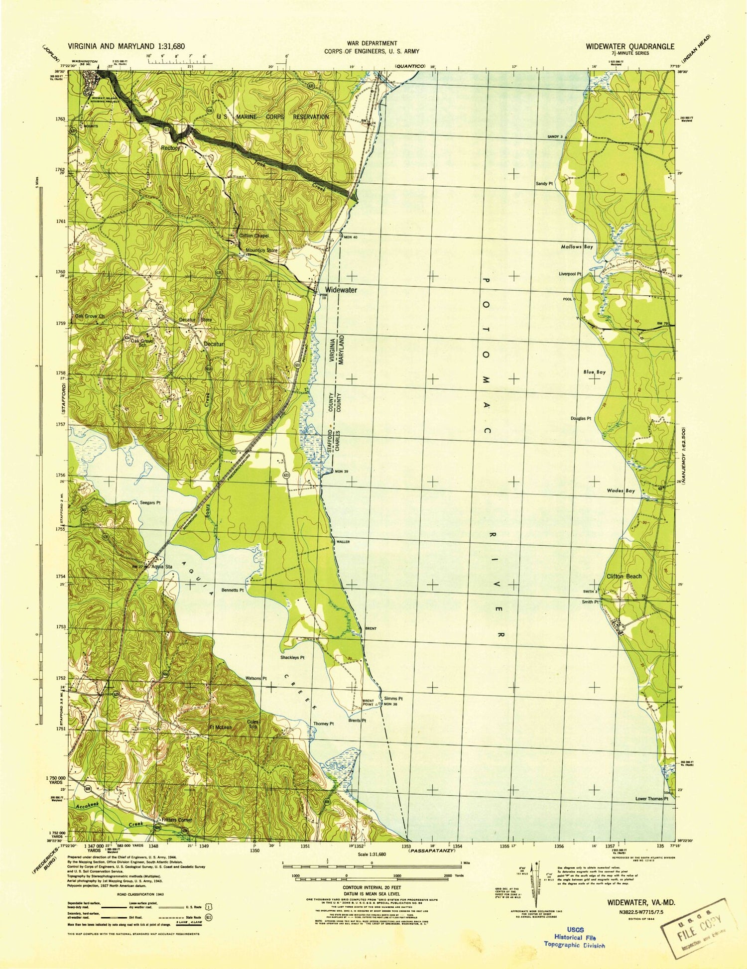
Classic USGS Widewater Virginia 7.5'x7.5' Topo Map
Couldn't load pickup availability
Historical USGS topographic quad map of Widewater in the states of Virginia, Maryland. Typical map scale is 1:24,000, but may vary for certain years, if available. Print size: 24" x 27"
This quadrangle is in the following counties: Charles, Stafford.
The map contains contour lines, roads, rivers, towns, and lakes. Printed on high-quality waterproof paper with UV fade-resistant inks, and shipped rolled.
Contains the following named places: Aquia Creek, Bennetts Point, Boars Creek, Brent Marsh, Brent Point, Chopawamsic Creek, Clifton Chapel, Clifton Point, Cole Trip Camp, Decatur Store, Gourds Point, Mountjoy Store, Oak Grove Baptist Church, Rectory, Salem Church, Seegars Point, Shackley Point, Simms Point, Tank Creek, Thorney Point, Watsons Point, Chimney View Airport, Arkendale, Fort McLean (historical), Fritters Corner, Midway Island, Youbedamn Landing, Widewater, Widewater Beach, Willow Landing, Aquia Station, Decatur (historical), Oak Grove School (historical), Widewater Elementary School, Aquia District, Griffis-Widewater District, Stafford County Fire and Rescue Department Station 3 Widewater, Aquia Landing Beach Park, Patawomack Band Memorial Park, Aquia Landing, Hope Springs Marina, Landmark Yacht Club, Aqua Villa, Aquia Bay Estates, Aquia Beach, Aquia Bend, Aquia Inlet Estates, Aquia Overlook, Bayview Estates, Brooke Ridge, Brooksmill Estates, Canterbury Estates, Chelsea Estates, Colonial Port, Estates of Widewater Pond, Freds Corner, Freedom Estates, Harris, Jessica Estates, Loy Landing, Midway Estates, Norman Estates, Northern View Estates, Poplar Hills, Quarry Estates, Raspberry, Rivendell, Sams Ridge, Saratoga, Stonebridge at Widewater, Sunshine Acres, Sunshine Hills, Sunshine View, Thorny Point Farm, Uly Brooks, Widewater Estates, Windermere, Brents Mill Elementary School, Holiday Harbor Marina, Willow Landing Marina, Blue Banks, Clifton Beach, Douglas Point, Liverpool Point, Mallows Bay, Sandy Point, Smith Point, Thorne Gut, Wades Bay, Blue Bay, Cooks Ferry (historical), Green Manor Estates, Liverpool Wharf, Mallows Creek, Purse State Park, Seventh District Volunteer Rescue Squad Company 59, Aquia Creek, Bennetts Point, Boars Creek, Brent Marsh, Brent Point, Chopawamsic Creek, Clifton Chapel, Clifton Point, Cole Trip Camp, Decatur Store, Gourds Point, Mountjoy Store, Oak Grove Baptist Church, Rectory, Salem Church, Seegars Point, Shackley Point, Simms Point, Tank Creek, Thorney Point, Watsons Point, Chimney View Airport, Arkendale, Fort McLean (historical), Fritters Corner, Midway Island, Youbedamn Landing, Widewater, Widewater Beach, Willow Landing, Aquia Station, Decatur (historical), Oak Grove School (historical), Widewater Elementary School, Aquia District, Griffis-Widewater District, Stafford County Fire and Rescue Department Station 3 Widewater, Aquia Landing Beach Park, Patawomack Band Memorial Park, Aquia Landing, Hope Springs Marina, Landmark Yacht Club, Aqua Villa, Aquia Bay Estates, Aquia Beach, Aquia Bend, Aquia Inlet Estates, Aquia Overlook, Bayview Estates, Brooke Ridge, Brooksmill Estates, Canterbury Estates, Chelsea Estates, Colonial Port, Estates of Widewater Pond, Freds Corner, Freedom Estates, Harris, Jessica Estates, Loy Landing, Midway Estates, Norman Estates, Northern View Estates, Poplar Hills, Quarry Estates, Raspberry, Rivendell, Sams Ridge, Saratoga, Stonebridge at Widewater, Sunshine Acres, Sunshine Hills, Sunshine View, Thorny Point Farm, Uly Brooks, Widewater Estates, Windermere, Brents Mill Elementary School, Holiday Harbor Marina, Willow Landing Marina, Blue Banks, Clifton Beach, Douglas Point, Liverpool Point, Mallows Bay, Sandy Point, Smith Point, Thorne Gut, Wades Bay, Blue Bay, Cooks Ferry (historical), Green Manor Estates, Liverpool Wharf, Mallows Creek, Purse State Park, Seventh District Volunteer Rescue Squad Company 59, Aquia Creek, Bennetts Point, Boars Creek, Brent Marsh, Brent Point, Chopawamsic Creek, Clifton Chapel, Clifton Point, Cole Trip Camp, Decatur Store, Gourds Point, Mountjoy Store, Oak Grove Baptist Church, Rectory, Salem Church, Seegars Point, Shackley Point, Simms Point, Tank Creek, Thorney Point, Watsons Point, Chimney View Airport, Arkendale, Fort McLean (historical), Fritters Corner, Midway Island, Youbedamn Landing, Widewater, Widewater Beach, Willow Landing, Aquia Station, Decatur (historical), Oak Grove School (historical), Widewater Elementary School, Aquia District, Griffis-Widewater District, Stafford County Fire and Rescue Department Station 3 Widewater, Aquia Landing Beach Park, Patawomack Band Memorial Park, Aquia Landing, Hope Springs Marina, Landmark Yacht Club, Aqua Villa, Aquia Bay Estates
