MyTopo
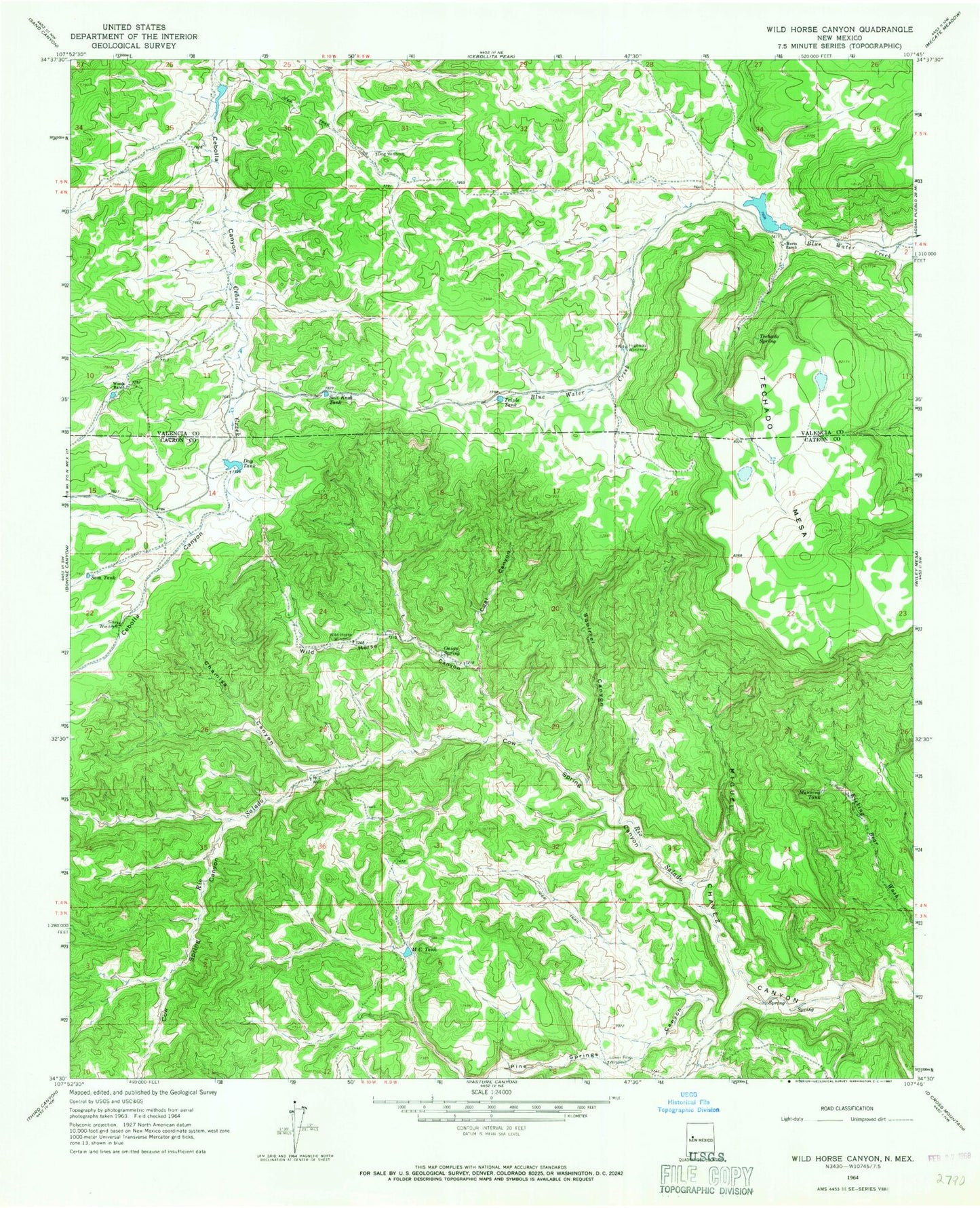
Classic USGS Wild Horse Canyon New Mexico 7.5'x7.5' Topo Map
Couldn't load pickup availability
Historical USGS topographic quad map of Wild Horse Canyon in the state of New Mexico. Typical map scale is 1:24,000, but may vary for certain years, if available. Print size: 24" x 27"
This quadrangle is in the following counties: Catron, Cibola.
The map contains contour lines, roads, rivers, towns, and lakes. Printed on high-quality waterproof paper with UV fade-resistant inks, and shipped rolled.
Contains the following named places: Chamisa Canyon, Coal Canyon, Day Tank, Dog Windmill, Highway Windmill, Lower Pine Windmill, M C Tank, M C Well, Manning Tank, Mertz Ranch, Onion Spring, Salt Knob Tank, Sam Tank, Sissy Windmill, Squirrel Canyon, Techado Spring, Triple Tank, Wild Horse Canyon, Wild Horse Windmill, Woods Ranch, Techado Mesa, Cow Spring Canyon, Pine Springs Canyon, Dog Windmill Water Well, Wild Horse Water Well, Sissy Windmill Water Well, Day Tank Water Well, Pyle, Bailey Butte, Wild Horse Volunteer Fire Department