MyTopo
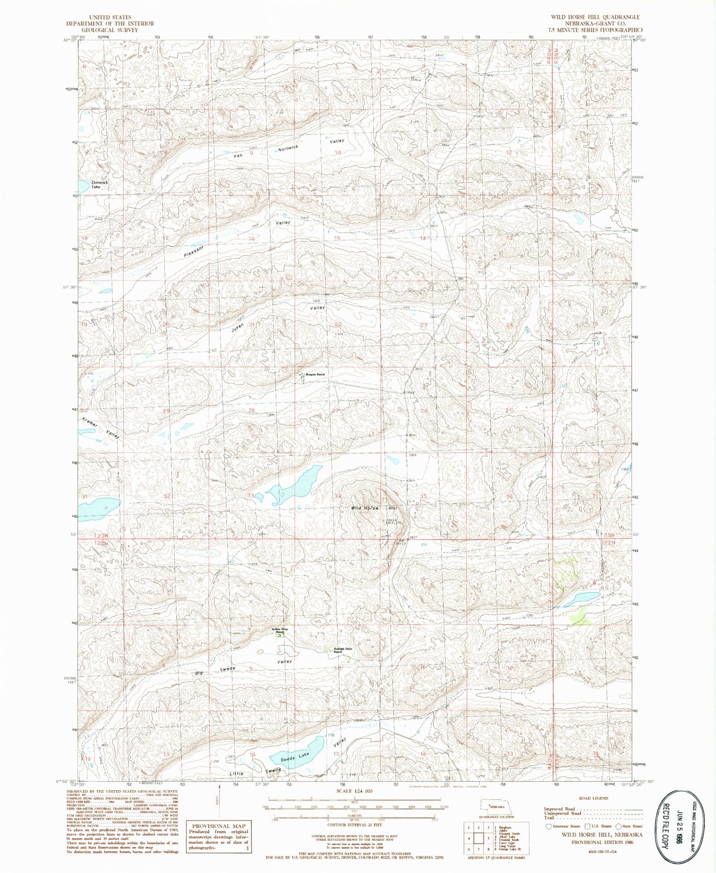
Classic USGS Wild Horse Hill Nebraska 7.5'x7.5' Topo Map
Regular price
$16.95
Regular price
Sale price
$16.95
Unit price
per
Couldn't load pickup availability
Historical USGS topographic quad map of Wild Horse Hill in the state of Nebraska. Map scale may vary for some years, but is generally around 1:24,000. Print size is approximately 24" x 27"
This quadrangle is in the following counties: Grant.
The map contains contour lines, roads, rivers, towns, and lakes. Printed on high-quality waterproof paper with UV fade-resistant inks, and shipped rolled.
Contains the following named places: Arthur Dubs Ranch, Ashby Election Precinct, Big Swede Valley, Burgess Ranch, Juten Valley, Little Swede Valley, Locust School, Pleasant Valley, Rudolph Dubs Ranch, Swede Lake, Van Nortwick Valley, Wild Horse Hill, Willey Ranch