MyTopo
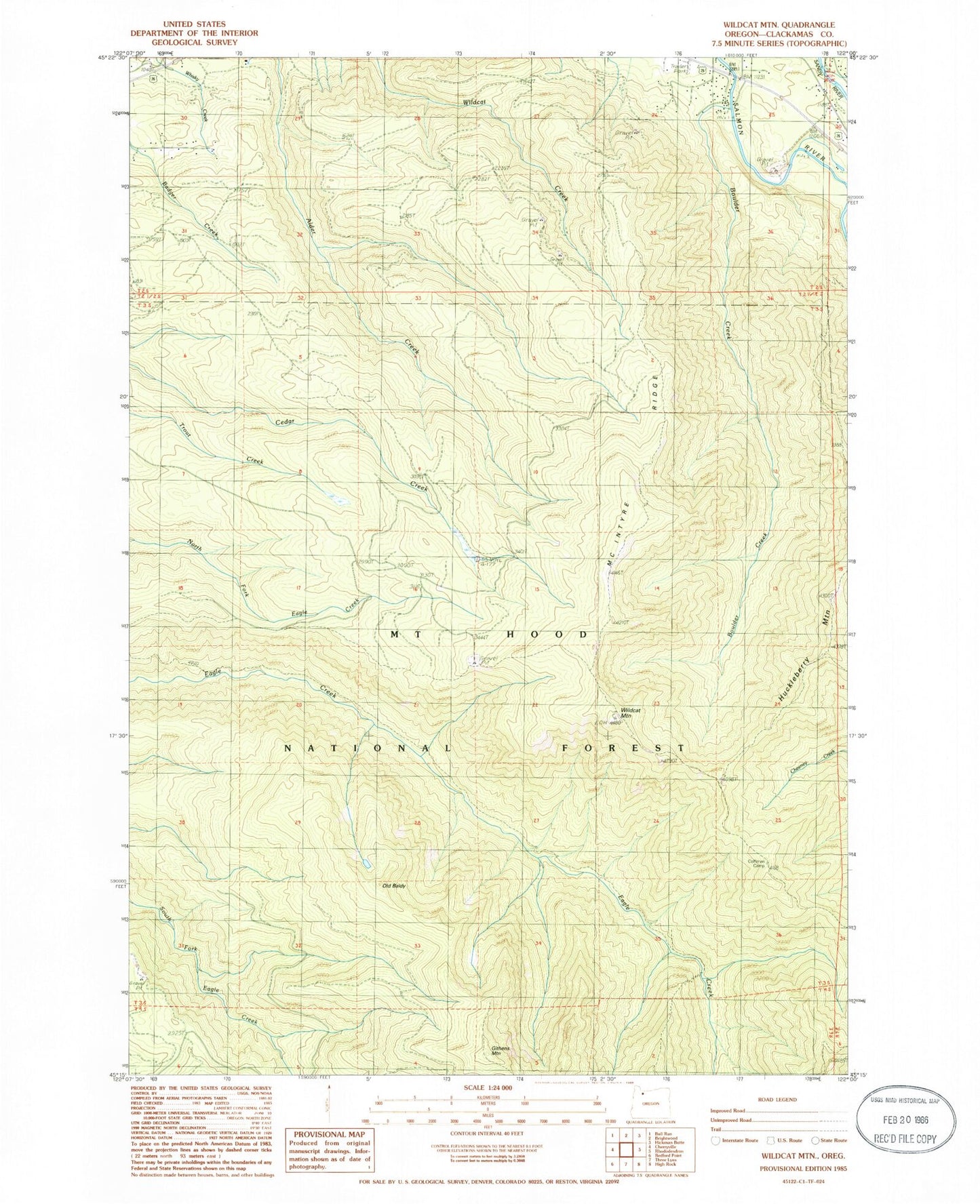
Classic USGS Wildcat Mountain Oregon 7.5'x7.5' Topo Map
Regular price
$16.95
Regular price
Sale price
$16.95
Unit price
per
Couldn't load pickup availability
Historical USGS topographic quad map of Wildcat Mountain in the state of Oregon. Typical map scale is 1:24,000, but may vary for certain years, if available. Print size: 24" x 27"
This quadrangle is in the following counties: Clackamas.
The map contains contour lines, roads, rivers, towns, and lakes. Printed on high-quality waterproof paper with UV fade-resistant inks, and shipped rolled.
Contains the following named places: Boulder Creek, Eagle Creek Cutoff, Eagle Creek Lookout (historical), Huckleberry Mountain, Old Baldy, Old Baldy Trail, Plaza Trail, Salmon (historical), Wildcat Mountain, Githens Mountain, McIntyre Ridge, Salmon Post Office (historical), Eagle Creek Wild and Scenic River